 Looks like the latest model upadte from the Bureau Access Model has now got extensive rainfall 28th to 29th January even as far down as Sydney! Well over 100mm of rainfall in the region now predicted.
Floods
Floods · Rain
Ex-Tropical Cyclone Low 28th 29th January 2013 Sydney and Central NSW
More storms near Sydney, NSW
 Severe Hailstorms and Wind Luddenham 3rd October 2026
3 Oct 2026 · Sydney, NSW
Severe Hailstorms and Wind Luddenham 3rd October 2026
3 Oct 2026 · Sydney, NSW
 Hailstorms Western Sydney and Lower Blue Mountains
26 Sep 2026 · Sydney, NSW
Hailstorms Western Sydney and Lower Blue Mountains
26 Sep 2026 · Sydney, NSW
 First Storm and Hail Event for Season 2026-2027 – Western Sydney – Friday 25 September 2026
25 Sep 2026 · Doonside, NSW
First Storm and Hail Event for Season 2026-2027 – Western Sydney – Friday 25 September 2026
25 Sep 2026 · Doonside, NSW
 Warm Weekend with 30C Maximum Daytime Temperatures – Western Sydney 19 and 20 September 2026
20 Sep 2026 · Western Sydney, NSW
Warm Weekend with 30C Maximum Daytime Temperatures – Western Sydney 19 and 20 September 2026
20 Sep 2026 · Western Sydney, NSW
 A Week of Rain – Eastern New South Wales and Queensland – May 24 to 29
31 May 2026 · Eastern NSW
A Week of Rain – Eastern New South Wales and Queensland – May 24 to 29
31 May 2026 · Eastern NSW
 Storm Chase and Spectacular Thunderstorm Cell Camden NSW – Thursday 26 March 2026
27 Mar 2026 · Camden, NSW
Storm Chase and Spectacular Thunderstorm Cell Camden NSW – Thursday 26 March 2026
27 Mar 2026 · Camden, NSW
 Camden to Campbelltown Hailstorm 26th March 2026
26 Mar 2026 · Sydney, NSW
Camden to Campbelltown Hailstorm 26th March 2026
26 Mar 2026 · Sydney, NSW
 Significant Western Sydney Afternoon Thunderstorm with Large Hail – Saturday 21 March 2026
21 Mar 2026 · St Marys, NSW
Significant Western Sydney Afternoon Thunderstorm with Large Hail – Saturday 21 March 2026
21 Mar 2026 · St Marys, NSW
 Heavy Showers Cause Localised Flooding Across The Sydney Region – 18 and 19 March 2026
20 Mar 2026 · Sydney, NSW
Heavy Showers Cause Localised Flooding Across The Sydney Region – 18 and 19 March 2026
20 Mar 2026 · Sydney, NSW
 Intense Rainstorm / Thunderstorm Impacts Parts of Western Sydney – Hornsby to Horsley Park – Saturday Evening 7 March 2026
8 Mar 2026 · Horsley Park, NSW
Intense Rainstorm / Thunderstorm Impacts Parts of Western Sydney – Hornsby to Horsley Park – Saturday Evening 7 March 2026
8 Mar 2026 · Horsley Park, NSW
 Late thunderstorm Outer Western Sydney – Monday 9 February 2026
13 Feb 2026 · Outer Western Sydney, NSW
Late thunderstorm Outer Western Sydney – Monday 9 February 2026
13 Feb 2026 · Outer Western Sydney, NSW
 A Contrast of Two Storms Across Western Sydney – Saturday 31 January and Sunday 1 February 2026
6 Feb 2026 · Western Sydney, NSW
A Contrast of Two Storms Across Western Sydney – Saturday 31 January and Sunday 1 February 2026
6 Feb 2026 · Western Sydney, NSW
All storm reports from Sydney, NSW →
Also on 27 January
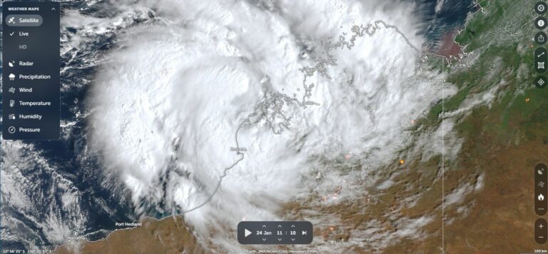 Tropical Cyclone Launa Crosses the Coast near Broome – Saturday and Sunday 24 and 25 January 2026
27 Jan 2026 · Broome, WA
Tropical Cyclone Launa Crosses the Coast near Broome – Saturday and Sunday 24 and 25 January 2026
27 Jan 2026 · Broome, WA
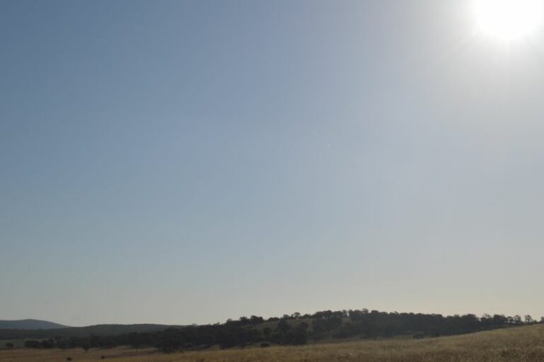 Intense heatwave tightens its grip across Southern Australia 26 January 2026
27 Jan 2026 · Southern Australia
Intense heatwave tightens its grip across Southern Australia 26 January 2026
27 Jan 2026 · Southern Australia
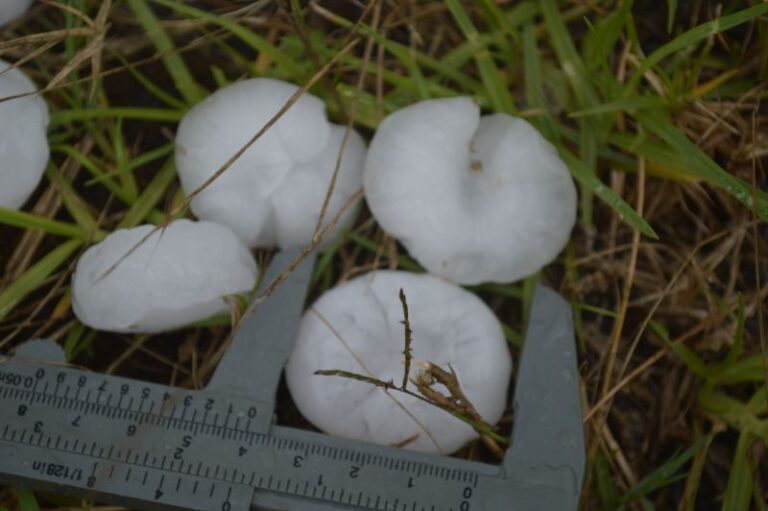 Storm chase, storms and hail events – Thursday 26 January 2023
27 Jan 2023 · Windsor, NSW
Storm chase, storms and hail events – Thursday 26 January 2023
27 Jan 2023 · Windsor, NSW
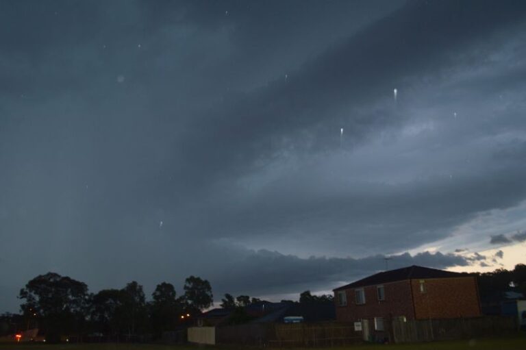 Significant and severe thunderstorms – Eastern NSW – Tuesday 24 January 2023
27 Jan 2023 · Eastern NSW
Insane Supercell Structure Dumas, Texas May 18 2010
27 Jan 2017 · Dumas, TX
Significant and severe thunderstorms – Eastern NSW – Tuesday 24 January 2023
27 Jan 2023 · Eastern NSW
Insane Supercell Structure Dumas, Texas May 18 2010
27 Jan 2017 · Dumas, TX
 Rainfall and Deficiencies January 2014
27 Jan 2014 · Howard Springs, NT
Canberra Severe Storm & Tornado 26/01/2013
27 Jan 2013 · Canberra, ACT
Severe Tropical Cyclone Yasi : from 30 January
27 Jan 2011 · Mission Beach, QLD
Mt Buningyong Wind Storm 13th Jan 2011
27 Jan 2011 · Buninyong, VIC
Impressive storms with decent anvil near Kempsey
27 Jan 2007 · Kempsey, NSW
Rainfall and Deficiencies January 2014
27 Jan 2014 · Howard Springs, NT
Canberra Severe Storm & Tornado 26/01/2013
27 Jan 2013 · Canberra, ACT
Severe Tropical Cyclone Yasi : from 30 January
27 Jan 2011 · Mission Beach, QLD
Mt Buningyong Wind Storm 13th Jan 2011
27 Jan 2011 · Buninyong, VIC
Impressive storms with decent anvil near Kempsey
27 Jan 2007 · Kempsey, NSW
3 comments
Add a comment
You must be logged in to post a comment.
Paul Graham reports that if the ex-tropical cyclone hits Sydney, it will be the first time since 1950!
As it stands, the latest models suggest that the low will side-swipe Sydney. The Sydney region will get about 50 to 60 mm of rain which is much needed and definitely ease the very long and hot dry spell!
For those who are not familiar with the difference between an ex-tropical cyclone / tropical low and an east coast or polar low, the temperatures in the mid-levels are relatively warm. The map here shows temperatures in northern NSW fairly warm 0 to -2C compared to the approaching polar low (upper trough extension of the low) with temperatures of -14C and obviously colder approaching Victoria. For the position of the low, just refer to the wind barbs circulating the centre of the low in each case!