Latest models again pointy to the potential of storms including some that may go severe later today. It would be great if the storms can tap into the surface moisture. Any storms that reach high up in the atmosphere will be the ones to watch. This is a similar environment tot yesterday. However, temperatures have warmed somewhat to -8C at 500hPa. a marginal setup but I suspect very electrically active storms if they can form in a deep atmosphere.

Storm report
Thunderstorms
Storms for eastern NSW 29th November 2012
More storms near Eastern NSW
 Severe Hailstorms and Wind Luddenham 3rd October 2026
3 Oct 2026 · Sydney, NSW
Severe Hailstorms and Wind Luddenham 3rd October 2026
3 Oct 2026 · Sydney, NSW
 Hailstorms Western Sydney and Lower Blue Mountains
26 Sep 2026 · Sydney, NSW
Hailstorms Western Sydney and Lower Blue Mountains
26 Sep 2026 · Sydney, NSW
 First Storm and Hail Event for Season 2026-2027 – Western Sydney – Friday 25 September 2026
25 Sep 2026 · Doonside, NSW
First Storm and Hail Event for Season 2026-2027 – Western Sydney – Friday 25 September 2026
25 Sep 2026 · Doonside, NSW
 Warm Weekend with 30C Maximum Daytime Temperatures – Western Sydney 19 and 20 September 2026
20 Sep 2026 · Western Sydney, NSW
Warm Weekend with 30C Maximum Daytime Temperatures – Western Sydney 19 and 20 September 2026
20 Sep 2026 · Western Sydney, NSW
 A Week of Rain – Eastern New South Wales and Queensland – May 24 to 29
31 May 2026 · Eastern NSW
A Week of Rain – Eastern New South Wales and Queensland – May 24 to 29
31 May 2026 · Eastern NSW
 Storm Chase and Spectacular Thunderstorm Cell Camden NSW – Thursday 26 March 2026
27 Mar 2026 · Camden, NSW
Storm Chase and Spectacular Thunderstorm Cell Camden NSW – Thursday 26 March 2026
27 Mar 2026 · Camden, NSW
 Camden to Campbelltown Hailstorm 26th March 2026
26 Mar 2026 · Sydney, NSW
Camden to Campbelltown Hailstorm 26th March 2026
26 Mar 2026 · Sydney, NSW
 Significant Western Sydney Afternoon Thunderstorm with Large Hail – Saturday 21 March 2026
21 Mar 2026 · St Marys, NSW
Significant Western Sydney Afternoon Thunderstorm with Large Hail – Saturday 21 March 2026
21 Mar 2026 · St Marys, NSW
 Heavy Showers Cause Localised Flooding Across The Sydney Region – 18 and 19 March 2026
20 Mar 2026 · Sydney, NSW
Heavy Showers Cause Localised Flooding Across The Sydney Region – 18 and 19 March 2026
20 Mar 2026 · Sydney, NSW
 Intense Rainstorm / Thunderstorm Impacts Parts of Western Sydney – Hornsby to Horsley Park – Saturday Evening 7 March 2026
8 Mar 2026 · Horsley Park, NSW
Intense Rainstorm / Thunderstorm Impacts Parts of Western Sydney – Hornsby to Horsley Park – Saturday Evening 7 March 2026
8 Mar 2026 · Horsley Park, NSW
 Late thunderstorm Outer Western Sydney – Monday 9 February 2026
13 Feb 2026 · Outer Western Sydney, NSW
Late thunderstorm Outer Western Sydney – Monday 9 February 2026
13 Feb 2026 · Outer Western Sydney, NSW
 A Contrast of Two Storms Across Western Sydney – Saturday 31 January and Sunday 1 February 2026
6 Feb 2026 · Western Sydney, NSW
A Contrast of Two Storms Across Western Sydney – Saturday 31 January and Sunday 1 February 2026
6 Feb 2026 · Western Sydney, NSW
All storm reports from Eastern NSW →
Also on 29 November
 Heat continues for NSW Sunday 29 November 2020
29 Nov 2020 · Sydney heat (Penrith/Blacktown), NSW
Heat continues for NSW Sunday 29 November 2020
29 Nov 2020 · Sydney heat (Penrith/Blacktown), NSW
 Four fire plumes on radar 29th November 2019
29 Nov 2019
Four fire plumes on radar 29th November 2019
29 Nov 2019
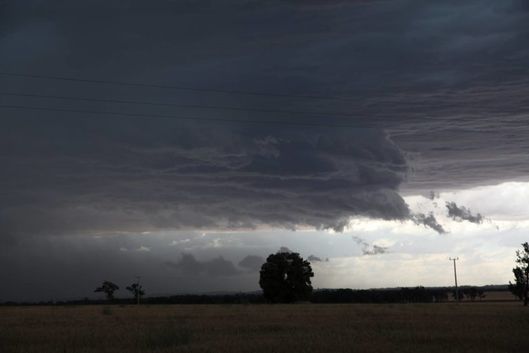 Temora Storm Complex 27th November 2017
29 Nov 2017 · Temora, NSW
Temora Storm Complex 27th November 2017
29 Nov 2017 · Temora, NSW
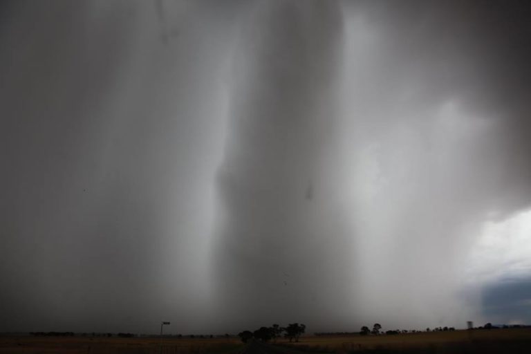 Bendigo Supercell 26th November 2017
29 Nov 2017 · Bendigo, VIC
Bendigo Supercell 26th November 2017
29 Nov 2017 · Bendigo, VIC
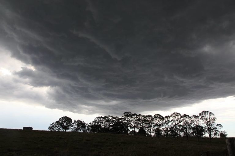 Luddenham Hailstorm Storm Chase
29 Nov 2017 · Luddenham, NSW
Storm Potential for central NSW 29th November 2011
29 Nov 2011 · Central NSW
Extreme CAPE in NW WA
29 Nov 2010 · Broome, WA
Excellent storm chase 27th November 5cm hailstones!
29 Nov 2006 · southern Mid North Coast, NSW
Third night of storms and lightning chasing
29 Nov 2006 · Lawrence, NSW
Luddenham Hailstorm Storm Chase
29 Nov 2017 · Luddenham, NSW
Storm Potential for central NSW 29th November 2011
29 Nov 2011 · Central NSW
Extreme CAPE in NW WA
29 Nov 2010 · Broome, WA
Excellent storm chase 27th November 5cm hailstones!
29 Nov 2006 · southern Mid North Coast, NSW
Third night of storms and lightning chasing
29 Nov 2006 · Lawrence, NSW
11 comments
Add a comment
You must be logged in to post a comment.
What are thoughts about today – soundings look reasonable.
I'm chasing if something pops on Southern Highlands/Tablelands. Hope for 3rd day of not putting a foot wrong! with good storms on Tuesday near Temora, and a unexpected outflow monster from Orange to Lithgow.
I have looked at the models but I will only go out if storms start to develop late afternoon. I do see some warming of the atmosphere. I have had 4 days in a row with a storm but a fifth day would be even better. If cloud towers do start to form over the Blue Mountains, then I will go out and chase.
Sounds great! Great you have nailed the storms. Please share some of your pictures on here.
if towers go up on the mountains I will head up, need the cap to break.. might struggle a bit today.
Weekend looks good for ya though mate
working all weekend………………..
I agree with Paul's assessment, even though the weekend holds lower CAPE, the dynamics are much better
First scrap of convection near Portland – lining up Putty for 1-2 hours time..LOL.
There was a significant storm SW of Grafton yesterday afternoon (29 Nov). Seems to have been a right mover supercell, and even resulted in a comment from Harald Richter:
“A pretty (borderline) supercell is heading NE towards Grafton NSW at present.
The storm lives on the backside of a midlevel trough that is poking into SE QLD.
The storm has a good Weak Echo Region (WER) capped by what looks like
a compact hail core with reflectivities reaching 68 dBZ. Most remarkably,
the storm has a very pronounced midlevel forward flank notch (V-shaped) downstream from
the updraft (downstream today in that area means NNW).”
128km Radar Loop for Grafton, 02:00 29/11/2012 to 08:00 29/11/2012 UTC
The storm resulted in over 1000 lightning strikes in the hour, but sure collapsed quickly coming off the range