This storm cell last Sunday November 18 in the early afternoon , was the first and from home, the one with the best structure that was initiated by the change coming up the coast. It fired up around Bundeena and displayed some nice backbuilding as it powered up offshore. I even tried timelapse on the camcorder which hopefully I can upload later. The boiling rolling updrafts punching into clear air was a great sight. The latter storms around sunset riding on the southerly were more dynamic but not visible due to the low level cloud quickly blanketing the view of the storms off the coast. Cheers, Con.
Storm report
Thunderstorms
Storm cell off the coast of Bundeena 18 November 2012.
More storms near Bundeena, NSW
 Severe Hailstorms and Wind Luddenham 3rd October 2026
3 Oct 2026 · Sydney, NSW
Severe Hailstorms and Wind Luddenham 3rd October 2026
3 Oct 2026 · Sydney, NSW
 Hailstorms Western Sydney and Lower Blue Mountains
26 Sep 2026 · Sydney, NSW
Hailstorms Western Sydney and Lower Blue Mountains
26 Sep 2026 · Sydney, NSW
 First Storm and Hail Event for Season 2026-2027 – Western Sydney – Friday 25 September 2026
25 Sep 2026 · Doonside, NSW
First Storm and Hail Event for Season 2026-2027 – Western Sydney – Friday 25 September 2026
25 Sep 2026 · Doonside, NSW
 Warm Weekend with 30C Maximum Daytime Temperatures – Western Sydney 19 and 20 September 2026
20 Sep 2026 · Western Sydney, NSW
Warm Weekend with 30C Maximum Daytime Temperatures – Western Sydney 19 and 20 September 2026
20 Sep 2026 · Western Sydney, NSW
 A Week of Rain – Eastern New South Wales and Queensland – May 24 to 29
31 May 2026 · Eastern NSW
A Week of Rain – Eastern New South Wales and Queensland – May 24 to 29
31 May 2026 · Eastern NSW
 Storm Chase and Spectacular Thunderstorm Cell Camden NSW – Thursday 26 March 2026
27 Mar 2026 · Camden, NSW
Storm Chase and Spectacular Thunderstorm Cell Camden NSW – Thursday 26 March 2026
27 Mar 2026 · Camden, NSW
 Camden to Campbelltown Hailstorm 26th March 2026
26 Mar 2026 · Sydney, NSW
Camden to Campbelltown Hailstorm 26th March 2026
26 Mar 2026 · Sydney, NSW
 Significant Western Sydney Afternoon Thunderstorm with Large Hail – Saturday 21 March 2026
21 Mar 2026 · St Marys, NSW
Significant Western Sydney Afternoon Thunderstorm with Large Hail – Saturday 21 March 2026
21 Mar 2026 · St Marys, NSW
 Heavy Showers Cause Localised Flooding Across The Sydney Region – 18 and 19 March 2026
20 Mar 2026 · Sydney, NSW
Heavy Showers Cause Localised Flooding Across The Sydney Region – 18 and 19 March 2026
20 Mar 2026 · Sydney, NSW
 Intense Rainstorm / Thunderstorm Impacts Parts of Western Sydney – Hornsby to Horsley Park – Saturday Evening 7 March 2026
8 Mar 2026 · Horsley Park, NSW
Intense Rainstorm / Thunderstorm Impacts Parts of Western Sydney – Hornsby to Horsley Park – Saturday Evening 7 March 2026
8 Mar 2026 · Horsley Park, NSW
 Late thunderstorm Outer Western Sydney – Monday 9 February 2026
13 Feb 2026 · Outer Western Sydney, NSW
Late thunderstorm Outer Western Sydney – Monday 9 February 2026
13 Feb 2026 · Outer Western Sydney, NSW
 A Contrast of Two Storms Across Western Sydney – Saturday 31 January and Sunday 1 February 2026
6 Feb 2026 · Western Sydney, NSW
A Contrast of Two Storms Across Western Sydney – Saturday 31 January and Sunday 1 February 2026
6 Feb 2026 · Western Sydney, NSW
All storm reports from Bundeena, NSW →
Also on 24 November
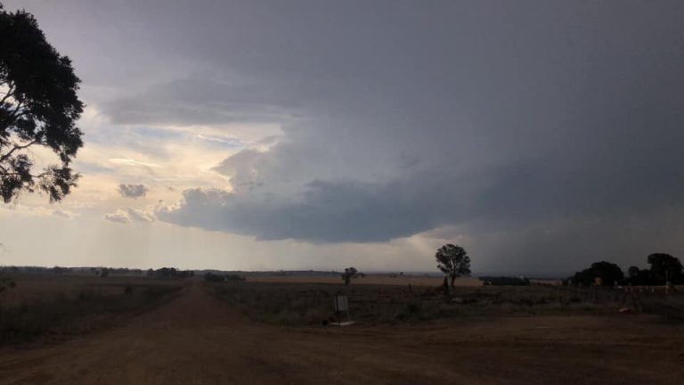 Got sunburnt until this storm approached from the southern periphery of the Coonabarabran storm complex 24th November 2019
24 Nov 2019 · Coonabarabran, NSW
Got sunburnt until this storm approached from the southern periphery of the Coonabarabran storm complex 24th November 2019
24 Nov 2019 · Coonabarabran, NSW
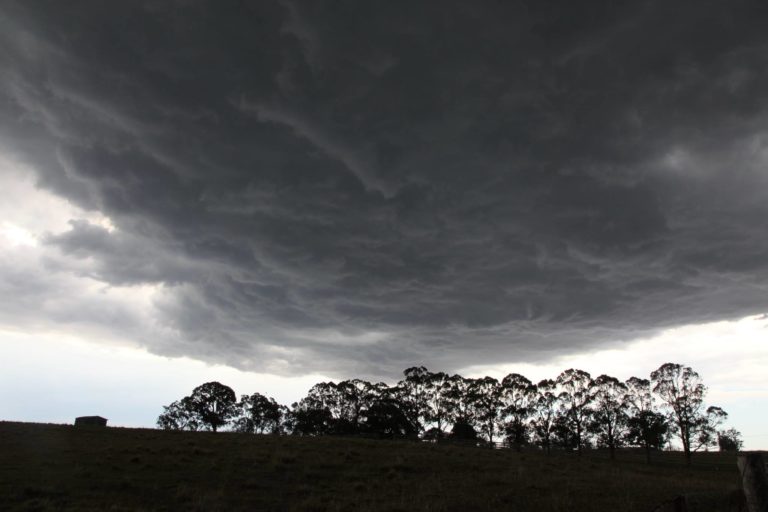 Hailstorms near Luddenham 24th November 2017
24 Nov 2017 · Luddenham, NSW
Hailstorms near Luddenham 24th November 2017
24 Nov 2017 · Luddenham, NSW
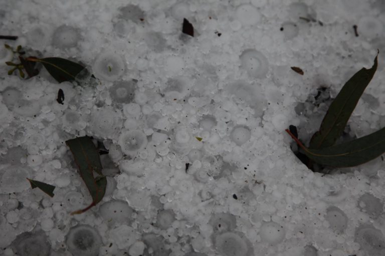 Hailstorms Blue Mountains 17th November 2017
24 Nov 2017 · Blue Mountains, NSW
Hailstorms Blue Mountains 17th November 2017
24 Nov 2017 · Blue Mountains, NSW
 When storms happened
Some impressive shelf cloud structure although slightly higher based. Full report
24 Nov 2014 · Western Sydney, NSW
When storms happened
Some impressive shelf cloud structure although slightly higher based. Full report
24 Nov 2014 · Western Sydney, NSW
 Significant storm near Cessnock (Hunter Valley)
24 Nov 2013 · Cessnock, NSW
Significant storm near Cessnock (Hunter Valley)
24 Nov 2013 · Cessnock, NSW
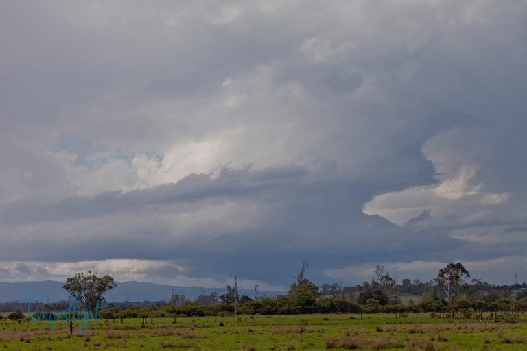 LP supercells northwestern Sydney
24 Nov 2013 · Windsor, NSW
VIC/SA/NSW Severe Thunderstorms 26 – 27 November 2009
24 Nov 2009 · Western Victoria
Possible chase though windshear not ideal!
24 Nov 2006 · Bellingen, NSW
Prospects of rain next Tuesday after extreme bushfires
24 Nov 2006 · Sydney, NSW
LP supercells northwestern Sydney
24 Nov 2013 · Windsor, NSW
VIC/SA/NSW Severe Thunderstorms 26 – 27 November 2009
24 Nov 2009 · Western Victoria
Possible chase though windshear not ideal!
24 Nov 2006 · Bellingen, NSW
Prospects of rain next Tuesday after extreme bushfires
24 Nov 2006 · Sydney, NSW
3 comments
Add a comment
You must be logged in to post a comment.
Awesome shots Con! Base structure is interesting. The shear obviously is strong on the day.
I remember watching this storm cranking along , very strong mid level winds . It was visibly moving fast even from 40-50 km away
I’m adding the time-lapse to this event, certainly was some decent shear in the mid levels Nick, , interesting near the end of the video when the surface north easterlies come into their own , quality is low res, I’ll put higher res later,
http://www.youtube.com/watch?v=ncZCVsxx6d0