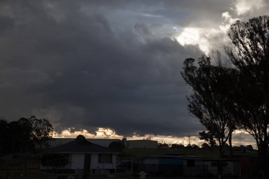
A storm produced flash flooding as 15mm fell in 15 minutes at North Ryde! It is unusual for storms to occur during winter so this storm cell was a surprise particularly its intensity! The storm was spawned near the Riverstone Schofields corridor and intensified as it moved over Baulkham Hills Castle Hill district finally dumping torrential rain over the North Ryde area. The storm then drifted east and gradually weakened. A boy was swept into a creek or river at the height of the storm.
Flash flooding at North Ryde with this storm Storm weakens rapidly near sunset
Floods · Rain
Flash flooding from Winter Storms in Sydney 16th July 2013
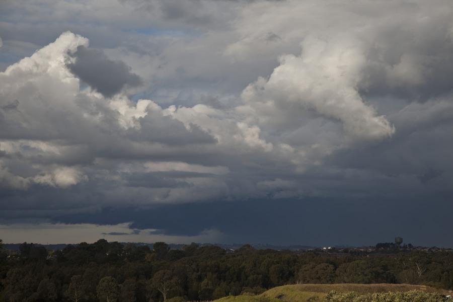
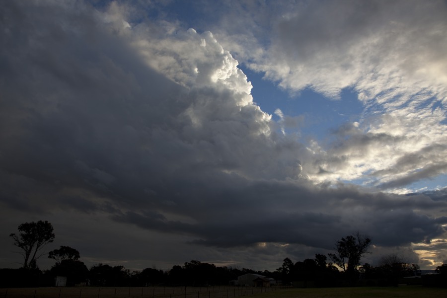
More storms near North Ryde, NSW
 Severe Hailstorms and Wind Luddenham 3rd October 2026
3 Oct 2026 · Sydney, NSW
Severe Hailstorms and Wind Luddenham 3rd October 2026
3 Oct 2026 · Sydney, NSW
 Hailstorms Western Sydney and Lower Blue Mountains
26 Sep 2026 · Sydney, NSW
Hailstorms Western Sydney and Lower Blue Mountains
26 Sep 2026 · Sydney, NSW
 First Storm and Hail Event for Season 2026-2027 – Western Sydney – Friday 25 September 2026
25 Sep 2026 · Doonside, NSW
First Storm and Hail Event for Season 2026-2027 – Western Sydney – Friday 25 September 2026
25 Sep 2026 · Doonside, NSW
 Warm Weekend with 30C Maximum Daytime Temperatures – Western Sydney 19 and 20 September 2026
20 Sep 2026 · Western Sydney, NSW
Warm Weekend with 30C Maximum Daytime Temperatures – Western Sydney 19 and 20 September 2026
20 Sep 2026 · Western Sydney, NSW
 A Week of Rain – Eastern New South Wales and Queensland – May 24 to 29
31 May 2026 · Eastern NSW
A Week of Rain – Eastern New South Wales and Queensland – May 24 to 29
31 May 2026 · Eastern NSW
 Storm Chase and Spectacular Thunderstorm Cell Camden NSW – Thursday 26 March 2026
27 Mar 2026 · Camden, NSW
Storm Chase and Spectacular Thunderstorm Cell Camden NSW – Thursday 26 March 2026
27 Mar 2026 · Camden, NSW
 Camden to Campbelltown Hailstorm 26th March 2026
26 Mar 2026 · Sydney, NSW
Camden to Campbelltown Hailstorm 26th March 2026
26 Mar 2026 · Sydney, NSW
 Significant Western Sydney Afternoon Thunderstorm with Large Hail – Saturday 21 March 2026
21 Mar 2026 · St Marys, NSW
Significant Western Sydney Afternoon Thunderstorm with Large Hail – Saturday 21 March 2026
21 Mar 2026 · St Marys, NSW
 Heavy Showers Cause Localised Flooding Across The Sydney Region – 18 and 19 March 2026
20 Mar 2026 · Sydney, NSW
Heavy Showers Cause Localised Flooding Across The Sydney Region – 18 and 19 March 2026
20 Mar 2026 · Sydney, NSW
 Intense Rainstorm / Thunderstorm Impacts Parts of Western Sydney – Hornsby to Horsley Park – Saturday Evening 7 March 2026
8 Mar 2026 · Horsley Park, NSW
Intense Rainstorm / Thunderstorm Impacts Parts of Western Sydney – Hornsby to Horsley Park – Saturday Evening 7 March 2026
8 Mar 2026 · Horsley Park, NSW
 Late thunderstorm Outer Western Sydney – Monday 9 February 2026
13 Feb 2026 · Outer Western Sydney, NSW
Late thunderstorm Outer Western Sydney – Monday 9 February 2026
13 Feb 2026 · Outer Western Sydney, NSW
 A Contrast of Two Storms Across Western Sydney – Saturday 31 January and Sunday 1 February 2026
6 Feb 2026 · Western Sydney, NSW
A Contrast of Two Storms Across Western Sydney – Saturday 31 January and Sunday 1 February 2026
6 Feb 2026 · Western Sydney, NSW
All storm reports from North Ryde, NSW →
Also on 17 July
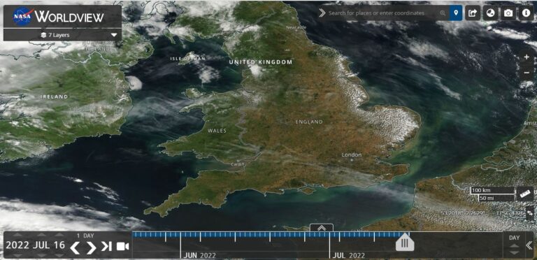 A two day heat outbreak across Southern England – 18 and 19 July 2022
17 Jul 2022 · Southern England, GB
A two day heat outbreak across Southern England – 18 and 19 July 2022
17 Jul 2022 · Southern England, GB
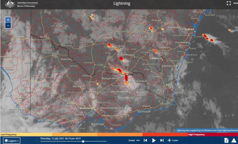 Prolonged outbreak of rain, cold, storms, wind and snow Southern Australia 13 to 18 July 2021
17 Jul 2021 · Southern Australia cold outbreak (Wagga Wagga)
Prolonged outbreak of rain, cold, storms, wind and snow Southern Australia 13 to 18 July 2021
17 Jul 2021 · Southern Australia cold outbreak (Wagga Wagga)
 Storms, snow event, cold and rain for NSW 16 and 17 July 2015
17 Jul 2015 · Sydney, NSW
SA cold-air tornado 14th July 2010
17 Jul 2010 · Two Wells, SA
Storms, snow event, cold and rain for NSW 16 and 17 July 2015
17 Jul 2015 · Sydney, NSW
SA cold-air tornado 14th July 2010
17 Jul 2010 · Two Wells, SA
5 comments
Add a comment
You must be logged in to post a comment.
John Grainger photographed a magnificent funnel during what looks to be the occlusion process. The funnel cloud is roping and more horizontal in nature. I am thinking that there is certainly strong horizontal vorticity evident in the photograph. Did the funnel cloud touch down? John Grainger suggests no. He may post the image on here later.
haha forgot it was winter for them. xD
This is a cell from yesterday at Minchinbury
Any thoughts on the potential for isolated tornadoes with storm cells tomorrow across north central Victoria? I've looked briefly at the forcast and it certainly looks like a strong system with a lot going for it. I read a comment by the SES that they must've picked up from the BoM where they stated that their is a chance of some "significant" thunderstorms tomrrow with such a moist warm airmass preceeding the cold front. Jimmy Chase! I'm down at Dinner Plain working and I tell you if I can get out down off the mountain tomorrow afternoon I might just do it.
Jeff, if you are down at Dinner Plain, there is an intense narrow band of rain with embedded storms crossing through into NE Victoria. Its quite messy but there are some embedded rain cells within it that are reasonably intense. In places where the intense cells passed over, rainfall figures are boosted. Mangalore scored 27.4 mm, Tatura scored 24.6 mm and Shepparton scored 19.6 mm from the same system in quite a short time. It seems peak wind gusts so far range from 50 km to 80 km/h within this system looking at weather stations most affected. It is a system to watch as it closes in on the higher elevations of Victoria and there are actual thunderstorms in it. The main threat appears to be the heavy rain (even possible flooding) and wind and I have seen weather alerts out for this system.
Further to the storm on Tuesday, I was at work at Auburn and I advise that the main bulk of the storm cell passed just to the north and east of the suburb. The Auburn area did get some rain from it and I heard some thunderclaps but it was not significant. Rainfall totals around Auburn were around the 1 mm to 2 mm mark being at the southern edge of it. I did not have a camera available so no photos.