There were some nice storms around Sydney and NSW today, some of them severe warned. I stayed close to Penrith as we were going to see family this afternoon but I had some time to get out and chase a local storm cell which put on quite a show and gave me some nice video. A cell developed first along the escarpment south of Kurrajong and it was a very lightning active cell and after it died off cells south west of Penrith really started to take off. I shot video for almost an hour before the storm hit Penrith and it will make a nice timelapse showing how the second cell pulled in lots of inflow before unleashing across western Sydney. I'll have some video and oics up shortly.
Jeff.

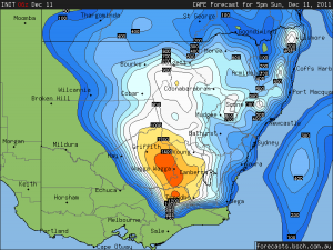
Hi Jeff,
I am glad you got the early action – looking forward to the video and images. I chased around Richmond then Penrith then near Richmond again but then headed off home. It may have been a fun chase but I guess a careful reminder that we should be cautious of lightning – one hit nearby whilst out of the car taking pictures.
Regards,
Jimmy Deguara
Hi Jimmy,
I was in a position at one point with close lightning as well and I got straight back into my car! Here is a link to a longer timelapse of yesterdays action.
http://www.youtube.com/watch?v=aDvVku8lL2A
Jeff.
Nice timelapse covering the history of the event locally. I definitely saw some turbulent base motions just north of your position.
Regards,
Jimmy Deguara
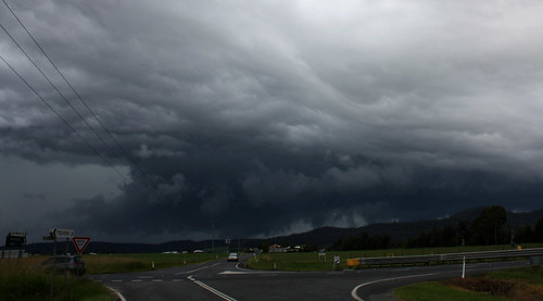
Here is a couple of images of the cell south of Penrith when it went outflow dominant.
Jeff.
Jeff,
Was I seeing things when I saw an elongated dark and consolidated base before it became outflow dominant? I never got there in time given the relatively short time frame that the bases were consolidating.
David C was at Kellyville – any pictures or video from there to upload?
Jimmy
Here is a panorama of the cell yesterday.
Jeff
Jimmy,
That is what I saw as well. The storm built for quite some time ingesting left overs from the earlier cell near Kurrajong and just before it became outflow dominant it definitely had a nice base with obvious inflow characteristics. It built for nearly an hour before dumping over Penrith.
http://www.youtube.com/watch?v=49_oaP8oETM
Jeff.
A nice Staccato Lightning bolt from yesterday
http://www.youtube.com/watch?v=hwDSEDSBdg0
Jeff.
Jeff,
Nice contrast on the shelf cloud. Apparently the shelf cloud nearer the coast was very low and quite spectacular.
Image by Peter Sawtell of Illabo
http://www.flickr.com/photos/23222866@N08/6495274819/sizes/l/in/photostream/
http://www.flickr.com/photos/23222866@N08/6495274783/in/photostream/
Image by Peter Sawtell of Illabo
On another note, David C just forwarded me a picture of a tornado near Bethungra in the South West Slopes. Nice!
Jimmy
Nice coverage of that storm Jeff – looked interesting on radar!!
And that tornado is incredible :-) Down in the S part of the state again! Seems to have been the place to be the last couple of years for tornadoes.
I did a massive 2000km chase on my days off – did the NWSP (mostly Gunnedah-Moree region) on the Sunday, and the NR on the Monday. Two great gusters on the NWSP on Sunday, and 3-3.5cm hail from the Coraki/Ballina storm/supercell on Monday, plus nice gusters and strong outflow and pea size hail near Grafton earlier in the day. So many photos to go through, and am working the next few days. So here is two dodgy panos from the Sunday on the NWSP – two of the best gusters I have personally seen.
Will get the larger versions/other pics up later.
Hi Ben,
Nice shelf cloud structures and high contrast opportunities. Well done on the chase! You are certainly putting in the time and effort.
Regards,
Jimmy Deguara
Nice tornado, that storm on radar didn’t really look that exciting but it just goes to show what perhaps local conditions can produce.
Love the shelf clouds Ben, beautiful contrast.
Jeff.
Thanks guys! I went to edit the rest of my photos on mums desktop computer, and the 2nd image was really dark. I hope no one else found this? I’m confused as to what PC is best to edit on for others monitors. Anyway here are the rest of the photos. And yes Jimmy, it is funny what SDS can do to you ;) It still isn’t satisfied as the entire chase I saw about 3 CG’s. Most disappointing.
11th December 2011
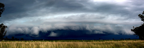
Guster near Boggabri
Possible funnel from this guster
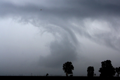
Guster south of Moree

12th December 2011
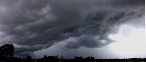
Guster near Grafton
Base coming over the hill
Rest of the pics + large versions can be seen at http://www.flickr.com/photos/28009095@N05/