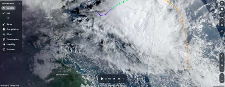
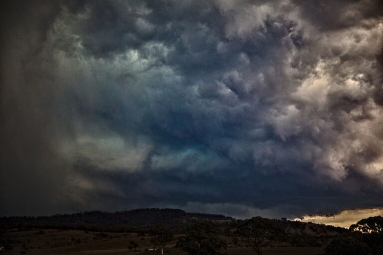
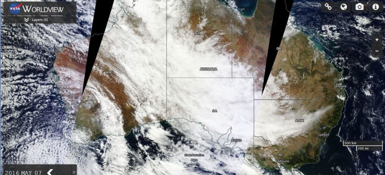
Weather models are beginning to identify a significant rain event for a wide swathe of eastern Australia commencing across north east Queensland, then spreading inland to Central Queensland then spreading south into New South Wales later on during the forecast period.
If 2022 has not already been wet enough, this event should it play out would have the potential to create more havoc including renewed flooding of low lying areas of rivers.
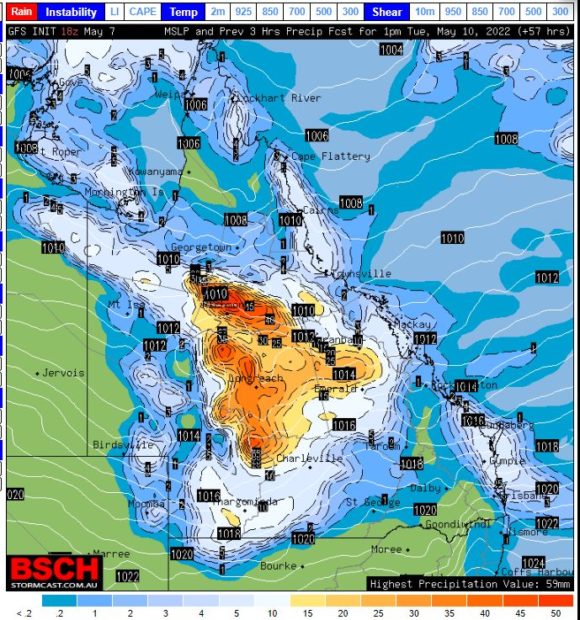
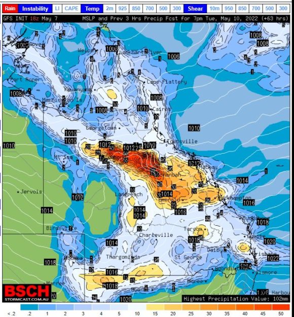
From what can be ascertained within the weather models:
Bureau of Meteorology – Water and the Land
1 – Cumulate totals of 200 to 300 mm are suggested within coastal area between Rockhampton northwards towards Cairns.
2 – Falls of 100 to 150 mm are suggested for inland areas of Queensland with falls of 50 to 100 mm for areas west approaching Mt Isa.
3 – Forecasts are being made for falls of 50 to 100 mm across a swathe of inland New South Wales and for coastal areas including Sydney.
4 – Widespread falls of 25 to 50 mm are made for a majority of New South Wales including northern Victoria.
BSCH
1 – Falls of 150 mm to 175 mm are being made for certain coastal areas of Queensland but interestingly, falls up to 150 mm of rain are being made for inland areas around Richmond then south east towards Emerald.
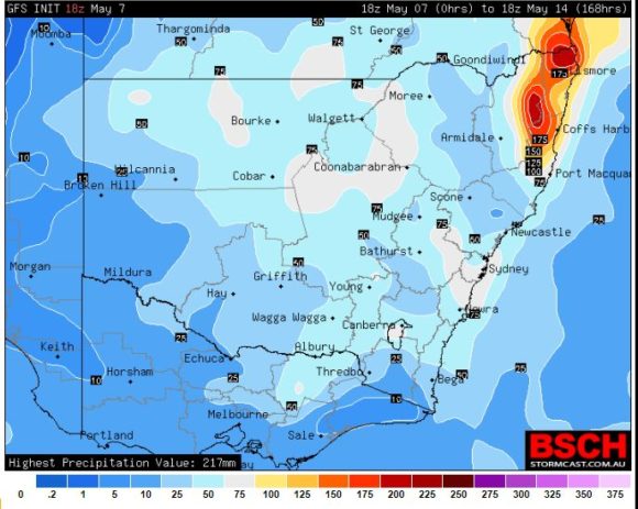
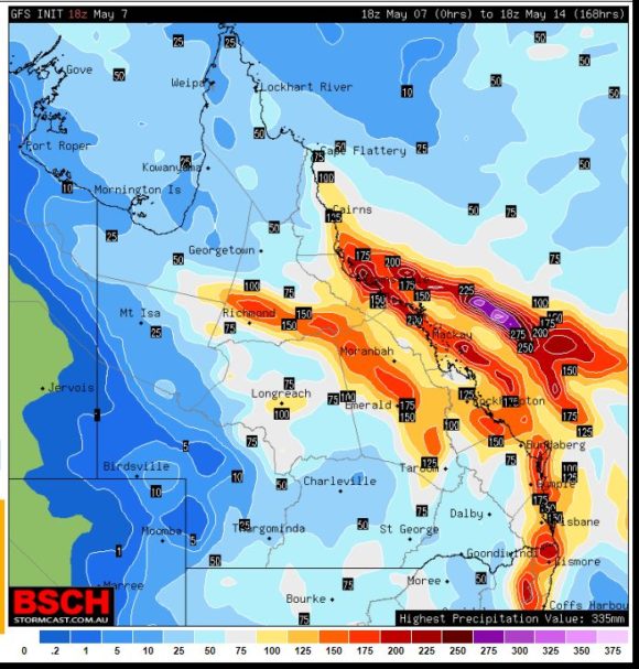
2 – It can be seen that high cumulative totals of 150 mm are being made for areas around Lismore and inland areas north west of Coffs Harbour in north east New South Wales.
3 – Widespread cumulative falls of 25 mm to 50 mm are being made for most inland areas of New South Wales.
There is some consistency of models occurring.
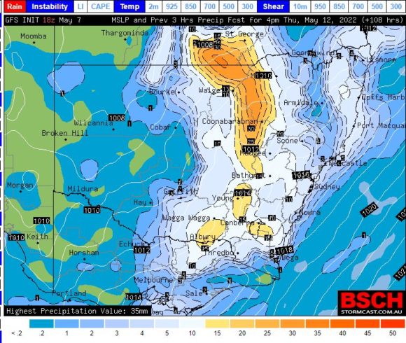
It appears that initially, such rainfall would occur in Queensland during the earlier part of the new week with falls occurring across inland New South Wales later during the forecast period (Approximately mid week to Thursday).
Given how wet it has been and recent flooding, any such rainfall would have potential to cause flooding on already wet river systems creating further stress on areas still recovering from the February and March floods.
Attached to this post are various rainfall synopsis for the next 7 to 8 days across eastern Australia.