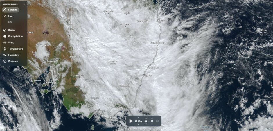
During Sunday and Monday 17 and 18 May, a large cloud mass crossed through New South Wales and Queensland providing useful rainfall across many regions of both states. However, much heavier rainfall fell across parts of Southeast Queensland and far northeast New South Wales.
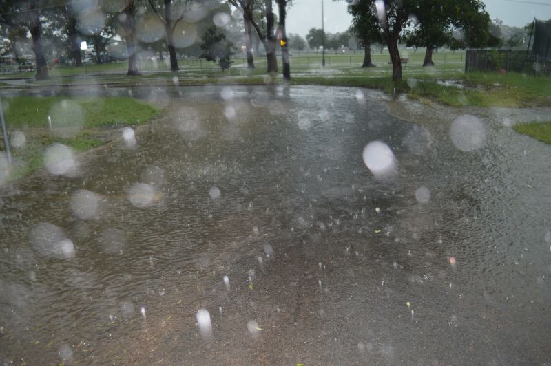
A burst of intense rainfall during Monday 18 May 2026 caused localised flooding across parts of the Gold Coast city region. Such heavy rainfall was localised to a small region of Southeast Queensland centred largely on the Gold Coast region and adjacent hinterland.
Similar rainfall from the same event spilled into a small area of the Northern Rivers region of New South Wales impacting areas west of Tweed Heads.
The intense rain event that impacted southeast Queensland produced isolated totals that approached 200 mm. This was a single day event and by Tuesday, rainfall had eased.
Generally, the heaviest rainfall within New South Wales fell across the northeast third of the state but the 100 mm totals were limited to a small region.
Some rainfall totals from the event include but not limited to:
Gold Coast City (South East Queensland)
- Springbrook National Park – 193 mm.
- Lower Springbrook – 177.2 mm.
- Springbrook Road – 177 mm.
- Natural Bridge – 165 mm.
- Biggera Creek Dam – 160 mm.
Note: Widespread 100 to 150 mm totals occurred right across Gold Coast city during the event.
Brisbane to the north received much less with 50 mm to 80 mm totals commonplace.
Tweed River region (New South Wales but adjacent to the border of Queensland)
- Couchy Creek – 151 mm.
- Upper Rous River – 149 mm.
- Palmers Road – 137 mm.
Other areas of the Northern Rivers received 50 to 99 mm.
The inland rainband that spread through New South Wales from the west and northwest during the 17 and 18 May produced widespread falls of 25 to 50 mm across the Central West and falls of 50 mm to 75 mm across the northwest of the state.
The heaviest totals across the inland regions were:
- Mt Kaputar National Park – 73.8 mm.
- Nundle – 71.8 mm.
- Weabonga – 67 mm.
- Gunnedah Racecourse – 60.2 mm.
What is interesting is that over the next 10 days, further rain events are suggested with cumulative totals exceeding 100 mm across several regions including those impacted by the events of the 17 and 18 May.
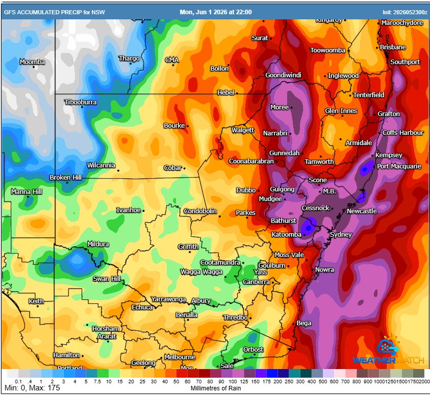
The GFS is suggesting the following:
- Moree region – Potential for 125 mm.
- Tweed River – Potential for 60 to 90 mm.
- Port Macquarie – Potential for 125 to 175 mm.
- Hunter Valley – Potential for 125 mm.
- Sydney Region – Potential for 70 to 150 mm with heavier totals across northern areas.
As such, the potential for new or further flooding exists across areas already saturated from the earlier event should this unfold.