Extreme Storms

General Weather

Failed Forecast 21st January 2014

· by Jimmy Deguara

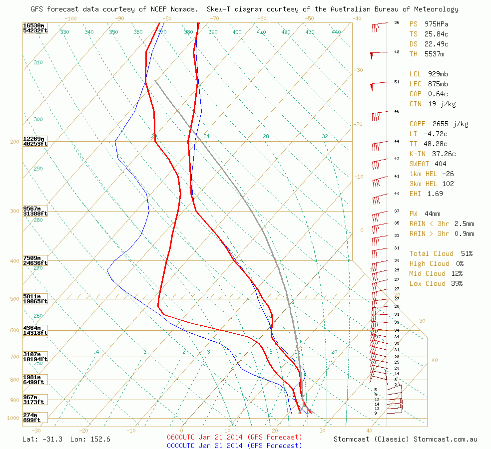
gfs.stormcast-sounding.bsch.init-2014012012z.fcst-2014012106.lat_-31.33_lon_152.61_custom-tdp_hodo-off
Fairly deep moist layer
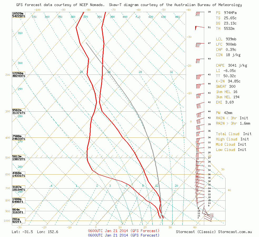
gfs.stormcast-sounding.bsch.init-2014012106z.fcst-2014012106.lat_-31.48_lon_152.59_custom-tdp_hodo-off
Moisture depth decreased in this model run.

The models, and models they are, were pointing to fairly impressive soundings in the region particularly near Port Macquarie. Taking the upper and lower limits, the CAPE and CIN values were pointing to a fairly substantial and easily breaking CAPE values in excess of 3000J/kg and CIN values of the 20 mark even as early as 2pm. There was a 20% value of fail mode based on the sensitivity of moisture plugging in the worst possible scenario. And the fail occurred. The region near Mt Seaview or jut south did receive and shower and  a storm to the north but it was NE NSW that received severe warnings for hail and wind. The day promised a low base scenario and deep ample moisture. So what went wrong?
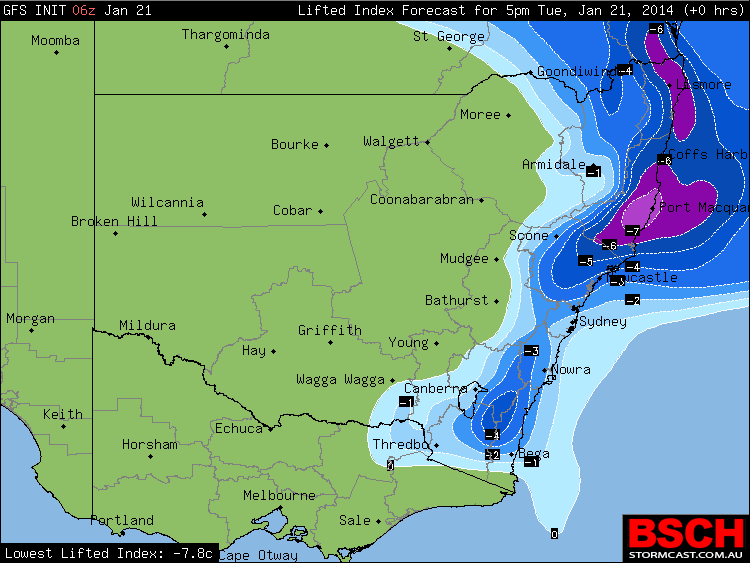
gfs.stormcast.bsch.init-2014012106z.fcst-201401211700z.li.nsw.null.0
Anticipated values of Surface Lifted Index – the region near Port Macquarie was where the soundings were taken above.
high_CAPE_Mid_North_Coast_21st_January_2014
Anticipated CAPE values in the Port Macquarie region
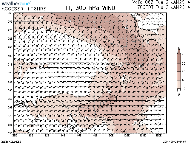
total_totals_21st_January_2014
Total Totals shifted out of the area in latter Bureau model run probably due to upper level warming.
gfs.stormcast-sounding.bsch.init-2014012106z.fcst-2014012106.lat_-28.51_lon_153.27_custom-tdp_hodo-off
Soundings in NE NSW with high CIN values – higher based convection eventuated.
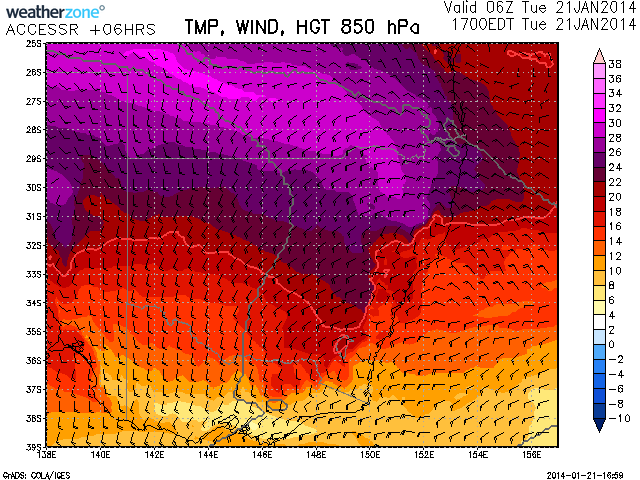
extremely_hot_850hPa_temperatures_21st_2014
fairly substantial heating over NE NSW

It seems the latter Bureau models put the temperatures at 500hPa of -6C which to me introduced substantial warming compared to the -8C. This meant that towers that did rise rapidly and only filtered through this layer quickly disconnecting from the anvils. There also seemed to be a lack of lower level forcing.
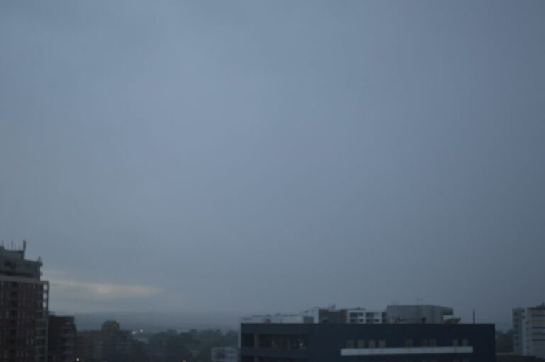
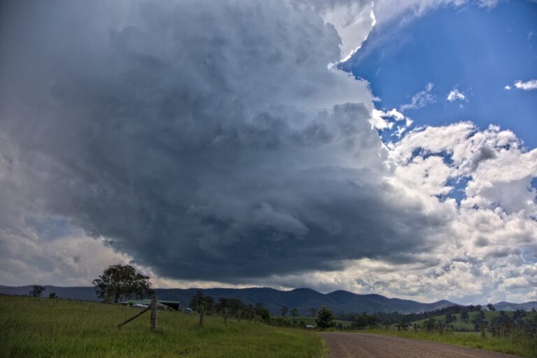
Open the storm map around Port Macquarie, NSW

More storms near Port Macquarie, NSW

Torrential rains and flooding crises for coastal New South Wales – 19 to 24 May 2025 24 May 2025 · Mid North Coast, NSW Ex Tropical Cyclone Alfred – The aftermath continues includes images Bellinger Valley NSW – Sunday 9 March 2025 9 Mar 2025 · Bellinger Valley, NSW This was a great chase! The first cell rotating nearby!Got the first storm S of Gloucester from birth which quivkly became a supercell but took the … 15 Jan 2023 · Gloucester, NSW A rare chase in April Mid North Coast I liked the structure and lighting and of course 5 to 6cm hail Earlier structure before the green tinge and fu… 10 Apr 2022 · Mid North Coast, NSW 1 year ago what? Gees Colin Bryant Colin and I chased for a couple of days with this being the return trip 22nd January 2021. Nothing terribly severe… 24 Jan 2022 · Mount Seaview, NSW Awesome day. 1 year ago. Gosh Got the first storm S of Gloucester from birth which quivkly became a supercell but took the wrong turn elsewhere and m… 15 Jan 2022 · Gloucester, NSW Not bad for a mid north coast Earlier structure before the green tinge and further updraft history. Time-lapse of this stage should be great! Then la… 10 Apr 2021 · Kempsey (Mid North Coast), NSW Heavy Rain and floods – Coastal New South Wales – 18 to 21 March 2021 20 Mar 2021 · Mid North Coast floods, NSW Colin and I chased for a couple of days with this being the return trip 22nd January 2021. Nothing terribly severe so more of a bonus photography sess… 24 Jan 2021 · Mount Seaview, NSW Got the first storm S of Gloucester from birth which quivkly became a supercell but took the wrong turn elsewhere and missed getting onto the hook whi… 15 Jan 2021 · Gloucester, NSW Kempsey Hailstorm 10th April 2016 6 Nov 2020 · Kempsey, NSW One to end the day north of Gloucester looking generally east or northeast 3 Nov 2020 · Gloucester, NSW

All storm reports from Port Macquarie, NSW →

Also on 22 January

4 comments

Add a comment

After the storm Hail damage repair Hail dents removed from behind, factory paint kept. Hail Dent Repair. Chase with us Chase a storm for real Guided storm chasing tours in Australia and Tornado Alley. See Thunderbolt Tours.
Coming soon Radar and storm forecasting Live radar tools and severe storm forecasts from the Extreme Storms team.