During the past 6 days, significant rainfall fell across parts of New South Wales and Queensland. The event could be described as intermittent as long dry periods did occur between individual events.
For Sydney, the event peaked on Thursday night with one significant burst of rain occurring across the southern and western suburbs of the city.
Across other regions of New South Wales and Queensland, the most significant events of the past 6 days include:
1 – Central West New South Wales
The event peaked during Monday and to 9 am Tuesday in which rainfall totals topped almost 60 mm at Dubbo (Total 59.4 mm) marking the second highest rainfall total recorded across the city for the month of May. This was followed by another 25.8 mm to 6 pm by Tuesday evening.
Other localities to receive 50 mm totals include Canowindra, Gilgandra and Yeoval.
2 – South Coast
Jervis Bay Airfield received 62 mm of rain to 9 am Tuesday morning.
3 – Northern New South Wales and Queensland
Thunderstorms brought heavy rainfall and localised flooding late Wednesday and early Thursday morning. Further it is calculated that at least 460,000 lightning strikes occurred within 800 km of Dalby during the event. This is remarkable just days out from June.
4 – Sydney
There were two separate events with one early Thursday morning that brought a burst of intense rainfall across parts of the northern suburbs and into parts of the Western Suburbs. The event impacted Blacktown just after midnight Thursday morning.
The second event was far more notable. An intense rainstorm swept in from the south east crossing through parts of the southern suburbs and into Western Sydney producing heavy rainfall during the Thursday evening peak hour period. For those suburbs affected by the event, rainfall totals reached 34 to 36 mm within a short period of time. This caused havoc including numerous vehicle accidents including two on the M4 Motorway with one occurring at Prospect (Blacktown).
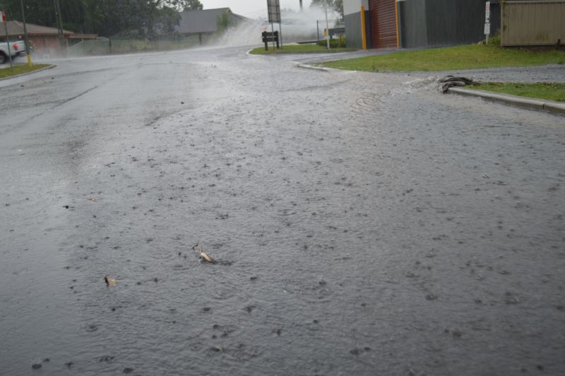
I drove home during the event from work and driving was a challenge during peak hour. This was made worse due to localised flooding of roads around Merrylands. This was the first time that I have seen any form of flooding at Merrylands within the vicinity of the Stocklands Shopping Centre.
5 – Central Coast
Heavy Rainfall with falls of 50 to 94 mm featured across the Central Coast of New South Wales during Thursday evening.
6 – Hunter Valley and Lower North Coast
Heavy rainfall impacted the Hunter Valley during Thursday evening. The same system brought 100 mm totals to a few isolated areas including:
- Careys Peak (Barrington Tops) – 160.6 mm.
- Mount Barrington – 143 mm.
- Comboyne Public School – 127 mm.
- Yarras Mountain – 105 mm.
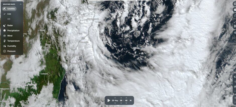
The low pressure system responsible for the rainfall quickly moved out to sea Friday allowing conditions to ease quickly.
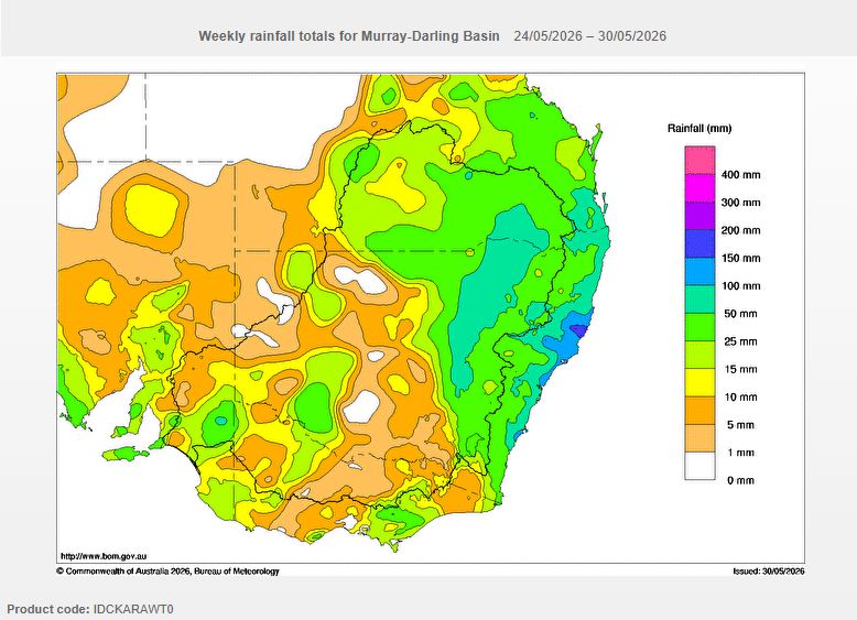
Some cumulative 7 day rainfall totals across the whole event include:
- Comboyne Public School – 271 mm.
- Crawford River – 243 mm.
- Careys Peak – 201 mm.
- Jervis Bay – 186.2 mm.
- Gosford Airport Weather Station – 162.8 mm.
- Tyungun Alert (Queensland being the highest total within the state for the selected period) – 113 mm.
Attached to the post are:
1 – A plot showing the cumulative rainfall totals across the Murray Darling Basin for the 7 day period to 9 am Saturday morning.
2 – A detailed NASA Zoom Earth image of Friday morning showing a horseshoe shaped cloud mass moving off the New South Wales coastline. The centre of the low is clearly visible in the image and located within the Tasman Sea.