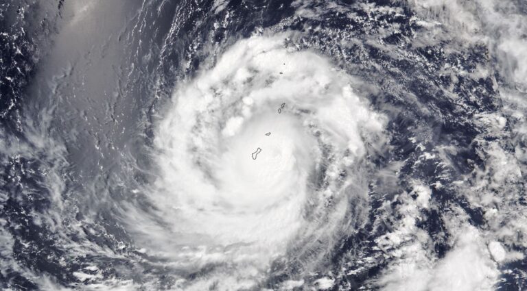
Super Typhoon Bavi is an amazing storm simply because it remained as a high end Category 4 system or a Category 5 storm on the Saffir Simpson Scale for considerable time.
Born southeast of Guam, the storm tracked northwest passing midway between Guam and the Northern Mariana Islands. The eyewall remained out to sea but the inner eyewall impacted the islands of Guam and most of the Northern Mariana Island chain.
The storm sustained peak wind gusts of greater than 250 km / hour for 3 days with peak winds gusting to 285 km/h during its strongest phase.
During the 7th July, the storm briefly weakened to a Category 4 system before re intensifying with peak wind regaining at least 250 km/h.
During its most violent phase, the storm was well supported by oceanic waters heated to 30C and 31C respectively.
Ther storm’s width has also been impressive reaching as much as 1,000 km in diameter.
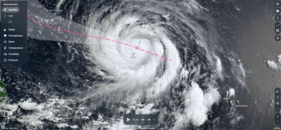
NASA’S Zoom Earth image of early Monday 6 July shows a spectacular spiral like storm system that is compact with spiral bands of cumulonimbus clouds surrounding an intense core featuring destructive winds. The storm resembles a spiral galaxy.
The storm is now weakening as it approaches the Chinese city of Whenzou south of Shanghai. Notwithstanding its weakening phase, significant rainfall and flooding is expected as the system comes ashore and breaks down into a rain depression.
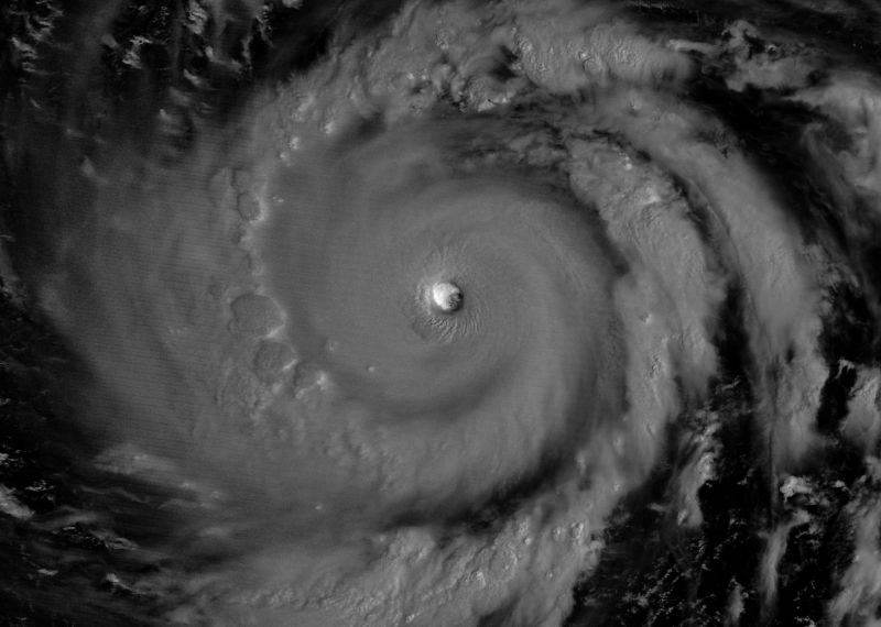
Note: The feature image above downloaded from NASA – Image of the Day shows the storm at night just east of Guam – The intense nature of the super typhoon is revealed complete with a compact eye. Cumulonimbus clouds are evident across the storm system. The storm had reached Category 5 on the Saffir Simpson Scale at the time the image was taken.