
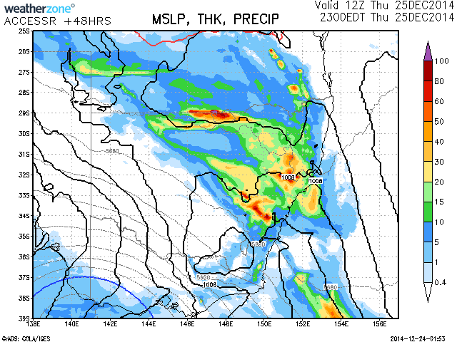
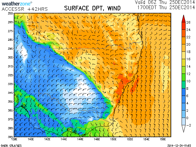
Models are still in agreement for a rainfall event for eastern NSW Christmas Day 2014. Some moderate to heavy falls should occur from the Blue Mountains to the Mid North Coast and Hunter Valley as rich dew points (22C dew points) stagnate from Sydney north to the Hunter. The high dew points combined with warm temperatures will make conditions rather uncomfortable but the rain falling should hopefully ease some of those conditions. Rainfall totals of 20 to 30mm should be rather widespread with falls of up to 60 to 80mm possible locally perhaps new boundaries and during thunderstorms.













Please find some commentary on this rainfall event:-
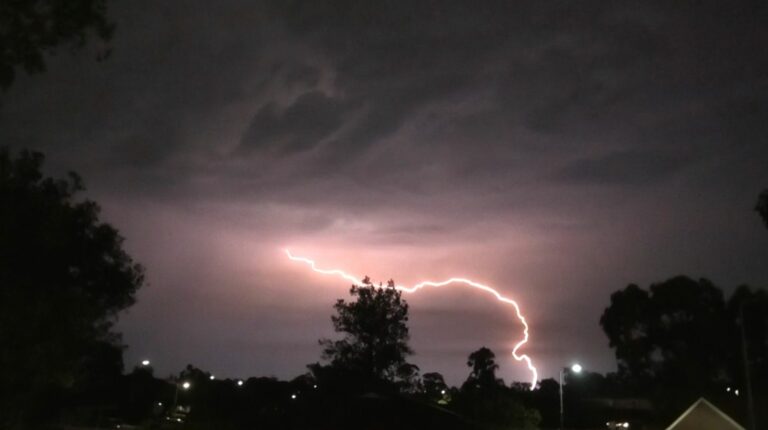
Christmas Day for Sydney was mostly fine and sunny for the first time in 3 years although cloud developed after 2 pm and thickened. A series of thunderstorm cells and showers moved across the city no earlier than 4 pm and showers continued throughout the evening period.
I did not chase this event for a number of reasons relating to Christmas. Across Sydney rainfall totals varied widely. The north east portion of Sydney received some strong rainfall totals including:-
54 mm at Berowra (Highest within Sydney).
47 mm at Mona Vale.
44 mm at Avalon.
41 mm at Hornsby.
40 mm at St Ives.
36 mm at Belrose.
Much of Sydney did not approach these figures and across the western suburbs general falls of 8 mm to 20 mm were common.
A fall of 36 mm fell at Camden and 34 mm near Campbelltown occurred.
South Coast
The bigger totals were boosted from thunderstorm cells. A locality called Grassy Gully just west of Nowra had 92 mm while nearby Nowra had 30 mm.
Bungonia and Touga had 53 mm. There was a fall of 33 mm at Burrell Lake just south of Ulludulla but further south, no storms or rain occurred.
Hunter Valley.
As mentioned in the primary post above, it was expected that big falls would occur in the Hunter Valley due to high dew points. Some strong rainfall totals occurred within the Hunter Valley and Lower North Coast which include:-
Dungog – 99 mm (The highest total).
Upper Chichester – 96 mm
Upper Myall Creek – 92 mm.
Mt George – 87 mm.
Tocal – 85 mm.
Wauhvoy – 83 mm.
Halton – 72 mm.
Loctock Dam – 71 mm.
Craven – 71 mm.
Careys Peak – 68 mm.
Upper Ravchel 68 mm.
Broke 67 mm.
Cressfield – 59 mm.
Cabbage Tree Mountain – 53 mm.
Carrowbrook – 53 mm.
St Seaview – 52 mm.
This generally covers all readings exceeding 50 mm. There are many readings in the same area within the 25 mm to 49 mm range. Generally from this system, the Hunter Valley and Lower North Coast received the most widespread and heaviest totals from this event.
Thanks Harley for the statistics report. The models seemed to have been pretty much spot on with rainfall predictions based on egion and totals anticipated. Welcome falls nevertheless!
Thanks Harley for the statistics report. The models seemed to have been pretty much spot on with rainfall predictions based on egion and totals anticipated. Welcome falls nevertheless!