During the early part of the week between Monday 26 and Wednesday 28 May 2025, two unusual weather events impacted separate parts of Australia being:
1 - An inland rain event impacting tropical and subtropical Northern Territory at a time when the dry season is taking hold.
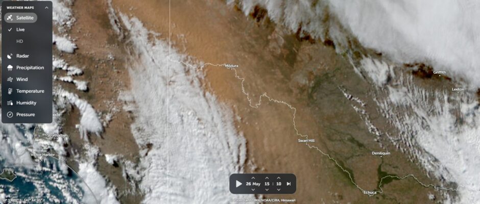
2 - A significant dust storm that passed over much of Victoria on a relatively dry cold front with the dust storm crossing the coast and passing out to sea Tuesday morning.
Both events are unusual because both would normally be expected during spring or summer rather than:
- For Northern Territory - The beginning of the dry season.
- Victoria - On the cusp of winter.
Inland Northern Territory Rain event
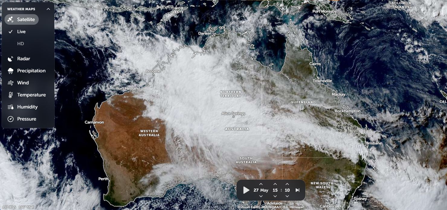
The inland Northern Territory rain event is a result of an extensive cloud mass passing over the state and into Queensland. With the dry season taking hold, such rain events would normally not be expected but this event:
- Produced rainfalls of 100 mm around Katherine with the Tindall Airforce Base weather station recording at least 179.8 mm. This is remarkable because according to Weatherzone, the average rainfall for May at the weather station site is 2.2 mm. This is a new weather record at the Tindal site (Since records commenced).
- Produced widespread rainfall across the inland areas including widespread falls of 40 to 80 mm including 40 mm falls around Alice Springs.
- Produced isolated 200 mm falls along part of the border of Northern Territory with Western Australia
This is highly unusual given the time of the year that this occurred.
The attached satellite image of Australia for Tuesday 27 May 2025 shows the extensive cloud mass covering much of the Northern Territory that produced the rain event.
Victoria Dust storm
A strong cold front passing across southern Australia on Monday and Tuesday 26 and 27 May produced a significant dust storm across eastern South Australia and Victoria. This part of the continent has had sparse rainfall over the past several months and drought conditions have taken hold. The several rain events impacting other parts of Australia have failed to penetrate into Western Victoria and Eastern South Australia.
The passage of the cold front resulted in a significant dust storm. There was little if any rainfall produced by the front and given the lack of surface vegetation cover, extensive orange coloured dust of kicked up by the wind change and carried east.
Surprisingly, the narrow dust storm passed over Sydney between 7 am and 9 am Tuesday morning with the wind change then out to sea.
This is usually an event seen during spring and summer rather than on the cusp of winter.
This shows how dry it has been across western Victoria of late.
The feature image of Western Victoria of Monday 26 May 2025 (ZOOM Earth NASA) clearly shows the dust storm on or ahead of the cloud mass and cold wind change and impacting San Hill and Mildura at the time the image was taken.