A multi day rain and flooding event has just impacted much of coastal New South Wales between Sydney to the south and Coffs Harbour to the north. The event commenced Sunday and continued well into Friday.
Some key features of this event include:
- Rainfall has exceeded 100 mm at locations on every day between Monday and Friday and daily totals have even exceeded 200 mm.
- At the time of writing, there are four (4) known fatalities.
- SES crews have undertaken at least 723 flood rescues since the event commenced Monday.
- Major flooding has occurred along coastal rivers and flooding has even cut the M1 Motorway linking major coastal centres. Up to 50,000 residents have been cut off.
- Flooding has impacted large service centres such as Port Macquarie and Taree.
- During early Friday morning, heavy rain impacted Windsor with more than 180 mm falling. This is the most rainfall that I have seen occur at this site since moving to Sydney in 1997. It appears that this could be a May rainfall record for the Richmond weather station site.
The system developed over Sydney Sunday night after dark and into Monday morning (May 18 and 19). The initial weather system then cleared Sydney early Monday morning tracking to the north. This left a few showers in its wake.
Rainfall totals across Sydney from that event are regarded as moderate to heavy depending on location. Some parts of southwest Sydney missed the event completely.
Key features of this event include:
- The rainfall spread ranged from 20 mm to 70 mm.
- The heaviest fall occurred at Wahroonga.
Heavier totals occurred across the Central Coast and Newcastle north of Sydney where falls exceeded 100 mm including:
- Lisarow - 107 mm.
- Kangy Angy - 121 mm.
- Wyee - 135 mm.
As the system passed over the mid north coast, a combination of weather setups including an upper cold pool of air, a developing low pressure and constant onshore winds blowing over a warm Tasman Sea enhanced the system. Convection occurred which resulted in higher rainfall totals. Further, the weather system stagnated over the same area resulting in a train echo effect where rain event after rain event trained onto the same area of coastline for 3 days.
Rainfall totals easily exceeded the monthly averages and the result was moderate and major flooding.
Some daily rainfall totals include:
To 9 am Tuesday morning
- Upper Allyn - 209 mm
- Port Macquarie Airport - 238.8 mm.
- Taree Airport - 269 mm.
A region extending from Port Macquarie (North) to Dungog (south) received daily totals of 100 mm or greater. Given that catchments were already wet from recent rain events, the Tuesday totals were enough to cause major flooding at Gloucester, Taree and areas along the Patterson River.

To 9 am Wednesday morning
- Taylors Arm - 215 mm.
- Kookaburry School - 222 mm
- Millbrook - 234 mm.
- Moppy Lookout - 244 mm.
- Mt Seaview - 319 mm.
Heavy falls fell around Coffs Harbour with falls ranging from 83 mm to 162 mm.
A region extending from Coffs Harbour south to Taree and Dungog received daily totals of greater than 100 mm with several locations receiving falls that exceeded 200 mm.
This only worsened the flooding situation with flooding now occurring within the Bellinger Valley.
To 9 am Thursday morning
This is a carbon copy of Wednesday with the same region again heavily impacted.
- Woolgoolga - 202 mm.
- Kookaburra School Hut - 224 mm
- Bowraville - 229 mm.
- Kooroowi - 240 mm.
Heavy falls fell around Coffs Harbour again with falls ranging from 158 mm to 246 mm including 215 mm within the Coffs Harbour city centre.
During Thursday, the system began to move south back towards Sydney. Over Sydney scattered showers turned to periods of moderate to heavy rain. By late Thursday, significant rain had set in across the city.
The same system also penetrated more inland but with lighter totals the further south and west the system travelled.
To 9 am Friday morning
Significant overnight rainfall totals impacted parts of Sydney with 100 mm totals occurring including 181.4 mm at Windsor.
Enough rain fell to cause some concerns of minor flooding within low lying areas of Richmond and Windsor. However, this was minor when compared to what was occurring at Taree and Port Macquarie. Rainfall figures included:
- Homebush Bay - 118 mm.
- Bulahdelah - 133 mm.
- Whoota - 148 mm.
- Lake Macquarie - 154 mm.
- Macquarie Pass (Est of Wollongong) - 242 mm.

Across Sydney, the heaviest totals occurred away from the coast rather than along the coast which rarely occurs. Upslope flow featured across the ranges which is why 181 mm fell at Windsor and 115 mm fell at Penrith.
A majority of suburbs had falls of greater than 70 mm with many areas receiving falls of 90 to 100 mm including a fall of 92.2 mm in my personal rain gauge.
Some incredible 4 day May totals include:
- Comboyne Public School received 704 mm in 4 days.
- Mt Seaview received 686.6 mm over 4 days.
- Taree Airport received 603.6 mm over 4 days.
During Friday, the rainfall eased with the rain passing out to sea or dissipating over the inland region. The same system brought some desperately needed rainfall to parts of the southwest inland but totals of 20 to 30 mm are not enough to ease developing drought conditions.

The event is likely to be declared a catastrophe given the loses that have occurred. At the time of writing, there is no idea what the likely loses will be.

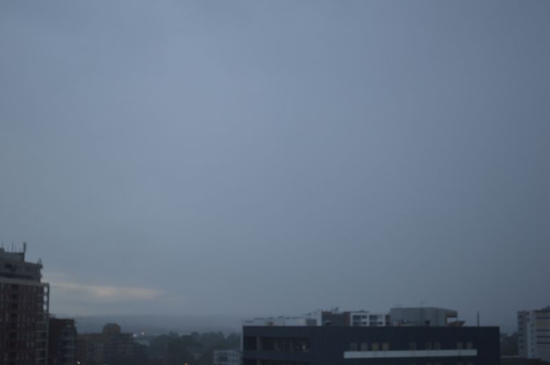
The feature image is taken at Auburn at sunrise Friday morning. A clearing trend is starting to occur to the west but there is still heavy rainfall to the north and east.