There were two separate thunderstorm events during Tuesday afternoon of significance with one event over parts of Western and South Western Sydney and another much stronger event that crossed through Victoria.
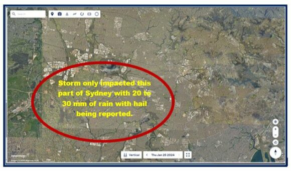
Using Nearmaps (January 2024 image), the location of the thunderstorm that impacted parts of Western Sydney can readily be plotted as shown. The storm formed over south west Sydney and only traveled a short distance before collapsing over the Bankstown area. It had a short life span but had a dramatic effect.

Thunderstorms have been rare events this spring / summer season across Western Sydney and this storm broke an unusually long summer period without a thunderstorm.
The storm was relatively intense despite being of short duration. Hail was reported around Lakemba and there were reports of trees being brought down and power outages.
Heavy rain was confined to a small area including:
- Kelso Creek - 32 mm.
- Rossmore South Creek - 30 mm.
- Bankstown - 25 mm.
- Badgerys Creek - 22 mm.
All areas outside the area edged in red was not impacted by any significant weather event or any rainfall throughout the day.
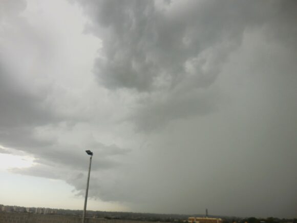
Photos of the storm taken at Auburn at 4 pm Tuesday afternoon are attached including one shown as the feature image.


Thunderstorm event - Victoria
A more significant event crossed through Victoria Tuesday afternoon that has had a dramatic impact on electricity supplies across parts of the state. The storm event coming with a cool change brought brief but sharp rain showers and destructive wind gusts.
A major 500 kilovolt electricity transmission line north of Geelong failed when six high voltage transmission towers fell during a thunderstorm that passed over the area and the northern Geelong suburb of Anakie. This impacted at least 529,000 customers businesses and homes across affected areas. Saturday morning, widespread power outages still exist showing the scale of the event.
A weather station near Colac (Mt Gelibrand) recorded a peak wind gust to 130 km/h.
Other weather stations in the path of the storm which impacted both northern and southern areas of the state also recorded peak wind gusts with the change including:
- Yarram Airport - 126 km/h.
- Avalon Airport - 122 km/h.
- Swan Hill - 117 km/h.
- Melbourne Airport - 102 km/h.
- Rutherglen and Yarrawonga - 87 km/h.
- Albury Airport - 10 minutes of wind gusts to 85 km/h between 7.44 pm and 7.54 pm.
- Sheoaks - 85 km/h.
- Wangaratta - 85 km/h.
- Geelong - 80 km/h.
This event was widespread across the state. Rainfall was not excessive but damaging winds was widespread across the state.
Given the widespread nature of the event, it will take time to fully restore the electricity supply to all affected customers.
