A significant rain and storm event has impacted large parts of New South Wales and Victoria over the past 2 days which has eased serious dry conditions for some regions.
The system pushed east across Victoria during Thursday afternoon but gathered strength as it crossed into eastern and northern Victoria during the latter part of the day.
While this was generally a rain event, there were embedded thunderstorm cells with this and as a result, some localities received significant falls. In some areas, this was the best rain event since late 2023.
Much of the rain fell between 8 pm Thursday Evening and into the early hours of Friday morning.
Emerging drought conditions have eased. This could be regarded as an autumn break given that enough rainfall fell.
Embedded thunderstorms pushed rainfall totals to over 50 mm at some locations but falls of 25 mm to 49 mm were common across northeast Victoria and far southern inland regions of New South Wales.
The best rainfall totals to 9 am Friday for Northeast Victoria include:
- Dohertys - 84 mm.
- Lake Eildon - 78 mm.
- Mt Hotham - 77 mm.
- Alexandria - 73 mm.
- Stringybark Creek - 64 mm.
- West Wodonga - 60 mm.
The best rainfall totals to 9 am Friday for southern inland New South Wales include:
- Albury Airport - 38.4 mm.
- Dandolco - 36 mm
The same system crossed New South Wales during Friday. The system passed over Sydney Friday morning producing very light rainfall totals in the 1 to 2 mm range before clearing to a sunny afternoon after 2 pm.
At the same time, the system redeveloped as it tracked through and into northeast New South Wales producing healthy rainfall totals for Friday including:
- Giralong - 67 mm (Bellinger Valley)
- Barraba - 52 mm.
- Dubbo - 36 mm.
Falls were not as heavy as those further south but they were still beneficial.
A very isolated fall of 92 mm fell at Kindee Bridge (Mid North Coast).
Again, embedded thunderstorms were also a feature in some locations which boosted rainfall totals.


Storm chase following the rain event - Wilton and Picton
While Sydney largely missed out on anything significant from the event, I did undertake some weather modelling on Wednesday and Thursday and determined that the potential did exist for thunderstorms to develop behind the rain band. My forecast assumed a period of heating Friday afternoon to enhance the development of thunderstorms.
The forecast proved correct. I had an ADO from work but held back from going out until after 3 pm. Isolated thunderstorms did develop over the Southern Tablelands with one cell near Marulan being of interest.


I left Doonside after 3 pm, traveled west along the M4 then south along The Northern Road. This was a smart move as a multi vehicle accident on the M31 at Campbelltown resulted in a major traffic snarl along this road. I would have missed the event at Wilton had I taken the M7 Motorway and subsequent M31 going south.
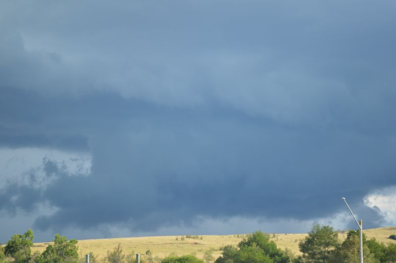
I managed to get down to Wilton where an isolated thunderstorm cell had indeed developed or was tracking north slightly inland from the coast. The cell was isolated but appeared to be riding a southeast wind change. I intercepted the cell within this area.
The cell displayed an interesting rain free base as well as solid updraft towers but it was over an area without roads. I waited an hour watching its development then went east to intercept the core.
Notwithstanding the storm splitting and the eastern cell weakening, I managed to position myself under the base to take the direct hit. I was also aware of another cell to the south but this one weakened. I did not pursue this storm.

I encountered a period of heavy rainfall and some wind but no hail. Given the structure that I was observing earlier, I cannot rule out hail further south but within an area of no roads.
Following this, I noted the western cell now to my north was going into decline but I noted a new thunderstorm developing to the west. I returned to Wilton to observe the new storm then went south to intercept the cell. Again, heavy and even intense rainfall fell but no hail where I was.
I then went west towards Picton where I was in and out of heavy rain and broke free of the rain just before arriving in Picton.
I went north stopping at the summit of The Razorback to observe another storm cell that was trying to develop at sunset. Unfortunately, I ran out of daylight. After taking a few additional photos, I returned home. Fading daylight ended the chase. The third cell did drop a heavy rain shower over Camden but it decayed thereafter.

Given that it was March 21 and on the day of the autumn equinox, I was relatively happy with the chase knowing that this is likely to be the last one for the summer season 2024/25 year.
The photos attached are from the storm chase taken around Wilton and Picton regions Friday afternoon.