Up until late September, the hurricane season for North America had been relatively quiet. While tropical storms and hurricanes have occurred across the tropical North Atlantic region including the Gulf of Mexico, there had not been any catastrophic events for the United States and such storms have stayed mainly away from land.
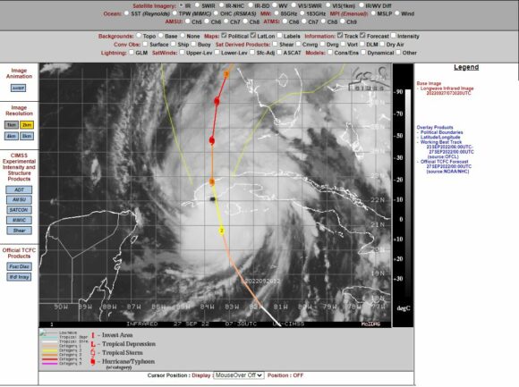
All that changed during the last few days of September.
A tropical storm developed to the south of Florida which rapidly intensified into a powerful hurricane. The storm was named "Hurricane Ian". Fueled by oceanic temperatures of 29C to 30C, this storm tracked north and became a powerful storm.
As it neared the South West coast of Cuba, it morphed into a Category 2 storm then a category 3 storm on the Saffir Simpson Scale.
Based on CIMSS modelling, it already had wind gusts at the core of 105 knots or 195 km/h prior to landfall across western Cuba. It crossed the western side of Cuba but with the land mass being narrow, this did not reduce its strength.
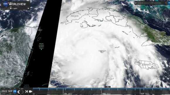

After crossing back out to sea, the storm then increased in power to a strong Category 3 storm then a Category 4 storm with winds of 220 to 250 km/h at the core.
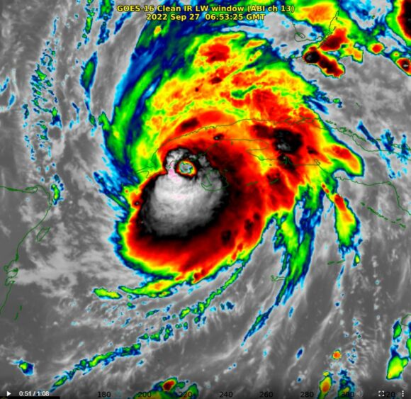
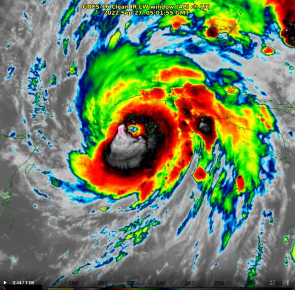
At approximately 100 km south west of Punta Gorda Florida, this storm had peak wind gusts to 155 mph or 249 km/h and was labelled a catastrophic storm.
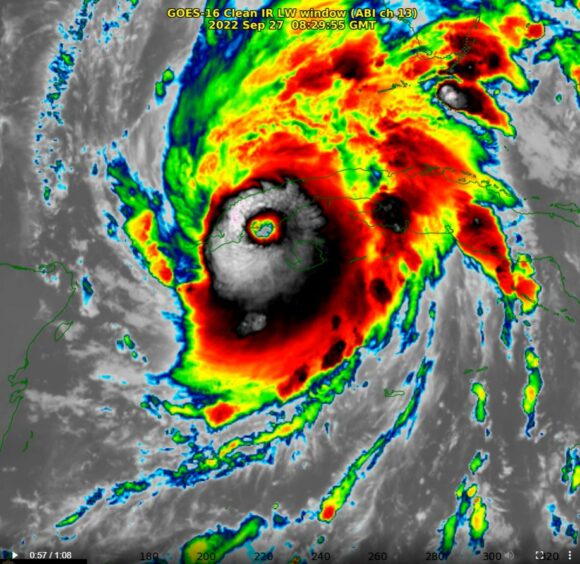

This storm has had a catastrophic impact across western Cuba with significant damage to infrastructure including electricity supplies and a sizeable death toll.
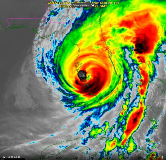
This storm then approached the west coast of Florida with the eye passing over Cape Coral, Port Charlotte and Venice, all areas west of Fort Meyers.
The satellites images and GOES images shows the storm in stark detail and convection and strong thunderstorms clearly visible close to the eye.
This storm had an unusually large eye. Satellite photos did show a high incidence of lightning close to the core of the storm.
In additional to storm surges and torrential rain, tornado warnings were also issued by the National Weather Service during landfall.
The storm weakened as it crossed the coastline but it has left a sizeable clean up and damage bill in its wake. Some early preliminary estimates place the damage bill at between $60 and $100 billion and death tolls to date are not fully known. Recovery will take time.
It is noted that the storm crossed back out to sea after crossing Florida. While redevelopment did occur, it did not gain its previous strength. The storm made landfall again across the Carolinas coastlines where the storm weakened into a rain depression as it tracked further northwards.
Attached are images of the storm from EOSDOS (AQUA), CIMSS and GOES all showing a powerful storm.
As such, a relative quiet hurricane season has now come to an abrupt end for the United States due to this one storm.
Images sourced from.
- NASA EOSDIS (NASA Worldview 2022).
- National Weather Service.
- CIMSS.
