As previously described, forecasts were being made that Western Sydney could experience a run of 6 consecutive days with maximum daytime temperatures exceeding 30C.
As at 6 pm Wednesday evening, this unusual run of 30C days did in fact occur.
It appears that a new weather record may have been established for much of Western Sydney following the run of days where maximum temperatures exceeded 30C. This record appears to be:
- The number of days where maximum temperatures reached or exceeded 30C for September.
- Having a run of 6 days where maximum daytime temperatures reached or exceeded 30C for the month of September.
I have spent considerable time researching September daily maximum temperature readings spanning several decades taken from weather stations across Sydney. Some previous records that can be identified are:
- September 1892 - There were 3 consecutive days during September where the maximum daily temperatures reached 28.8C, 28.9C and 27.2C at Sydney Observatory Hill between September 22 and September 24 that year. There were no other weather stations across Sydney at that time. It is possible that it could have been warmer inland away from the coast.
- September 1898 - It reached 27.6C, 31.7C and 32.1C on 3 consecutive days at Sydney Observatory Hill on the 20, 21 and 22 September.
- September 1901 - There is an interesting event crossing over 5 days where maximum daily temperatures were 12 - (28C) 13 - (27.8C) 14 - (30.7C), 15 - (24.5C) and the 16 - (29.6C) at Sydney Observatory Hill. It could have been warmer inland where Penrith is today. This was a September warm spell across Sydney that could have prevailed over 5 days across inland suburbs such as Richmond and Penrith.
- September 1928 - Sydney Observatory experienced 4 consecutive days where maximum temperatures reached between 28.7C and 31.4C (Only 1 x 30C day). There were too few if any weather stations elsewhere to verify what occurred inland away from the coast.
The 1928 event is an interesting statistic because if Sydney experienced 4 unusually warm days, it is possible that it could have been warmer inland. However, I am unable to locate historical readings from a Bureau of Meteorology Weather Station based at or near to Penrith during that period. This period is worth considering especially across inland regions of the Cumberland Plain.


- September 26 1965 - It reached 34.6C at Observatory Hill.
- 1980 - There were 4 days across parts of Western Sydney where maximum daytime temperatures reached 30C or higher during September.
- 1982 - It reached 30.5C at Prospect on September 2.
- 1987 - Between September 25 and September 28, there were 4 consecutive days across large areas of Sydney where maximum temperatures reached 30C or higher but maximum daytime temperatures remained generally within the low 30s during the period.
- 1998 - A run of five days occurred commencing on September 30 and concluding on October 3 across Western Sydney where maximum daytime temperatures reached or exceeded 30C. This occurred just prior to the onset of the La Nina spring / summer rains that year. Maximum daytime temperatures reached at least 33.9C at Prospect and 33.8C at Penrith on October 1 that year.
Even Observatory Hill experienced a run of 5 days where maximum temperatures reached or exceeded 30C but maximums did not exceed 33.7C.
- September 29 2006 - It reached 34.5C at Observatory Hill.
It is difficult to find early statistics at many locations as weather stations that exist today did not exist back as early as the 1950s or 1960s.
I could only find temperature records going back to 1965 at Prospect and nowhere do I see more than 4 days in a row with 30C or higher occurring.
The current event - Western Sydney
Notwithstanding the old records, this event has been exceptional as during this period, temperatures even exceeded 36C at Penrith and Richmond and 35C at Horsley Park on the Monday. In particular:
- During Saturday - Maximum temperatures peaked between 30C and 33C.
- During Sunday - Maximum temperatures across Western Sydney peaked between 32C to 33.6C.
- During Monday temperatures soared right across Sydney with 34C to 36.5C common.
- During Tuesday, similar temperatures occurred again. It reached 35.9C at the airport.
- During Wednesday, maximum temperatures hovered at least 33C to 35C across large areas of Sydney.
The current event - Other areas
This event is exceptional and remarkable for its longevity. However, it was not limited to Sydney. Much of New South Wales and adjacent regions has experienced similar conditions across the same period. Some stand out maximums include:
- Ceduna in South Australia experienced 39.8C on the Sunday.
- Port August in South Australia experienced 38.4C on the Sunday.
- Smithville (Adjacent to the South Australia state border) reached 36.2C on the Sunday.
- During Sunday, much of Western New South Wales had maximums of 34C to 36.2C.
- At Mildura it reached 36.5C on the Monday.
- At Ulludulla, it reached 35.4C on the Monday.
- The heat penetrated into the northern areas of Victoria but was short lived. For example, it reached 31C.3C at Albury Airport during Tuesday which is more unusual as such maximums are exceptionally rare for the month.
- It reached 36C at Smithville and Wilcannia in Western New South Wales during Tuesday.
- It reached 34C at both Bega and Merimbula on the New South Wales South Coast during Tuesday.
The above does show how widespread this was. A slow moving cool change has crossed the state with conditions now moderating. Certainly, this event will be remembered for its longevity and the time of year that it occurred.
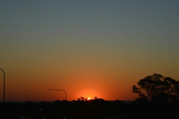
I have attached images of a sunset taken Monday afternoon at Doonside looking west which provides a fitting reminder to the events of September 15 to September 20 2023. These are taken using my DSLR camera D3200 at around 5.45 pm.
