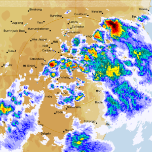
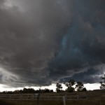
What are anyones' thoughts? Does this photograph which was taken several minutes I assume after the wall cloud represent a developing rear inflow. Given the radar was suggestive of a change in structure into a bow.
See : 128km Radar Loop for Canberra, 23:00 25/12/2013 to 23:00 26/12/2013 UTC
 Here is the radar from Canberra of this event - you will see after the initial convection once cell develops south of Braidwood and moves NNE - long tracked!

