See : 128km Radar Loop for Alice Springs, 05:00 06/11/2012 to 10:00 06/11/2012 UTC
Thanks Michael for pointing it out as I forgot to check myself. The storm on the Alice Springs radar was nicely moving ahead of the advancing bow echo segment. I had suggested in a sort of forecast that a boundary was going to set up in the region and this is what this storm was attempting to do – follow an east west oriented boundary. Nice to see the cell trying veer slightly left of the mean flow. Not sure whether the storms were surface based – Michael may wish to show a sounding of this event from Alice Springs. However, models were indicating NE winds feeding the storms and meeting southerly oriented flow along a boundary near Alice Springs.



Nice radar echos there Michael Bath on the Alice Springs radar – thanks for picking that up.
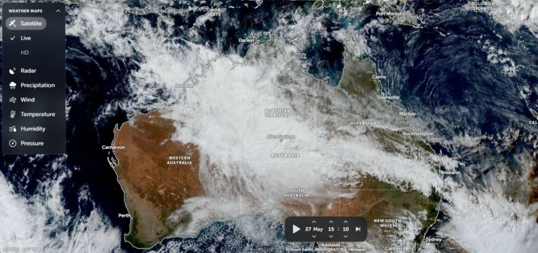
I see that the storms are putting another incredible display around the southern Northern Territory stretching north west. Looks to be a developing MCS (mesoscale convective system). A lot of energy pushing through to an expanding anvil shield! It covers a fair sized region as observed on the satellite image here: