Often Australia experiences some of the most varied weather found anywhere in the world and this reputation has certainly been true for the first seven days of February 2025.
In this regard, the inland and southern regions of the continent have been experiencing another burst of summer heat with heatwave conditions prevailing. This is especially true for most of the inland desert and semi arid regions including New South Wales and much of Western Victoria.
At the same time, heavy and torrential rain has impacted regions of the northern coastal areas of Queensland around Cairns, Townsville and south towards Mackay. Further to this, the monsoon has finally broken across the Top End of the Northern Territory.
Furthermore, two tropical cyclones have developed well to the west of Western Australia although these are too far away to have any impact to any part of Australia.
The weather systems have generated their own separate conditions as described briefly below.
Inland heat with 40C daily maximum temperatures

A vast region of Australia which includes the southern areas have been subjected to a strong burst of heat and in some areas away from the coast, maximum daily temperatures have exceeded 40C. The heat has reached all the way into southern Victoria providing Melbourne the strongest burst of heat seen in several years. As shown in the table below for Victoria and inland New South Wales:
| Town or city
|
Max Temp
1 Feb |
Max temp 2 Feb | Max Temp
3 Feb |
Max Temp
4 Feb |
Max Temp
5 Feb |
| Albury / Wodonga | 36.9C | 38.2C | 37.8C | 39.6c | 38.2C |
| Broken Hill | 41.7c | 41.2C | 37.2C | 39.3C | 38.9C |
| Melbourne (Airport) | 33.6C | 38.9C | 37.7C | 38.4C | 23.8C
Cool change |
| Mildura | 41.3C | 43.2C | 38C | 41.5C | 34.7C |
| Shepparton | 38.1C | 38.9C | 38.4C | 39.4C | 33.8C |
| Walpeup | 40.1C | 43C | 40.3C | 41.2C | 34C |
This provides a basic overall of a few selected locations within the affected area. If this was expanded to cover more towns and cities, it will be seen that there are locations that have just experienced 4 consecutive days with maximum temperatures soaring above 38C and even 40C making this a significant summer heatwave.
In addition to this, there have been fires and even occasional thunderstorm outbreaks across some regions including the Grampians and parts of south western Victoria. This has made this heatwave more interesting.
Sunday afternoon, isolated thunderstorm activity impacted parts of south western Victoria which has even produced isolated totals up to 40 mm and 50 mm but such falls were very isolated.
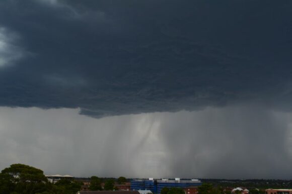
A particular thunderstorm impacted Mt Gellibrand Sunday afternoon which produced damaging to destructive wind gusts to 124 km/h between 5.22 pm and 5.30 pm as well as 20.4 mm of rain (May have included some hail fall).
Tropical cyclones
There are two tropical cyclones well off the west coast of Western Australia. The storms are names Vince and Taliah. Both storms have moved far enough off the coast that they do not pose any threat to any coastal location. Both have reached at least Category 2 or 3 on the Saffir Simpson Scale and both are expected to dissipate over open ocean in due course.
North East Queensland Cairns, Townsville and Mackay
While the torrential rainfall has eased, the flood crises that have enveloped the Cairns / Ingham and Townsville regions continue. There are now 2 known fatalities from this event and the crises continue. Floodwater has not receded and the damage bill is significant and extensive.
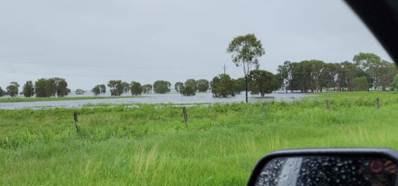
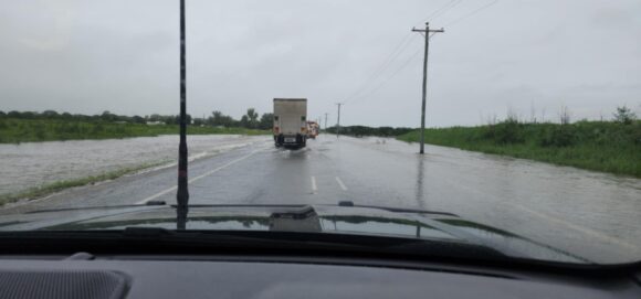
The feature image provided above showcase the current flood situation south of Townsville but north of Mackay. Picture credit is from Zaydah and Denny who have granted permission for its use.
The February 2019 flood event appears to have cost $1.24 Billion. It is far too early to estimate the true cost of what has occurred over recent days but it is now declared a significant event. An early estimate being discussed is $2 billion to $2.5 billion which is approaching double that of the 2019 event. It will probably be higher once floodwater recede.
The weather system that caused the event has now weakened but more rainfall has occurred along the affected coastlines. Daily rainfall totals in the 100 mm to 200 mm range have occurred each day since Monday somewhere within the affected regions.

It would also appear that some weather stations have malfunctioned as official recordings are hard to obtain. Power loss, damage to instruments or instruments not being read have contributed to missing data or inaccurate readings.
However, enough data exists to demonstrate what has occurred including:
| Town or city
|
Rainfall 1 to 4 February 2025
|
| Cardwell | 1,110 mm (1,344 mm to 9 am Thursday for interest) |
| Townsville | 761.2 mm. |
| Alva Beach | 400.4 mm. |
| Cairns Racecourse | 347.2 mm. |
| Cairns | 323 mm. |
These are from official stations. The Ingham station only shows 289.8 mm for the 1 February with no observations thereafter. It would appear that the weather station is damaged as falls have been far higher than this.
Heavy falls also extended to Mackay at times including 188 mm at South Mackay and 190 mm at Paget Alert for the 24 hours to 9 am Tuesday morning.
The city of Cairns and environs also experienced heavy falls Tuesday into Wednesday with 164 mm falling to 9 am Tuesday and 180 mm falling to 9 am Wednesday morning.
While the worst of the conditions may have eased, this event is clearly ongoing.
Another heavy total of 101.2 mm fell at Townsville Airport and 142 mm at South Townsville to 9 am Friday morning from what appeared to be a localized overnight downpour concentrated over the city region.
Further to this, flooding rains have also occurred over regions south west of Townsville city but further inland from the coast with rainfall totals topping 240 mm including 239 mm at St Anna Alert to 9 am Friday morning.
Storms New South Wales and Northeast Victoria
Some thunderstorm activity occurred across parts of New South Wales during Wednesday afternoon including Goulburn, Canberra, Southern Ranges and the Central Tablelands. These were convective activity and by sunset such activity waned for the day. Some of the higher falls occurred around Goulburn with 24.2 mm at Goulburn Tafe and 12.6 mm at Kapooka (Southwest of Wagga Wagga city).
Renewed thunderstorm activity occurred over the southwest inland of New South Wales and Northeast Victoria Friday afternoon. A particular thunderstorm impacted the town of Wangaratta resulting in a sudden fall of 17 mm and peak wind gusts to 107 km/h between 3.25 pm and 3.30 pm.
Further to this, I am expecting some thunderstorm activity Saturday across the Southern Tablelands which I expect to be chasing. Should this occur, a separate post will be prepared covering individual events that may be encountered.
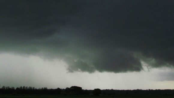
As shown above, a highly dynamic and active weather situation has prevailed which is likely to continue. Photos attached to this post are from:
- Zaydah and Denny who have kindly provided additional photos showing the floods south of Townsville and north of Mackay. Permission is granted for use and a special thank you is given.
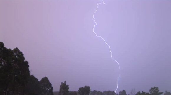
- Former weather events documenting heat, storms and monsoon storms and rain to showcase the wide varied of current weather conditions being experienced across the continent.
