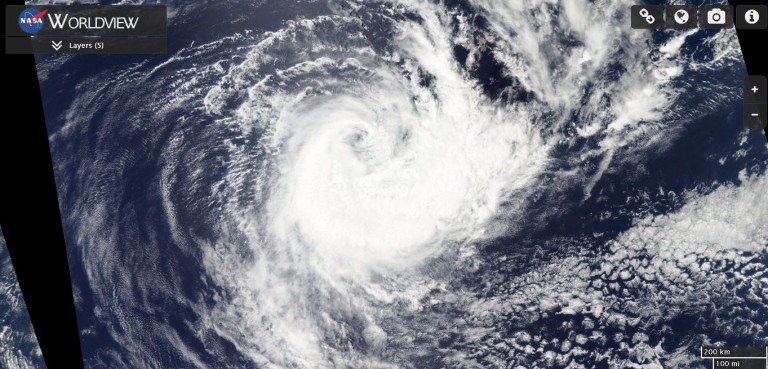
The first low for the Australian cyclone season of 2010/11 has formed way off the WA coast. Although a long way from the Australian Mainland Cocos Islands are in the track path hence the warning has been issued.
It has also been interesting reading over the last few weeks of the possible season that lays ahead for Australian waters with La Nina dominating our weather pattern.
Advice from BOM regarding the low
TROPICAL CYCLONE ADVICE NUMBER 1
Issued at 9:12 am WST on Saturday 30 October 2010
A Cyclone WATCH has been declared for a developing tropical low for the Cocos
(Keeling) Islands.
At 8:00 am WST a Tropical Low was estimated to be
530 kilometres north of Cocos Island and
moving west at 11 kilometres per hour.
The low is forecast to develop into a tropical cyclone today or early on
Sunday. Although it is currently moving westwards, it is expected to take a
southwards turn, and is likely to pass close to Cocos Island on Tuesday.
Conditions are favourable for intensification and Cocos Island is at risk of
impact from a Severe Tropical Cyclone.
Gales are not expected on the islands during the weekend, but may develop by
sunrise on Monday as the system moves closer and intensifies.
Details of Tropical Low at 8:00 am WST:
.Centre located near…… 7.5 degrees South 96.0 degrees East
.Location accuracy…….. within 75 kilometres
.Recent movement………. towards the west at 11 kilometres per hour
.Wind gusts near centre… 85 kilometres per hour and INTENSIFYING
.Severity category…….. below cyclone intensity
.Central pressure……… 1002 hectoPascals