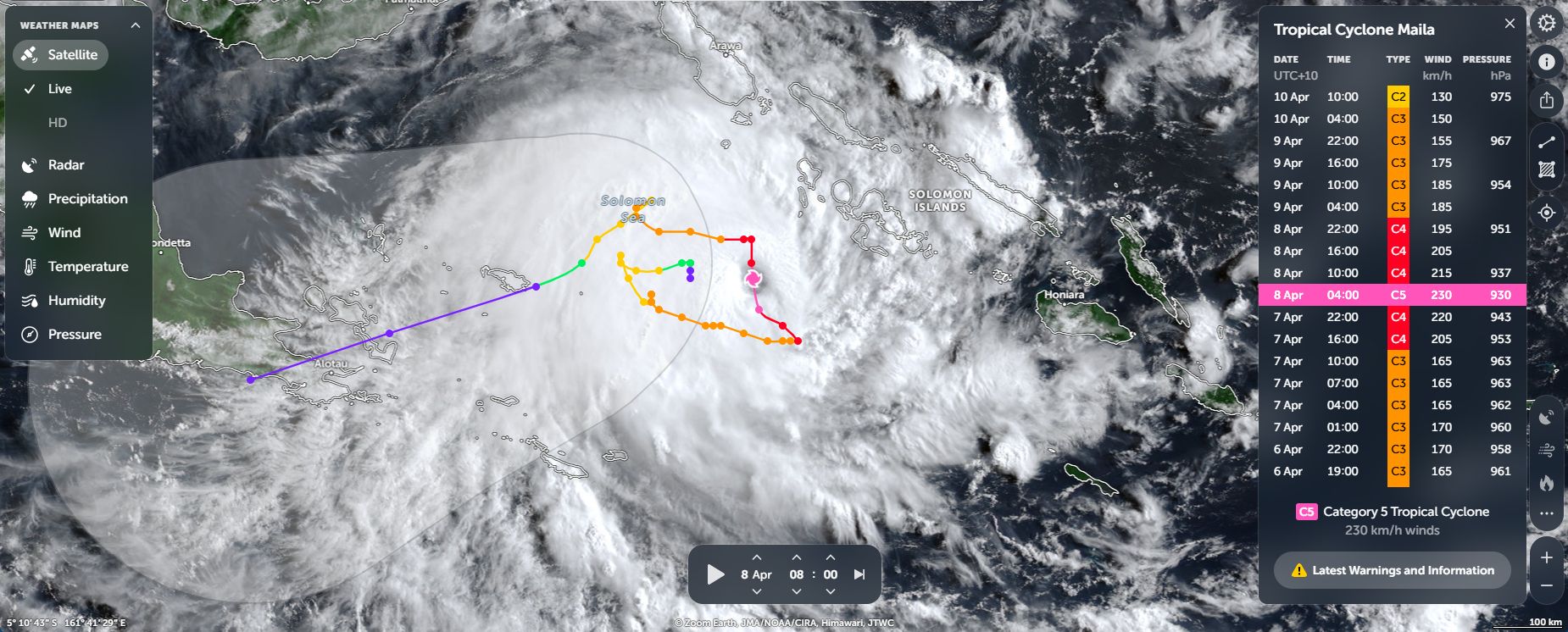
Tropical Cyclone Maila is now the latest storm to form over waters close to Australia. The storm is unusual, has behaved erratically and even defied all projected weather forecasts.
In this regard, the storm was initially forecast to form close to the Solomon Islands then track west southwest and make landfall over the Cape York Peninsula of North Queensland.
The storm was initially supported by oceanic waters heated to 29C and 30C but by Saturday morning, oceanic waters across the region had cooled to 28C and 29C within the area affected by the storm.
By Saturday morning, the storm had largely broken apart over open waters.
The storm acted in an erratic manner. In this regard, the storm morphed into a tropical cyclone during Sunday 5 April then:
- Tracked west.
- Then turned and tracked southeast.
- Stalled then briefly shifted northwards.
- Ceased its northward motion then turned east southeast.
- Stalled again then turned northwest then north.
- Ceased its northward motion then turned west.
- Turned northeast then stalled again.
- Then turned southwest as a weakening storm system.
In this regard, the storm had no forward steering motion for any period of time and travelled over the same region cooling the waters below it at the same time.
Maila had a peak intensity of Category 5 under the Australian Tropical Cyclone Intensity Scale 1989 with peak winds at the core reaching 230 km/h and Category 4 under the Saffir Simpson Scale.
The storm was expected to make landfall across the northern Queensland coast but it now appears that this will no longer occur. This is a good outcome given the number of storms that have impacted the Queensland coastline this season.
The feature image (NASA Zoom Earth of Wednesday 8 April 2026) above shows Maila at peak intensity situated west of the Solomon Island and far enough east of Papua New Guinea but not affecting the country.