A rare weather event incorporating a tropical low and abundant tropical moisture has been delivering widespread rainfall across vast regions of Australia over the past 6 days. Much of this rain has fallen across remote areas and desert regions and flooding has been commonplace. The weather event has impacted:
- South Australia (First the outback regions and now parts of the southeast).
- Outback Queensland.
- Outback New South Wales.
- Western and Northwestern regions of Victoria focused on the Mallee region.
This event has brought relief from drought conditions and provides a fitting conclusion to a difficult summer that has been punctuated with heatwaves.
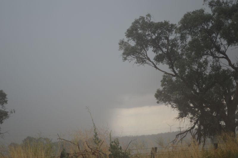
Normally such systems provide rainfall for 2 to 3 days before they either break down or move on. This system has stayed within the same general location for days which makes this event highly unusual.
There has been some incredible rainfall from this event including but not limited to the following:
New South Wales
Tibooburra – The tiny township in far northwest New South Wales recorded 152.6 mm of rain for the month of February 2026 to 9 AM February 28. This includes 43.6 mm Sunday and Monday morning 23 and 24 February.
Northern Territory
Alpurrurulam – Located approximately 180 km west of Mt Isa received 250 mm of rain during one storm event including 205 mm between 11 pm and 5 am Sunday and Monday morning – 23 and 24 February 2026.
Queensland
Mt Isa – This town in outback northwest Queensland recorded 399.2 mm of rain for the month of February 2026 to 9 am February 28. This includes 75 mm to 9 am Saturday 28 February and 58 mm on February 21.
The township of Cluny had 164 mm of rain for the 24 hours to 9 am 26 February 2026.
South Australia
Woomera – A fall of 31 mm occurred to 9 am 28 February 2026. A least 75 mm of rain fell for the month of February.
Maree – The weather station recorded 116 mm of rain for the month of February 2026 to 9 am February 28.
Moomba – The weather station here recorded 188 mm of rain for the month of February 2026 until 9 am 28 February 2026 which included 49.2 mm for the 24 hours to 9 am 25 February.
Oodnadatta – The weather station recorded 97 mm of rain for the month of February 2026 until 9 am 28 February.
The outback townships lie well north of Adelaide within the driest regions of Australia where average yearly rainfall struggles to reach 150 mm. This event makes this unique and rare for such regions.
Victoria
Horsham – A thunderstorm of late February 27 dropped 96.4 mm of rain across the town.
There have been times when such moisture has flowed further east and south providing enhanced rainfall and storms over small regions such as:
- Sunday afternoon – Heavy rain and storms brought falls of up to 110 mm within a small region of northeast Victoria including 103 mm at West Wodonga.
- Wednesday afternoon – Heavy rain and storms across parts of Victoria brought rainfall of 40 to 50 mm around Cowwarr Weir (52 mm) Doherty (50.2 mm) and Kyabram (42.2).
- Thursday afternoon – A burst of heavy rain occurred over large parts of Sydney producing up to 134 mm of roads at Abbotsford, 122 mm of rain at Lidcombe, 114.8 mm of rain and Shanes Park and 50 to 70 mm of falls across Blacktown.
- Thursday afternoon – A separate event brought falls of up to 131 mm at Mt Pleasant and 122 mm at Darkes Forest (Wollongong region).
- Friday afternoon – Thunderstorms brought intense rainfall and copious amounts of small hail to small areas east of Ballarat. Rainfall figures topped 35.8 mm at Blackwood (East of Ballarat city).
All events have caused issues of localised flooding and most are limited to relatively small regions.
This is a widespread event that has crossed through 4 states and the Northern Territory and once floods have receded, the damage to infrastructure and roads will become clear.
The low pressure system has now been pulled further south with some drought affected areas of Western Victoria and South Australia finally receiving some relief from the incessant dry.
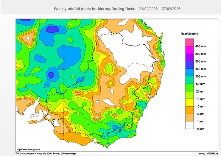
Sunday morning 1 March, the following rainfall figures have emerged across some areas of northwest Victoria, eastern South Australia and southwest parts of New South Wales as follows:
Mildura (Airport) – 65.8 mm.
Wamberra Station – (Northeast of Mildura) – 60mm.
Loxton – (South Australia) – 56 mm.
Pooncarrie – (New South Wales) – 45 mm.
Renmark Airport – (South Australia) – 44.4 mm.
Walpeup (Northwest Victoria) – 34.6 mm.
Hopetoun Airport – 25.8 mm.
A small region within the Lower Murray region northeast of Georgetown (South Australia) experienced 100 mm plus totals including:
- Yunta Airstrip 129 mm.
- Mc Coys Well 125 mm.
- Panaramitee 120.4 mm.
For Adelaide, this was a disappointment as falls only reached 7 to 12 mm, far less than forecast. Slightly heavier totals fell across the Adelaide Hills reaching up to 19 mm.
The system will now track across southern areas of the country and become entrained into the westerly airstream and tropical moisture will now start to dry out.
This system has provided relief and a satisfying end to a very dry and intense summer.