The month of August 2025 has been unusually wet. Between August 1 and August 22, there have been four separate rain events across 22 days for much of Sydney. The first three events did not result in excessive rainfall totals.
However, the fourth event was far more significant in terms of duration and impact. August 2025 has featured the following for Sydney:
- A rain event between August 1 and August 5.
- A rain event between August 8 and August 10 mainly from passing showers.
- Further showers on the 14 and 15 August.
- A more broader rain event starting on August 18 continuing through to the evening of August 22.
August is generally a month where winter usually gives way to warmer days and when 20C days become more common. However, for August 2025, this has not occurred and maximum daytime temperatures have struggled to reach 13C to 16C across multiple days.
A key feature of the weather setups include:
- High pressure cells lying well to the south than what should be occurring. This is more akin of what would often occur between March and June.
- Easterly winds blowing onto the coast generating cloud and regular showers.
- A warmer than normal ocean temperature of the east coast. Ocean temperatures off Sydney are at least 2C to 4C warmer than what they should be at this time of the year.
- For several days this month, I have observed low topped cumulonimbus clouds just off the coast of Sydney early morning. This is something that is more common during March to June.
The result is a wet month as follows to Friday morning 22 August:
- Sydney (Observatory Hill) – 368.8 mm falling on 17 days (A significant portion of that falling between the 18 and the 22 August).
- Sydney Airport – 319.6 mm falling on 17 days.
- Parramatta – 215.2 mm falling on 16 days.
- Richmond – 166.4 mm falling on 15 days.
- Horsley Park – 143.4 mm falling on 16 days.
- Penrith – 100.2 mm falling on 15 days.
While rainfall totals across Sydney decreases the further inland one travels, it is still wet for August even at Penrith. This is in stark contrast to August 2024 which was a dry month with little rainfall occurring.
Outside Sydney, the current monthly rainfall totals stand as:
- Port Macquarie – 368.8 mm
- Ballina – 305 mm
- Kiama – 270.6 mm.
- Ulladulla – 210.6.
- Coffs Harbour – 200 mm.
- Kempsey – 186.4 mm.
- Cessnock – 175 mm.
- Maitland – 169.2 mm.
- Lismore – 116.2 mm
- Armidale – 93 mm.
It is shown that coastal Sydney and an area around Port Macquarie are amongst the wettest areas of the state for the month of August.
This is compared the southwest half of the state where drought conditions now prevail. Within this region, monthly rainfall totals to date at several centres are less than 10 mm which is indicative of a dry month.
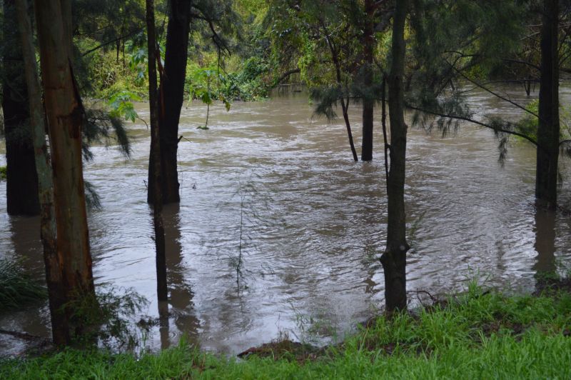
The most recent rain event of August 18 to 22 is by far the most significant in terms of duration and rainfall totals. The event of August 18 to 22 has lasted 5 days and some rainfall totals have been moderate to heavy.
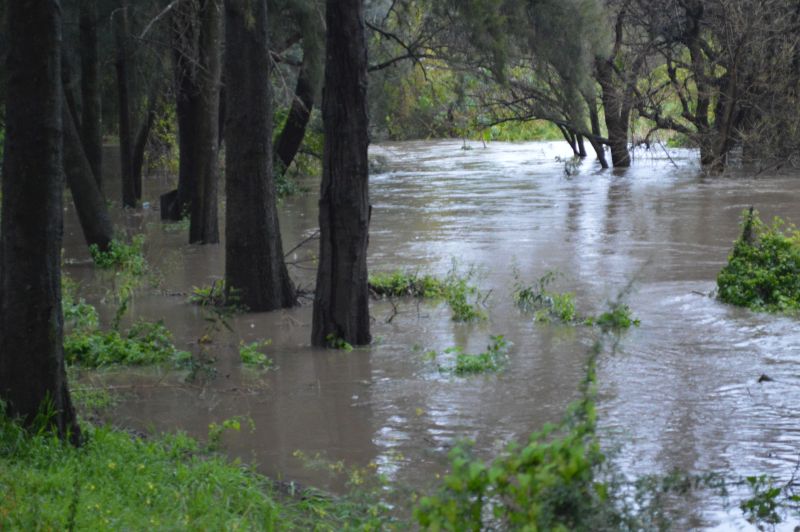
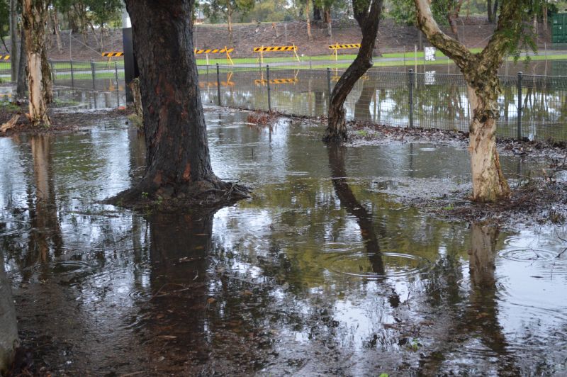
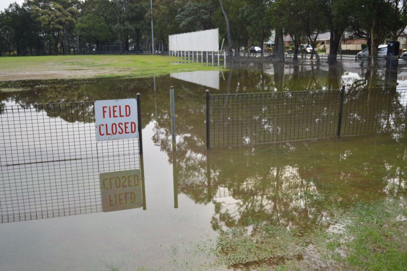
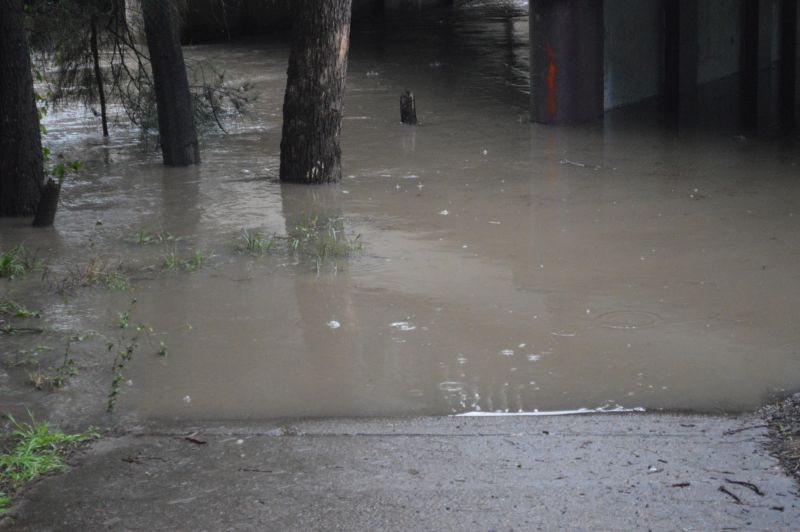
Catchments are saturated and even some flooding has featured. The images attached to the post are taken at or near Duck River and at Mona Park Auburn Thursday afternoon. Minor flooding has featured following moderate and even heavy rainfall totals. By Friday morning, the flooding that occurred had subsided. As rainfall eased.
The most recent event peaked during Wednesday evening and into Thursday. Across Sydney, rainfall totals for the 24 hour period to 9 am Thursday is divided into:
- Sydney’s eastern half – 50 to 75 mm.
- Sydney’s western half – 30 to 50 mm.
Maroota to the north had 91.8 mm and minor flooding featured along the Colo River and parts of the Nepean River.
It should be noted that there were two fatalities near St Albans Wednesday night following a vehicle collision with a tree and with the vehicle finishing up within a flooded water course.
There was also minor flooding around Tamworth following moderate rainfall totals of 30 to 50 mm (Mainly due to catchments being wet from previous rain events).
There were also 130 to 150 mm rainfall totals around Port Macquarie with 149.4 mm at Lake Cathie being the highest figure for that period.
The most recent rain event is now easing and clearing conditions are starting to emerge.
It would now appear that a burst of fine and clear weather will prevail for the next week which will allow some drying to occur across affected regions.