A feature of 2025 has been the high number of Tasman Sea lows and East Coast lows affecting eastern New South Wales and Queensland including Sydney. Another feature has been the warmer than normal sea surface temperatures that have contributed to the various weather events that have occurred.
At the time of writing, eastern New South Wales is experiencing the second east coast low event in the space of one month and the third such event since early May 2025.
The current event has produced two separate bursts of rain and to date, the coldest winter day for 2025.
On Wednesday 30 July, the first rain event was not particularly significant in terms of rainfall but it was significant in terms of the cold weather that resulted.
Persistent light rain was a feature with the following observed:
- Eastern Sydney receiving 28 to 41 mm of rainfall to 9 am Thursday morning.
- Western half of Sydney receiving 10 to 18 mm of rain to 9 am Thursday morning.
There were a few stand falls with isolated rainfall totals exceeding 50 mm with the Long Reef Golf Club receiving 80 mm (Highest figure) and Newport receiving 50 mm being amongst the highest totals.
While rainfall was not too significant, it was the cold maximum temperatures that stood out. Wednesday 30 July was the coldest day for 2025 across Sydney with maximum daytime temperatures struggling to reach 12C to 13C as follows:
- Penrith 13.1C.
- Sydney 12.5C.
- Horsley Park 11.4C.
- Campbelltown 10.6C.
Low level nimbostratus cloud and persistent light rain prevented any warming occurring for the day.
A second burst of rain from the same event occurred Friday evening to Saturday morning that generated some reasonable rainfall totals (Almost a carbon copy of Wednesday).
The heaviest rainfall totals for the second event are:
- Avalon – 75.5 mm.
- Long Reef Golf Club – 64 mm.
Other than a few isolated 50 mm totals, rainfall was much lighter with 12 to 20 mm across Sydney’s western suburbs and 22 to 47 mm across Sydney’s eastern suburbs with slightly higher totals across the northeastern areas close to the coast.
The bulk of the rainfall has fallen between Newcastle to the north and Batemans Bay to the south.
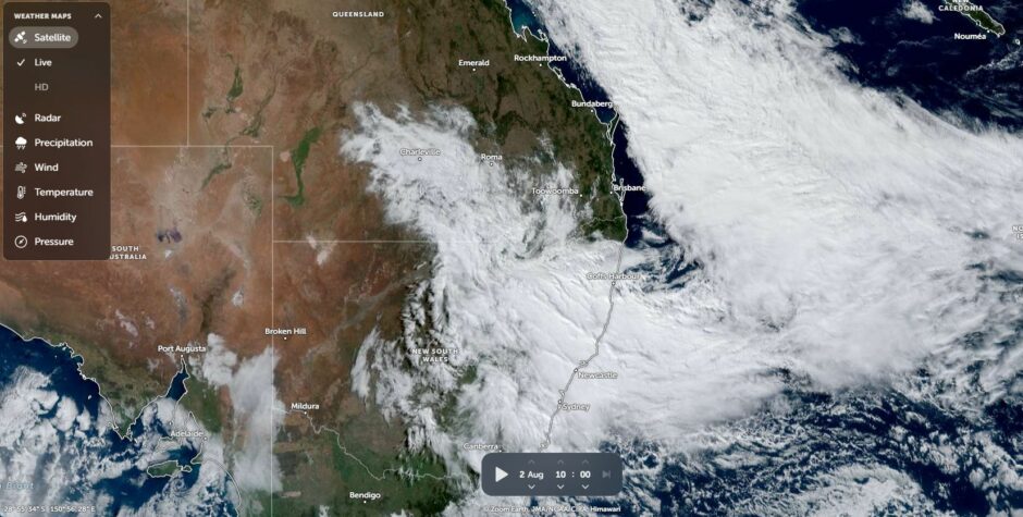
Some useful rainfall has also penetrated into the Tamworth and Gunnedah regions with upwards of 46 mm falling but for the most part, rainfall is generally limited to the coastal areas.
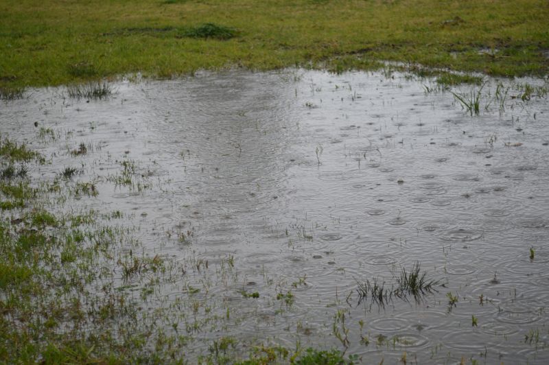
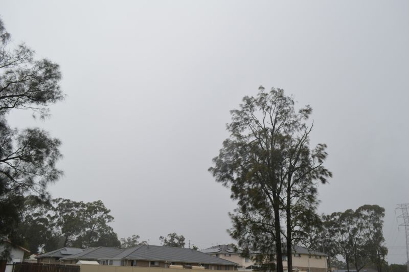
The feature images attached to the post are taken around Doonside Saturday morning as another burst of moderate rainfall passes over with thick nimbostratus cloud featuring across the sky.