The aftermath of Hurricane Milton is now being realized and the cleanup is considerable.
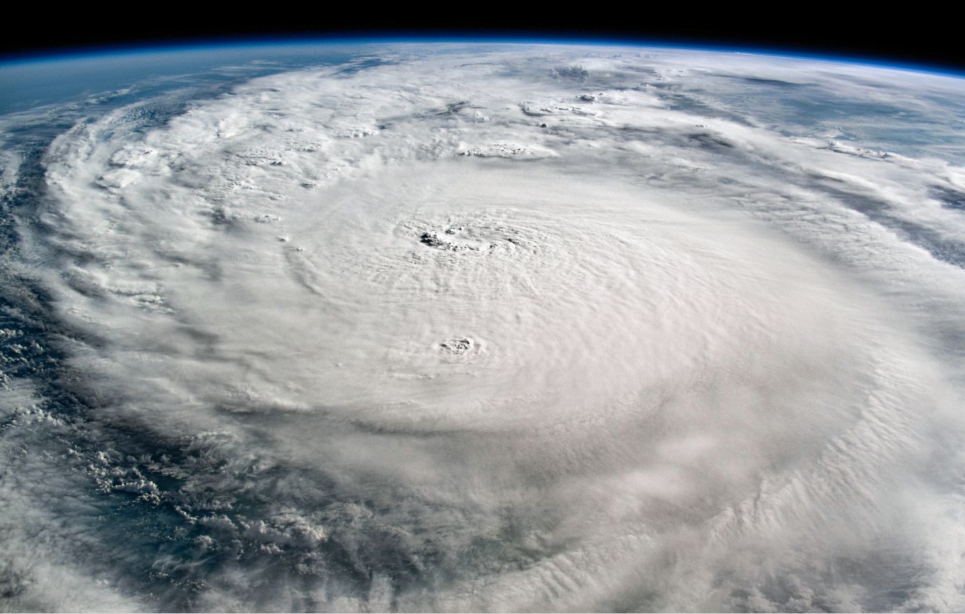
The above feature image of the storm is taken by NASA on Wednesday 8 October 2024 from the ISS (Earth Observatory NASA) just prior to landfall over Sarasota. Following the storm, the following is now identified:
- A final peak wind gust of 106 miles per hour or 170.5 km/h occurred at Anna Maria (Sarasota).
- The heaviest rain fell at St Petersburg Airport where 18.54 inches fell (Converted to 470 mm).
- Certain wind strengths cannot be verified as several weather stations failed due to power loses. The figure of 106 miles per hour quoted above is what is officially known. Stronger winds may have occurred within areas not covered by a weather station or within areas where weather stations failed.
- The number of verified tornadoes that occurred is still under review. At the time of writing, at least 12 tornadoes are confirmed including one major event west of Clewiston (Located NW of Miami). It is known that one tornado impacted a mobile home park. In addition to this, the number of tornado warnings issued broke the state record being 126. (Figures since verified). At least two are confirmed as being EF3.
- The number of residents without power immediately following the storm varied depending on source with figures ranging from 1.562 million to around 3.4 million. The numbers were fluctuating wildly as more and more information was trickling in across affected areas. Either way, the numbers were well into the millions.
- Up to 75% of residents living across Pinellas County were without power and a figure of 80 to 90% was estimated for Sarosota County.
- A rising death toll was evident with 6 identified from the tornadoes. The 6 are within St Lucie County being the county most impacted by the tornadoes. A total of 17 fatalities have so far been identified by the entire event. The number appears much lower than expected and it would imply that the majority of residents headed the early warnings. This is a positive outcome.
- Considerable flooding was and is still evident across vast areas.
- The storm surge appears not to have been the worst case scenario due to how the rain behaved. In this regard, areas to the south of the eye received much lighter totals while areas to the north of the eye received most rain. This appears to have helped in terms of lowering the final storm surge.
- A crane collapse was confirmed on a major building site where the structure fell 46 stories to the ground.
- A stadium in St Petersburg had its roof shredded by the winds.
Insurance assessors suggest that the damage impact will range between $36 billion and $55 billion which is still costly but not a worst case scenario. This is currently under review.
When adding the two storms together (Helene and Milton), the potential loses starts to climb towards the $100 billion total which is considerable.
This event will be felt for considerable time across the state and of course it can be expected that the after effects will be felt for years to come within the worst affected areas.