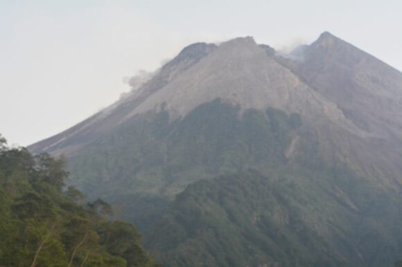
During the period Monday 24 July and Thursday 3 August 2023, I was in the Indonesian city of Yogyakarta (Java) Indonesia. Lying approximately 28 km to the north of the city centre lies Indonesia’s most active volcano being Gunung Merapi or Mount Merapi in English.
Gunung Merapi
This volcano is active and at the time of visit, the alert level was raised to Level 4 at times (Alert levels range from 1 to 4). That has now been reduced since our departure as the volcano has somewhat settled down. In addition:
- Climbing the mountain was and is still prohibited.
- There is a 3 to 7 km cordon surrounding the mountain with the public being warned to stay 3 km to 7 km away from the crater based on location due to continual collapses of the active lava dome and pyroclastic lava flows.
- The volcano currently has a height of 2,968 metres although this can vary and changes following an eruption.
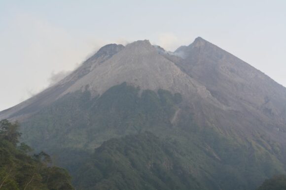
Gunung Merapi is a Decade Mountain. It is given this status as part of an International Decade for Natural Disaster Reduction (1990-2000) and is heavily monitored. It is possible to observe and view live data from this volcano via “Volcano Discovery”.
It is highly recommended to do this prior to any trip to this mountain.
It is a violent volcano with a violent past with the most recent eruptions occurring during late 2010, 2018 and again during 2022 and 2023. The eruption of March 11 2023 produced a lava flow up to 7 km long and eruptions continue to this day.
These eruptions have generated significant pyroclastic flows down the western and southern sides into populated areas causing significant destruction to towns and villages and even impacting the city of Yogaykarta to the south.
Major volcanic eruptions have generated thunderstorms and lightning flashes within the eruptive clouds and this is one mountain where it is possible to observe such phenomena as it occurs.
Given the status of this mountain and the fact that I was in Yogakarta during late July and early August 2023, I took 3 cameras with me and made a significant attempt to catch one of these eruptions.
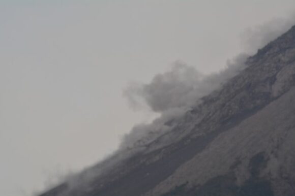
While I did not catch an actual thunderstorm, I did document my first ever volcanic eruption and even witnessed a lava dome collapse which included hot rock cascading down the upper slopes of the active cone. I successfully observed and documented at least 5 minor eruptions.
Even pyroclastic flows can generate lightning and one such flow that I observed had potential to do so.
To observe this mountain, my wife and I took a special tour being a sunrise tour and thus we were inside the 7 km exclusion zone and within 4.4 km of the active crater.
During this tour, helmets must be worn at certain times and safety rules must be followed.
Actual eruptions observed and photographed
The first eruption that I witnessed occurred shortly after 5 am being a substantial lava dome collapse down the south west side of the cone. Rocks, lava bombs and even a pyroclastic flow were observed cascading down the upper summit at substantial speed. It is quite possible that if this event was any stronger, I could have observed lightning.
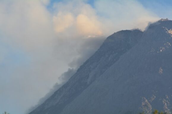
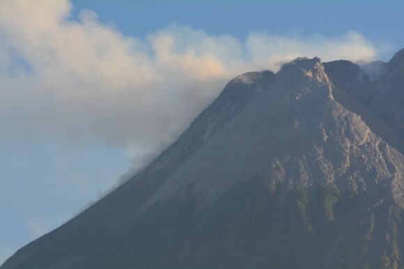
Further lava dome collapses were observed and photographed at sunrise (Tuesday 25 July 2023). These were cascading up to 2 km down the south western summit.
During the afternoon of the same day, we climbed to the top of a 1,200 metre high lookout with direct views of the lava dome. A minor pyroclastic lava flow and lava dome collapse was observed high up on the summit. The main lava dome was certainly visible at the summit being a dome perched dangerously close to the south west crater rim.
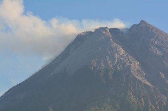
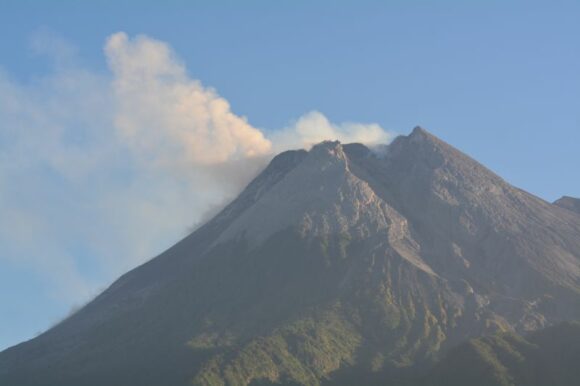
This lookout known as Puncak Bukit Turgo Makam Syech Jumadil has direct views to the main crater and lies close to the 3 km limit to the main cone. However, while the views are incredible, any sizeable eruption occurring would render this lookout as being a frightening place to be where a person could be killed. It is ill advised to be here during any major eruption.
While I did not catch a thunderstorm, I certainly caught my first ever volcanic eruption which made this mission a relative success.
A special thank you to “Lava Tours Merapi” for providing an excellent overview and early morning tour of this frightening volcano and making it quite safe given the status of this mountain.
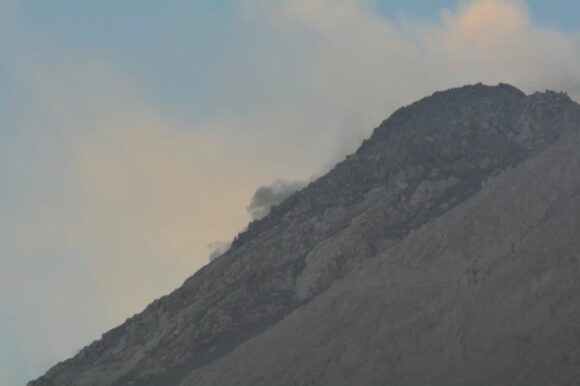
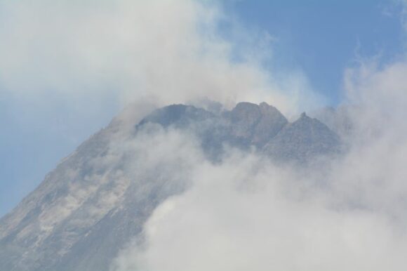
The photos attached show some of the eruptions that occurred. I have also attached two maps showing where the photos were taken with one in 3D Google Earth Experimental.
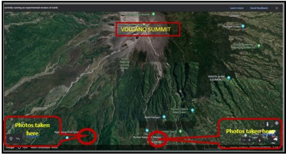
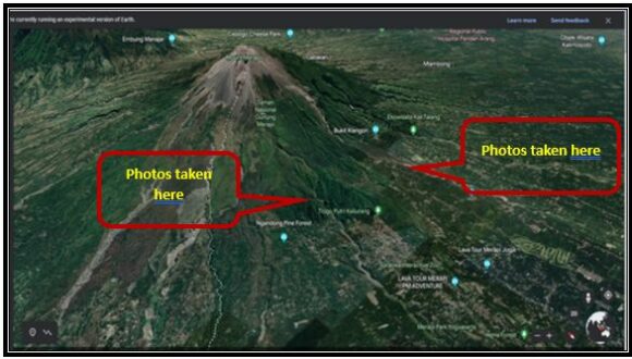
Photos were taken using my Nikon DSLR cameras with various degrees of zoom and various settings to catch each event.
