While not an extreme rain event, a significant rainband has crossed south east Australia over the past 3 days that has brought widespread rain to large areas.
Widespread falls of between 25 mm and 50 mm with isolated heavier falls of above 50 mm has been a feature. Generally, the northern areas of the South West slopes, Central West New South Wales, Central Tablelands and the eastern areas of the plains (Wheat / Sheep belt) of New South Wales has benefitted the most.
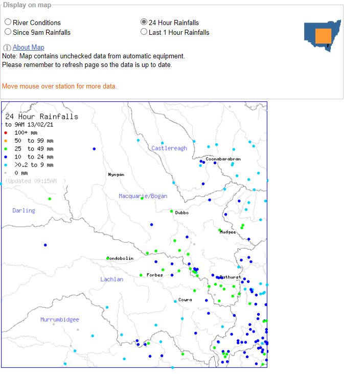
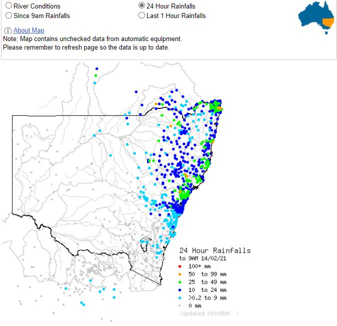
This is the third or in some cases, the fourth major weather event within the past 3 weeks. While no major rivers are in flood, this rain is certainly reducing the effects of the most recent drought and generating runoff for dams and rivers.
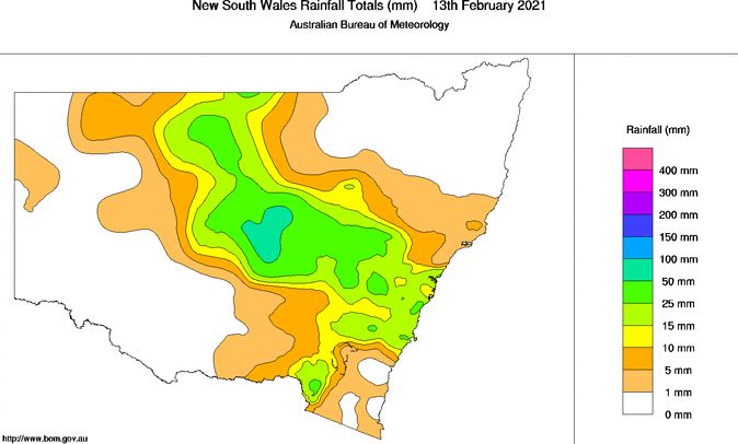
This event past over Victoria but produced only light showers generally between 1 and 5 mm. However, as it moved into the South West Slopes and Central West areas of New South Wales, rainfall totals increased dramatically due to more moisture being available.
The heaviest totals include an isolated fall of 81 mm at Wollombi, south west of Cessnock, 67 mm at Barrington Tops, 59 mm at Barrington (Bonnie Doon Salisb) and 53 mm at Warialda. Large swathes of the New South Wales wheat sheep belt centred on Dubbo, Forbes, condobolin and Mudgee received between 25 mm and upwards of 50 mm from this event.
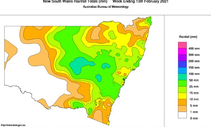
This event past over Sydney and produced widespread rainfalls within the range of 20 mm to 40 mm.
A number of rainfall plots produced from the Water and the Land for January and the start of February 2021 are showing how beneficial this rainfall and others have been. There has been remarkable recovery across the Central West areas of the state, the lower north coast and to a lesser extent, the southern Murray region due to the events and the back up rain that is occurring.
As a result of this event plus other recent events, no part of New South Wales remains in drought.
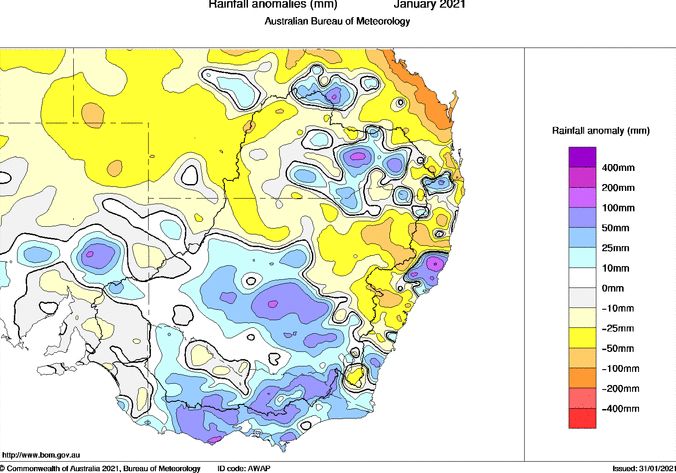
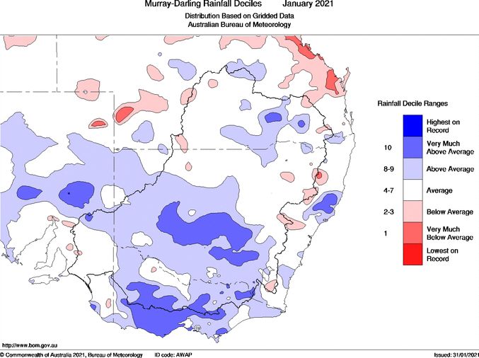
The plots attached to this post are generated from the Water and the land include the rainfall for the Central West areas of New South Wales, the rainfall plot for the 24 hours to 9am 13/2/2021, the rainfall plot for the 24 hours to 9 am 14/2/2021, the weekly rainfall plot for New South Wales and the monthly rainfall anomalies and deciles both of which show how significant the most recent rain events have been.
