During Friday morning 4 March 2022 and as described in an earlier post, the flood peak at Windsor reached 11.99 metres AHD. The flood peak occurred during the early hours of Friday morning and I managed to visit the area at a time when the flood levels were at 11.69 metres AHD (Generally 20 to 30 cm lower than the initial peak).
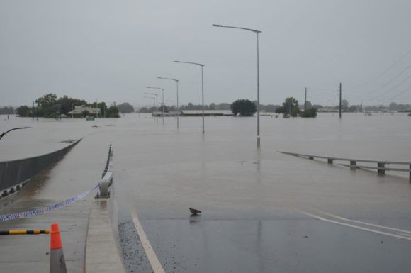
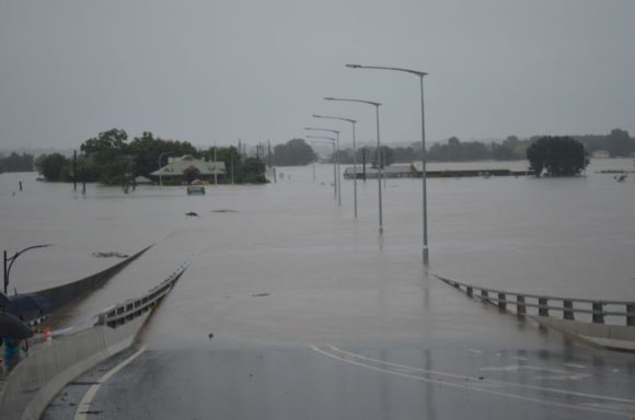
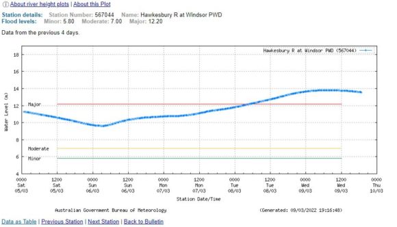
During Saturday morning, river levels had subsided to 9.62 metres AHD at approximately 3.15 am before rising due to the second burst of heavy rain and storm activity across the region.
It is identified that at the time of writing, a second but higher flood peak has passed along the river at Windsor. While the first flood peak reached 11.99 metres or just 290 mm below the major flood level, the second flood peak reached 13.79 metres between 5.15 am and 10 am Wednesday morning (A period of 4 hours and 45 minutes). The second flood peak reached 1.59 metres above the major flood level.
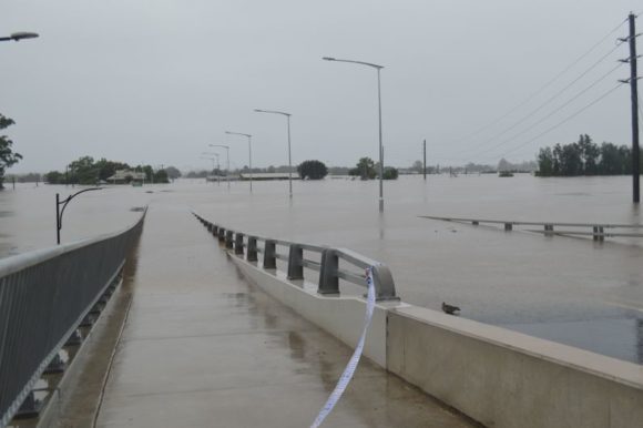
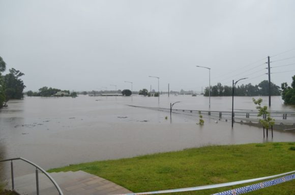
The photos attached to this post were taken when flood levels were at RL 13.31 metres (Approximately 480 mm below the final peak). Flood levels are now subsiding and have just fallen below major flood level.
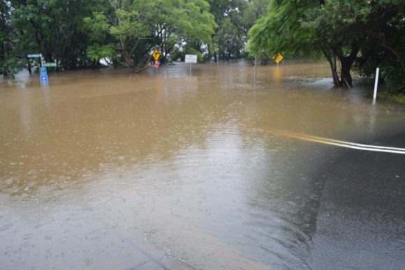
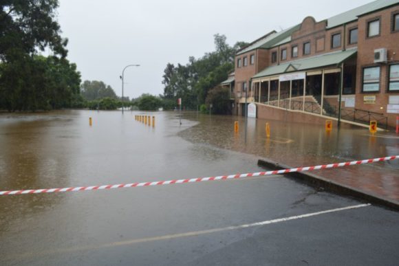
During my visit of Tuesday evening, the following were visible in addition to news crews preparing statements for the evening news bulletins:-
- The entire Windsor Bridge was submerged.
- Buildings had been damaged by flooding and flood waters were being pumped out of the adjoining buildings.
- Floodwaters were lapping up against buildings and businesses on streets that adjoin The Terrace such as Kable Street, Fitzgerald Street and Baker Street.
- Substantial road closures were in place creating limited road access to and from Windsor.
The second flood peak was 1.8 metres higher than the first peak and the difference between the two were significant. The second peak was more disruptive than the first peak.
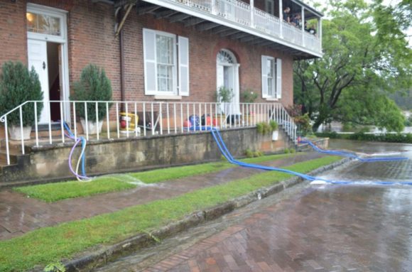
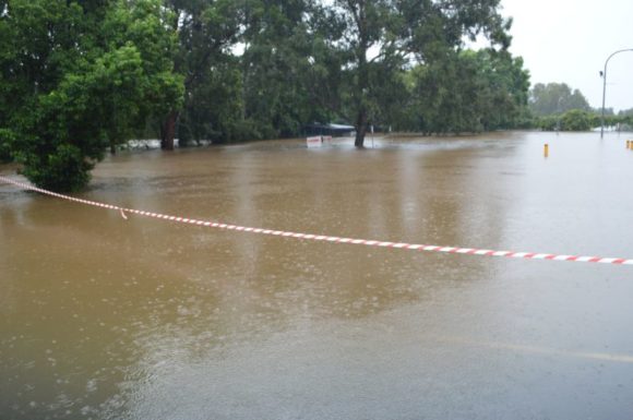
During Tuesday, Sydney experienced its final wet day. Rain has fallen at some point on every day between Tuesday 22 February and Wednesday 9 March 2022 which is a period of sixteen days. When tallied, cumulative totals have ranged between 400 and 700 mm. In Sydney city (Observatory Hill) 617.2 mm has fallen across the past 16 days.
At Richmond, 501 mm has fallen across seventeen days. Further, at Richmond, 681 mm of rain has fallen so far this year to Wednesday 9 March 2022. Some of the figures are approaching the average yearly rainfall for such areas and the scenes of such flooding soon becomes obvious.
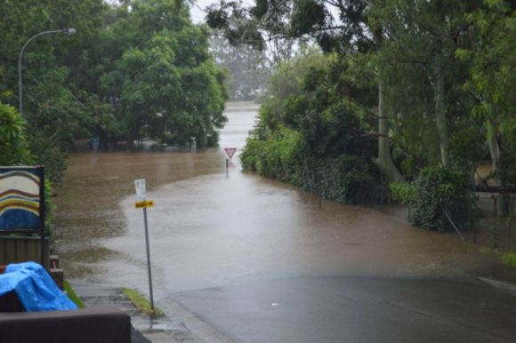
Nowhere across Sydney has escaped and every suburb is impacted in some form. However, the worst of the flooding is across Sydney’s West. As part of my second visit to flood ravaged Windsor, it is also evident that flood waters have reached into the western side of Blacktown being areas just west of Dean Park including areas around Scholfields and Riverstone.
https://fb.watch/bFp60CzLbc/
It is also identified that the river has been in flood for eight days which is a considerable length of time.
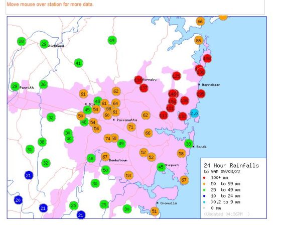
For the 24 hours to 9 am Wednesday morning, rainfall totals approached 200 mm at one location on the Northern Beaches being 195 mm with other nearby areas recording between 100 mm and 150 mm. Such high totals have resulted in flash flooding even in Manly causing damage.
Late Tuesday, rainfall eased and early Wednesday, the rainfall cleared Sydney allowing for the flood levels to begin receding. At the time of writing, the true extent of the damage is not known but it will be extensive. During Wednesday, another fatality from the event was confirmed being a truck driver who drove into flood waters then drowned.
It will be some time before flood levels recede to safe levels and the true extent of what has occurred is known.
Attached to this post are:-
1 - Photos all taken during Tuesday evening at Windsor.
2 - The Livetraffic link to images showing the Windsor Bridge being submerged (From Transport for New South Wales) dated 2 March 2022.
3 - Flood levels plot at Windsor PWD.
4 - Rainfall for the 24 hours to 9 am Wednesday morning (BOM recording stations only for Sydney).
