Similar to the previous discussion, large areas of Australia continue to experience dramatic weather events. There have been some significant thunderstorms through Victoria, New South Wales and Queensland and while this has been occurring, an inland heatwave has continued but its effects are now starting to ease for many inland towns.
Tropical Cyclone Jasper made landfall near Cape Tribulation during Wednesday and Thursday but the effects of this still continue with some incredible rainfall and flooding in affected areas.
Significant rainfall across large areas of South Australia from Saturday to Tuesday has led to some impressive rainfall totals but also led to two days of unusual cold for some desert regions.
The contrasts between these have been stark and incredible in some instances. This post will briefly cover the events.
Damaging storms
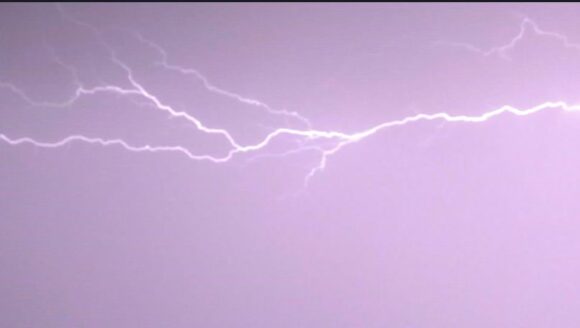
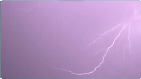
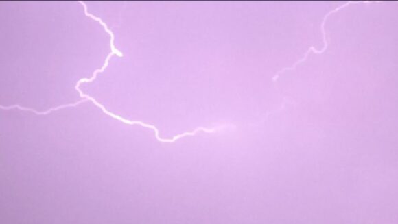
On Wednesday night, thunderstorm activity occurred over large parts of Western Sydney. These were high based but were lightning active. While some rainfall occurred including 15 mm at Prospect, most other falls were light. A key feature of these storms were the amount of lightning (Mainly sheet lightning) observed.

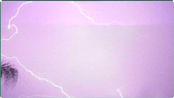
All the images attached to this post were taken at Doonside where I had my camera pointed skywards in an attempt to capture some of the lightning.
Generally, the storms following a warm to hot day across Sydney were nothing compared to what occurred at Wagga Wagga on Wednesday afternoon / evening.
The City of Wagga Wagga in the Riverina region of New South Wales was hit hard by significant thunderstorm activity producing 54.6 mm of rainfall. The storms have caused damage and significant power loss to much of the city.
Further south, a brief thunderstorm passing over Wodonga also did the same causing long lived extensive power loss to large parts of the city.
The most dramatic thunderstorm which may have been a supercell passed over parts of the Western suburbs of Brisbane on Friday afternoon. This storm:
- Produced peak wind gusts to 169 km/h at a weather station at Archerfield between 4.31 pm and 4.37 pm causing significant levels of property and tree damage.
- Hail to 3 and 4 cm.
- Rainfall intensities including 15.6 mm in 4 minutes (Almost 4 mm per minute) between 4.30 pm and 4.34 pm Friday afternoon.
- More than 50 mm fell during this event.
- Another weather station recorded 53 mm in 30 minutes being Round Mountain.
The peak wind gusts from this thunderstorm were significantly stronger (54 km/h) than that recorded by weather stations as Tropical Cyclone Jasper made landfall.
Tropical Cyclone Jasper
An accurate account of this storm system is available as the storm passed close to or over enough weather stations which has ensured that a high degree of reliable data is available. Verified maximum peak winds gusts identified include:
Lihou Reef Lighthouse
- 113 km/h at 9.08 pm from the south west Monday.
- The eye passed directly over the lighthouse with winds dropping to 13 km/h at 11.30 pm.
- At 4 am Tuesday morning, peak wind gusts briefly reached 102 km/h from the north.
Low Isles
- 115 km/h at 3.30 pm on Wednesday.
- 111 km/h at 2 and 4 pm also on Wednesday.
The eye passed just to the north of this weather station and thus the weather station was very close to the eye wall with the inner rain band passing over the weather station.
Marion Reef
- 109 km/h at 3.02 and at 3.04 am Monday morning.
- 107 km/h at 9.30 pm on Sunday.
Generally, winds between 80 km/h and 110 km/h were commonplace as far as weather stations can reveal.
In terms of strength, the CIMSS models suggested that the storm was below tropical cyclone strength at landfall being a “Tropical storm” (An intense tropical storm at or near the threshold of a Category 1 tropical cyclone under the Saffir Simpson Scale).
Under the Australian tropical cyclone intensity scale 1989, it is suggested that the storm had an intensity of a category 2 system at landfall. However, when accounting for verified wind speeds and gusts from official weather stations, it appears that the storm would reach Category 1 under the Australian Tropical Cyclone Intensity Scale but towards the upper end and an intense tropical storm under the Saffir Simpson Scale at landfall.
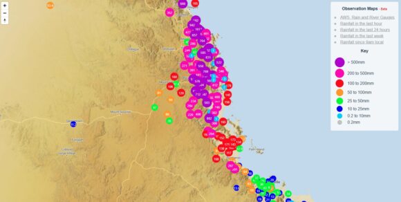
A feature of this is not the wind but the rainfall that occurred. Being slow moving and with its path impacted by the ranges to the west of Cairns, orographic rainfall has featured. There has been some incredible rainfall from the storm that has resulted in major flooding. The heaviest rainfall is limited to the coastal area north of Townsville to Cairns then north to Cooktown.
The following has been observed:
To 9 am Thursday
- Yandill - 624 mm.
- Diwan TM - 507 mm.
- Black Mt TM - 476mm
- Bairds TM - 471 mm.
- Port Douglas - 291 mm.
- Mary Parker Drive Alert - 284 mm.
- Cairns Aero - 178.6 mm.
- Low Isles - 156 mm.
Anywhere from Cairns to Cooktown and inland to at least 50 km was drenched.
To 9 am Friday
- Alloomba - 192 mm.
- Daintree Village - 189 mm.
- Yandill - 179 mm.
- Port Douglas - 122 mm.
To 9 am Saturday
- Tully George Alert - 357 mm.
- Cooktown - 340 mm.
- Crawfords Lookout Alert - 291 mm.
- Yandill - 231 mm.
- Battle Camp - 277 mm.
Yandill - An incredible 1,034 mm has fallen over the past 3 days from the event.
Most rivers between Ingham and Daintree have flood warnings ranging from minor to major.
Inland Heatwave conditions Ease
The inland heatwave continued but has now abated somewhat. Temperatures exceeding 40C continued at places such as Borona Downs, Bourke and Ivanhoe during Saturday, Sunday and into Monday but maximum temperatures began to ease from such highs from Tuesday onwards.
During Saturday 9 December, maximum temperatures reached over 42C and 43C at many areas across Western Sydney including:
- Penrith 43.5C.
- Horsley Park 42.6C.
Another hot day occurred across much of Sydney on Thursday 14 December where 38C was reached at several centres including:
- 39.5C at Penrith.
- 39.4C at Sydney Olympic Park.
- 39.1C at Richmond.
- 39C at Parramatta.
- 38.9C at Observatory Hill.
- 38.6C at Horsley Park.
On Saturday, high temperatures again featured with maximum temperatures reaching as high as 36.6C at Penrith and 36.4C at Sydney Olympic Park with 35C to 36C being commonplace elsewhere. Similar maximums have been recorded across the northern inland of New South Wales with 38.2C at Moree being the highest so far to 3.38 pm Saturday afternoon.
There is another hot day expected on Tuesday prior to a more substantial change that will end the current sequence of events.
South Australia
In addition to the rain event of Saturday to Tuesday that brought widespread 50 to 100 mm cumulative totals to an otherwise dry state, the main feature of this event was the cold that it brought. For example:
Adelaide - It reached 16C on Saturday 9 December.
Other notable daytime maximum during this event include:
- Adelaide (West Terrace) 15.9C (9 December).
- Andamooka 17.8C on the 10 December. This is remarkable as on the 6 and 7, it reached 45.9C on 2 consecutive days and 40C temperatures were recorded for 5 days in a row between Monday 4 and Friday 8 December.
- Coober Pedy - Similar heatwave conditions prevailed between the 4 and 8 December with 46.1C being reached on December 7. On December 10, the maximum temperature struggled to just 15.3C and 19.9C on December 11 (Almost 49 mm of rain fell here during December 10 and 11).
- Cleve - Just over 100 mm fell from this event.
The above shows how varied and extreme conditions have been which has made the start to summer rather interesting.
I have also attached the cumulative weekly rainfall for North East Queensland showing the considerable rainfall that has occurred within this part of the state until Saturday 16 December 2023.
