A storm currently moving off the east coast of the Top End of the Northern Territory is being watched closely because the system is expected to develop into a tropical cyclone within the next 24 hours.
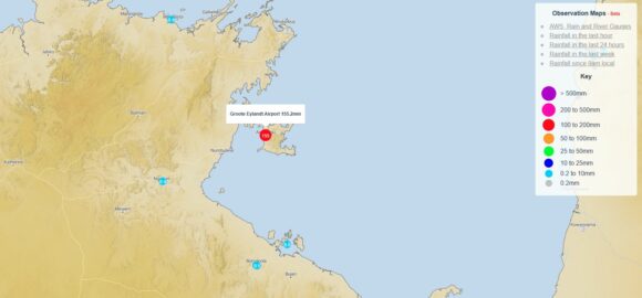
The storm is already having a significant impact for the affected areas within its influence. A weather station at Groot Elylandt Airport is currently providing good observations as to what is occurring close enough to the core. For the 24 hours to 9 am Saturday morning:
- The weather station recorded 249.4 mm.
- The weather station was recording peak wind gusts of up to 69 km/h.
Between 9 am and 1.20 pm Saturday, another 182.6 mm had fallen with heavy rainfall continuing. As such, flooding rains are a feature along the east coast of the Top End of the Northern Territory at the present time.

Once the system fully crosses the coast, the storm is expected to intensify then track south east then south and cross back over land as a tropical cyclone close to the Queensland / Northern Territory State border.
Satellite photos already show strong convection close to the core and with sea surface temperatures of 30C and 31C being recorded, the storm has potential to become a strong system.
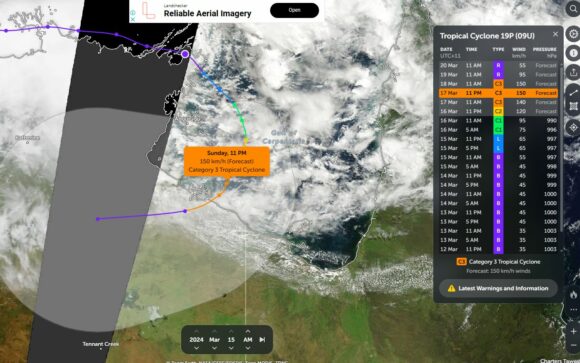
Already CIMSS forecast models have been upgraded for Storm Number 19 - (Currently not officially named as a tropical cyclone). CIMSS models project a strong Category 1 system at landfall with peak wind gusts to 80 knots at the Core (148 km/h). This is close to the threshold of a Category 2 system under the Saffir Simpson Scale.
Under the Australian Tropical Cyclone Intensity Scale 1989, the storm is expected to fall within the range of a Category 2 system and may even skirt the threshold of Category 3 system. What is most noteworthy is that this storm has potential to become the strongest tropical cyclone close to the Australian mainland so far this season.

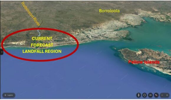
The current suggested forecast landfall site is mostly uninhabited. Should the storm maintain its track, then landfall would occur close to where the Robinson River meets the sea which is mostly marshlands, mangroves and shallow estuaries. This area is east of the Sir Edward Pellow Group (Pellow Islands) There are no major towns within this area. Should this change and the storm tracks further west, then the remote township of Borroloola would be threatened more directly by the storm system being gale force winds and flooding rains.
Attached are current weather models for the storm including the most recent CIMSS model forecast track that is the feature image for this statement.
I have produced using Google Earth, a general map showing the current expected landfall region looking south in 3D format. This area is mostly lowland and generally uninhabited.

Note: There is another storm that has low potential to form a tropical cyclone off the north west Coast of Western Australia. The storm known as “Tropical Storm 18” has a much lower chance of forming into a strong storm as it is located in a less than favourable environment to support such development. This will be covered as a separate post should the storm develop further and cross the coast.
