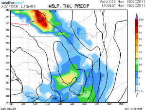
 This event was on the cards for some time. Warnings are current in South Australia and western NSW. This system will gradually contract east over the next day or so with the potential for heavy rainfall.
Jimmy Deguara
Places
Storm types
Pages
Chasers
Rain
This event was on the cards for some time. Warnings are current in South Australia and western NSW. This system will gradually contract east over the next day or so with the potential for heavy rainfall.
Jimmy Deguara
 Extreme heat in 1896: Panic stricken people fled the outback on special trains as hundreds die. « JoNova
22 Oct 2020 · Bourke, NSW
Extreme heat in 1896: Panic stricken people fled the outback on special trains as hundreds die. « JoNova
22 Oct 2020 · Bourke, NSW
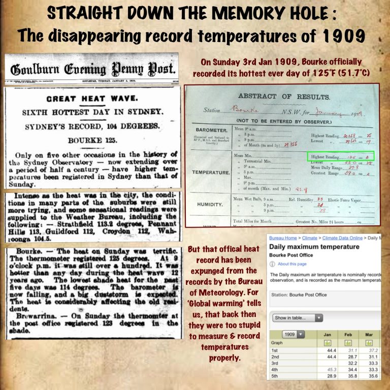 Validity of Old Record for Bourke
21 Dec 2019 · Bourke, NSW
Validity of Old Record for Bourke
21 Dec 2019 · Bourke, NSW
 NSW Severe Thunderstorm Warning
9 Jan 2014 · Bourke, NSW
Storms NSW Storms Floods – Record Bourke Rainfall from severe storm
16 Feb 2009 · Bourke, NSW
NSW Severe Thunderstorm Warning
9 Jan 2014 · Bourke, NSW
Storms NSW Storms Floods – Record Bourke Rainfall from severe storm
16 Feb 2009 · Bourke, NSW
All storm reports from Bourke, NSW →
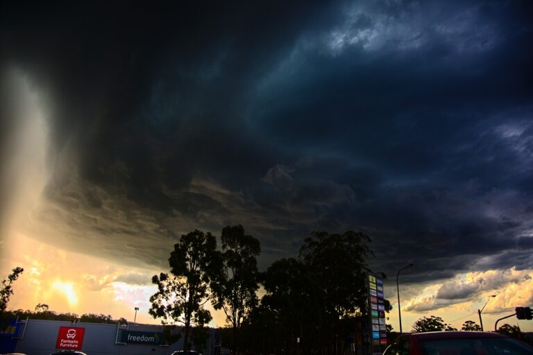 A year ago goodness
Finally a chase with structure! Got onto a storm near Liverpool and followed it including copping hail to about 2cm or so not mea…
17 Dec 2021 · Liverpool, NSW
A year ago goodness
Finally a chase with structure! Got onto a storm near Liverpool and followed it including copping hail to about 2cm or so not mea…
17 Dec 2021 · Liverpool, NSW
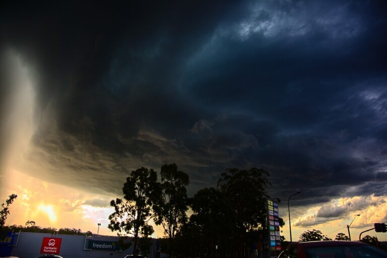 Finally a chase with structure! Got onto a storm near Liverpool and followed it including copping hail to about 2cm or so not measured as I was in tra…
17 Dec 2020 · Liverpool, NSW
Finally a chase with structure! Got onto a storm near Liverpool and followed it including copping hail to about 2cm or so not measured as I was in tra…
17 Dec 2020 · Liverpool, NSW
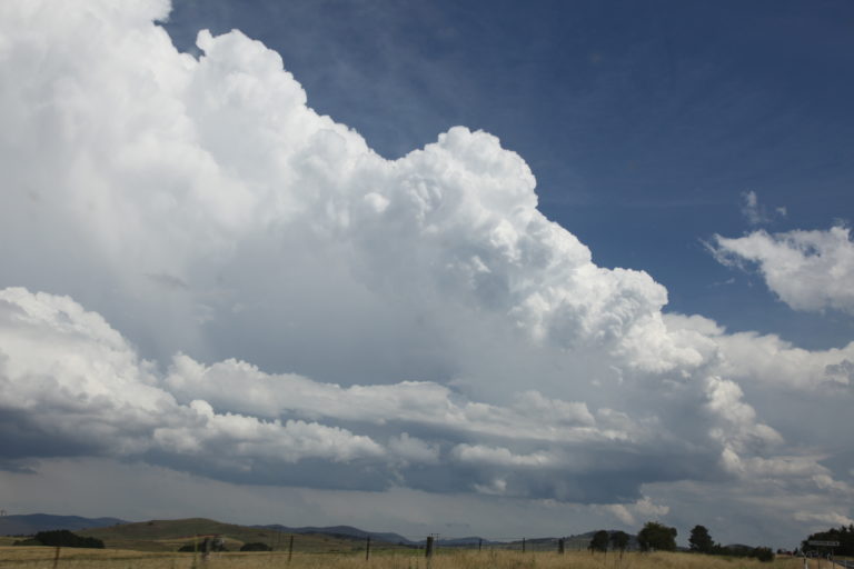 Storms Bredbo 17th December 2017
17 Dec 2017 · Bredbo, NSW
Storms Bredbo 17th December 2017
17 Dec 2017 · Bredbo, NSW
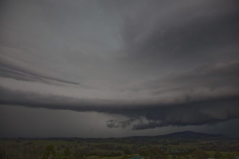 Supercell explodes west of Casino 15th December 2013
17 Dec 2013 · Mallanganee, NSW
Supercell explodes west of Casino 15th December 2013
17 Dec 2013 · Mallanganee, NSW
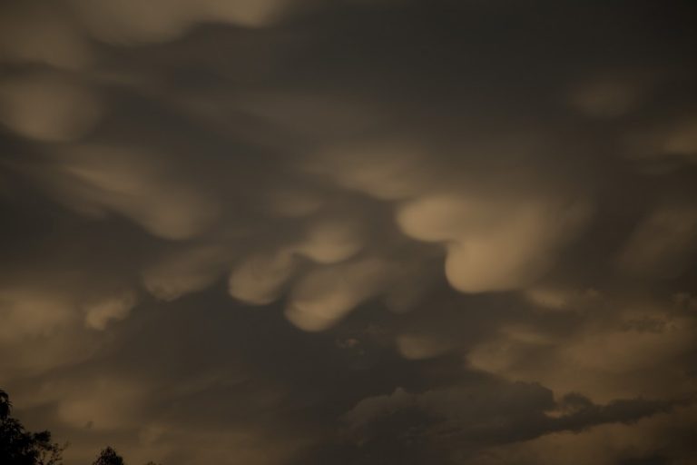 Supercells northeast NSW 14th December 2013
17 Dec 2013 · Grafton, NSW
Supercells northeast NSW 14th December 2013
17 Dec 2013 · Grafton, NSW
 Storms NE NSW 17th December 2012
17 Dec 2012 · Dorrigo, NSW
Re: QLD & NSW severe storms large hail supercells 12 – 17 Dec 2010
17 Dec 2010 · Sydney, NSW
Nsw / vic heat, Rain and storms 17 – 19 Dec 2009
17 Dec 2009 · Westmead, NSW
Tropical Cyclone Billy: WA 17-26 Dec 2008
17 Dec 2008 · Wyndham, WA
Impressive storms once again in the Northern Rivers
17 Dec 2006 · Northern Rivers, NSW
Storms NE NSW 17th December 2012
17 Dec 2012 · Dorrigo, NSW
Re: QLD & NSW severe storms large hail supercells 12 – 17 Dec 2010
17 Dec 2010 · Sydney, NSW
Nsw / vic heat, Rain and storms 17 – 19 Dec 2009
17 Dec 2009 · Westmead, NSW
Tropical Cyclone Billy: WA 17-26 Dec 2008
17 Dec 2008 · Wyndham, WA
Impressive storms once again in the Northern Rivers
17 Dec 2006 · Northern Rivers, NSW
You must be logged in to post a comment.
There were storms in South Australia last night – no doubt some were supercells on the back end of the system behind the retreating cloud band. Interesting scenarios can pop up in South Australia when the moisture hits the area.
See : 256km Radar Loop for Adelaide (Buckland Park), 00:00 17/12/2011 to 00:00 18/12/2011 UTC
This video is from the Whyallah region
http://www.youtube.com/watch?v=K2jEqkhU97U
http://www.youtube.com/watch?v=jlT_SrICn7s
Funnel cloud and possible tornado north of Laura, South Australia
http://www.youtube.com/watch?v=wsDDkdwcRL8&feature=plcp&context=C3973c09UDOEgsToPDskIfMd_2uKzAcOUXtQTXFI0n
This system appeared to maximize over Victoria on Sunday. Some of the rainfall totals were amazing and notably Halls Gap which received 90mm in 20 minutes. That is a phenomenal rainfall rate, even for the tropics let alone for western inland Victoria!
Jeff
Hi,
Nick Moir and his companion had an excellent chase in the northwest plains of NSW yesterday. Here is a small video of the main storm he chased. He has some other footage and spectacular photographs that he will post himself when he gets home.
http://media.smh.com.au/news/environment-news/thunder-lightning-rain-and-rainbows-2849036.html
Regards,
Jimmy Deguara
Jeff Brislane said:
“This system appeared to maximize over Victoria on Sunday.”
I think the most intense storms were over South Australia.
Regards,
Jimmy Deguara
Totally agree about the storms being much better in South Australia, I was actually thinking more about the rainfall side of this event and it seems that western Victoria copped the brunt of extreme rainfall.
Late afternoon of the 19 December 2012, I observed what appeared to be a thunderstorm building around the Prospect area which was embedded within light rain and low cloud. Driving home from work along the Great Western Highway, I observed a darkening cloud base and first observed the rain core at Pendle Hill. At Prospect, I drove into heavy rain. I turned into Flushcombe Road and parked the car at the Prospect Woolworths. I was amazed at what happened thereafter.
The Prospect area went on to experience a deluge from that storm, some 52 mm in a very short period of time. I took a number of photos and the rainfall was so heavy that the only way to capture the event was to hold my umbrella high above my head and with my other hand, take my photos pointing the camera down to ensure that I did not get rain or spray on my lens. I succeeded in capturing the rain / storm event but was drenched in the process.
During that event, the stormwater system within the Prospect Woolworths Supermarket could not handle the downpour and stormwater began pouring through the roof in places and staff were at the doors with mops trying to keep water from entering the supermarket. The car park filled with water as drains filled and overflowed. Surface water was seen pouring over Flushcombe Road as nearby household gutters could not handle the deluge.
This was a localised thunderstorm with Merrylands West getting 62 mm, followed by Prospect getting 52 mm of rain. A small number of rain guages around Blacktown showed 40 mm to 48 mm. Any rain guage or weather station outside this small area received much less with only 26 mm at Parramatta (Source BOM rainfall observation totals 20/12/2011). I provide two photos which captures the event.
Photo shows car park filling with water during the storm.
A section of Flushcombe Road inundated with water.
Heavy rain causes the car park to overflow.
Surface flooding is shown during the storm.
Haha, i didn’t know you have a time machine Harley!