The Christmas period across New South Wales has seen significant variations of weather ranging from flooding rains to storms to hot dry and windy conditions.
During the period 22 to the 28 December, New South Wales has been a state of two halves with the north and eastern half being saturated with rain, some of which has been significant while the west and south west has been bathed in sunny and often hot conditions.
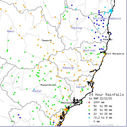
In particular and just prior to Christmas (22/12/2020), the region surrounding Tamworth and Gunnedah and other nearby towns were saturated with heavy rain with falls of up to 98 mm occurring. Much of the North West slopes and plains of New South Wales received between 50 and 98 mm of rain during this event and localised flooding of rivers and streams occurred.
During the 26/12/2020, there were thunderstorms on the ranges and the Hunter Valley of New South Wales although no such chase could be undertaken as my wife and I were in Albury on the New South Wales Victorian State border.
It is interesting to see that west of Conroys Gap (West of Yass New South Wales), the impacts of the La Nina weather pattern is significantly less. The region further west is typically dry with the grass having dried out. Near Albury, it is significantly dry and the fire risk is heightened. Where we are staying, it has been quite hot and it reached 35.6C on the 27/12/2020. Further west, it has been hotter.
Near Robinvale in North West Victoria, a bushfire was burning out of control by evening on the 27/12/2020 due to high winds and high temperatures. It reached 40C at Mildura and the high 30s across south west New South Wales on the 27/12/2020 being the areas not impacted by the recent rain events.
During the evening of the 27/12/2020, a strong cool change passed through southern New New South that brought little if any rain but brief wind gusts of 52 km/h at Albury Airport. The cool change brought little rain across northern Victoria but its impact in eastern New South Wales will be different to that of northern Victoria due to more moisture being available.
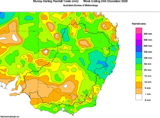
The attached rainfall plot produced on the Bureau of Meteorology "Water and the Land" website prepared on the 24/12/2020 is showing the weekly accumulative rainfall for the Murray Darling Basin. As shown, the heaviest falls have occurred across the north east of New South Wales. There is a narrow corridor focused on northern Victoria and south west New South Wales that has missed most of the recent rainfall events. This is the region that has been experiencing the high summer temperatures and where the bushfire threat is most high.

The second plot is showing the location of the rain event to 9 am 22/12/2020 across the north west New South Wales.

