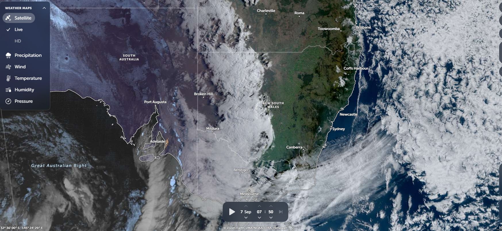
Over the past few days, weather models have been hinting at an inland rain event which is receiving some attention through the media.

When reviewing this more closely, it appears that there are two outcomes projected because both the GFS and ACCESS model differ in terms of who will receive what and where.
It is generally accepted that Sunday, a band of rain and showers will cross through Victoria and into southwest New South Wales but final totals from that event do not appear to be significant - Generally 5 to 10 mm of rain.
It is the second event that appears to be more widespread. The development of an inland low across New South Wales and Victoria on Tuesday will assist final totals and the development of some thunderstorm activity around Griffith and rural areas of the Riverina (New South Wales) cannot be ruled out.
This event is expected to deliver more widespread totals with falls of 10 to 30 mm generally widespread.
This event could be crucial because much of the south west region of the state and northern and western Victoria are either in drought or skirting with drought following rainfall totals that were average or below average for the winter season just concluded.
There are two outcomes projected from the two events as combined:
1 - GFS to the close of Thursday
A widespread event in which falls of 15 mm occur but heavier totals of 30 mm to 40 mm occur from the ranges then northwest towards Tibooburra but lighter totals along the coast north of Sydney and with the southwest of the state receiving little rainfall.
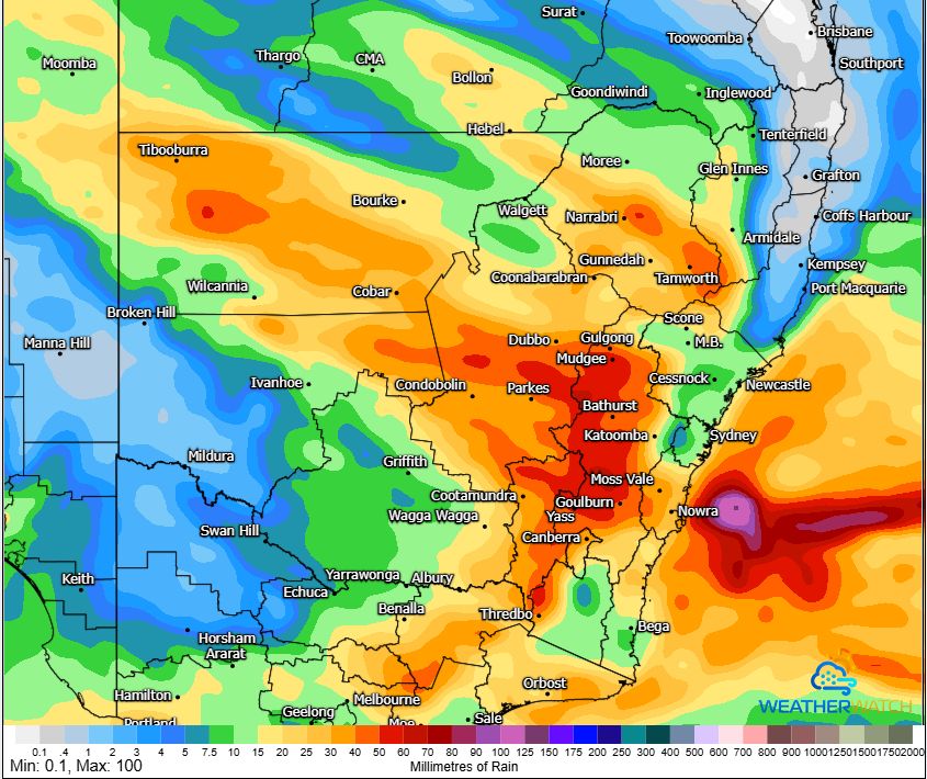
In this regard, areas around Mildura / Swan Hill (Northwest Victoria) and Ivanhoe (New South Wales) generally misses out on anything significant.
Areas from Goulburn to Mudgee receive the heavier totals of at least 50 mm and the south coast to receive 15 to 30 mm.
2 - ACCESS to the close of Thursday
The model is vastly different to the GFS because this suggests a vast region to receive at least 20 to 30 mm thus areas around Albury, Echuca, Swan Hill, Horsham to receive upwards of 20 mm, 30 mm and even 40 mm.
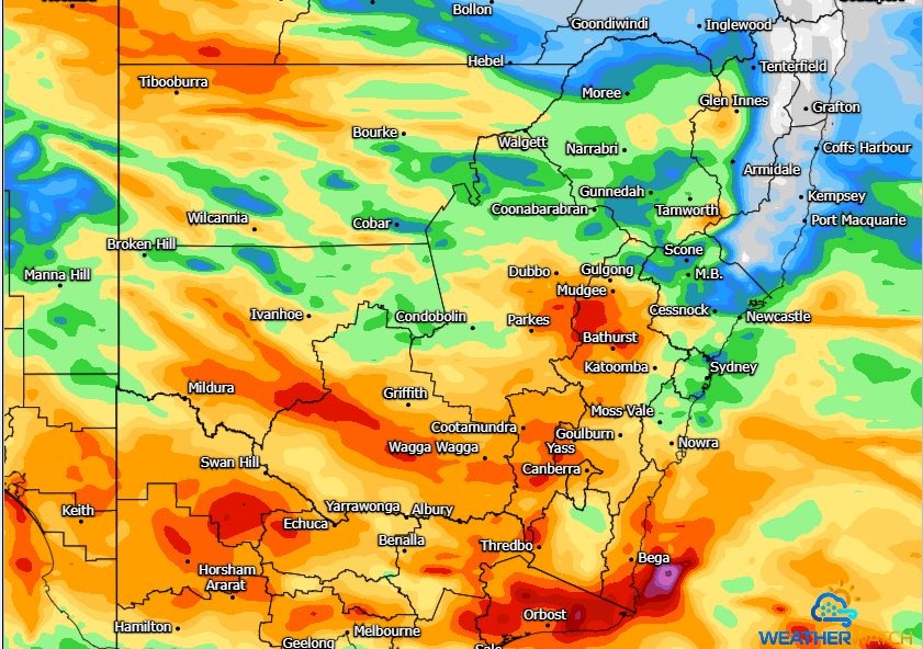
Given how dry it has been within this area, this would be the preferred outcome as it would suggest some decent rainfall totals for areas that have largely missed out on winter rainfall. This outcome would go along way to reducing rainfall deficits that are building up across the region.
Only time will tell as to what will occur over coming days. This is certainly an interesting setup and one to watch to see which model proves to be the more accurate in terms of rainfall.