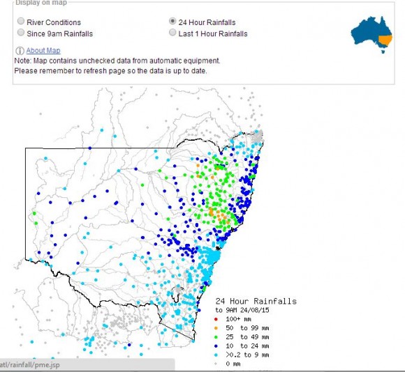
The cloud mass situated over New South Wales has produced some substantial rainfall across parts of the state. For the 24 hours to 9 am 24 August, the best falls occurred at the following centres:-
Careys Peak (Barrington Tops) 81 mm.
Upper Rouchel - 71 mm.
Cressfield - 69 mm.
Dungog 58 mm.
Upper Chichester - 56 mm.
Granite Heights and Murrurundi - 55 mm.
Numerous centres across the North West Slopes and Plains, Northern Tablelands and Hunter Valley received between 25 mm and 55 mm during the period.
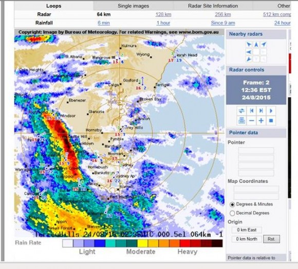
There have been several thunderstorms occurring during this event. In particular, one storm passed across Sydney between 12 midday and 1 pm that brought hail to some outer western areas and the Blue Mountains and a period of very heavy rainfall. At Auburn a number of thunderclaps were heard during this event.
For the 9 hour period 9 am to 6 pm 24/8/15, the best falls across Sydney were:-
Bondi - 21 mm.
Fairfield City Farm and Frenchs Forest - 20 mm.
Penrith - 19 mm.
A large number of suburbs received between 14 and 21 mm of rain from the event and ensuring showers that occurred later in the day. Isolated lightning flashes were seen from passing showers on my way home from work.
After 8 pm, another thunderstorm has passed over Blacktown producing some very heavy rainfall with several flashes of sheet lightning being observed.
During the period 9 am to 6 pm 24/8/15, some significant rainfall occurred across parts of the Illawarra Region including:-
Foxground - 79 mm.
Brogers No 2 - 65 mm.
Wollongong AWS - 61 mm.
Broughton Creek - 52 mm.
An isolated fall of 69 mm occurred at Narooma.
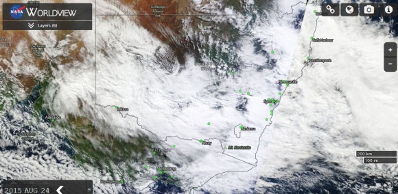
As shown on the MODIS Worldview satellite image with overlays (Acquired from NASA 24/8/15), large areas of New South Wales is under substantial cloud. When viewed more closely, some cumulonimbus cloud formations can be identified within the large cloud mass.
A BOM radar image of the storm passing across western Sydney after 12.30 pm is attached.
This system will continue to produce large rainfall totals as the event unfolds.


