Being winter, it was a shock to see a full blown system and the Bureau of Meteorology issuing a day 2 forecast for severe storms. And not only that - the threat of supercells! The synopsis had a strong upper level jet and right exit region over central NSW. A supercell track seemed to be progged consistently for the region between Bathurst, Mudgee and the central Coast to Putty region. Rapid destabilisation with modest for winter moisture surface dew points 11C and sufficient heating of 21C with upper level temperatures of -25C and light backed NE winds at the surface. These conditions seem to favour low topped supercell environments.
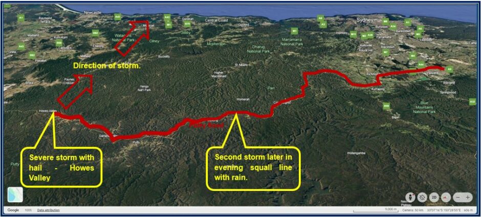
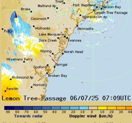
Harley and I decided to target the Putty region due to ideal conditions there but also the limited daytime storms in light 4pm to 5pm period for photography Central Tablelands through to Putty (central coast had storms after sunset.
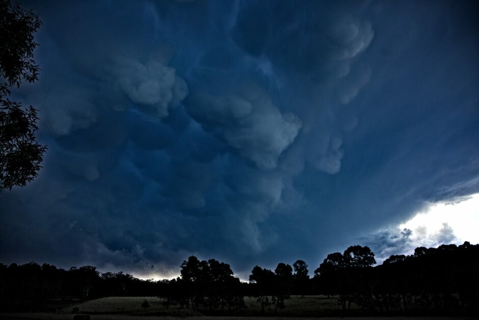
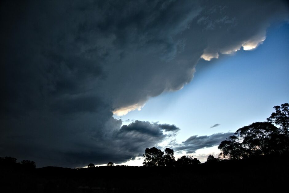
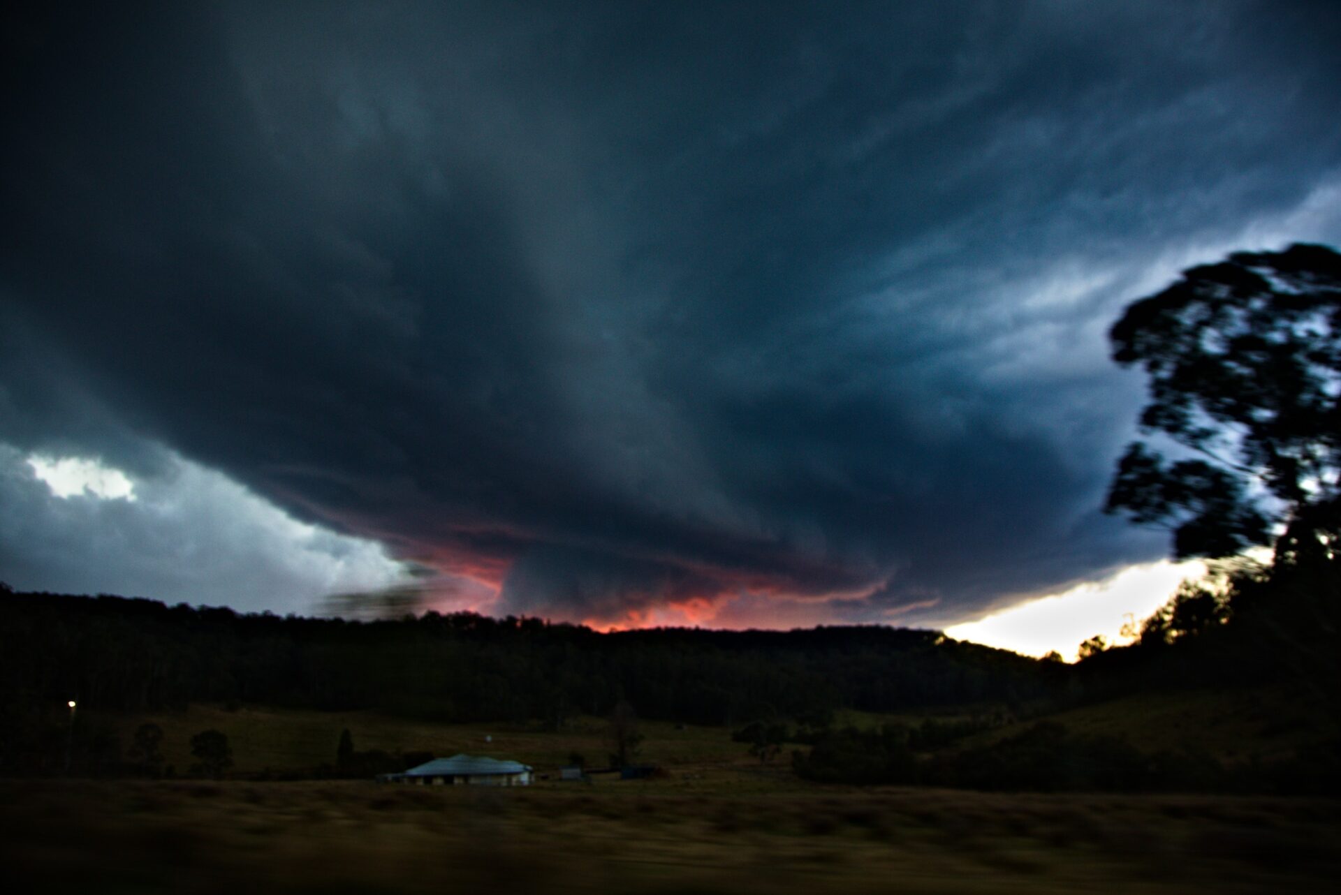
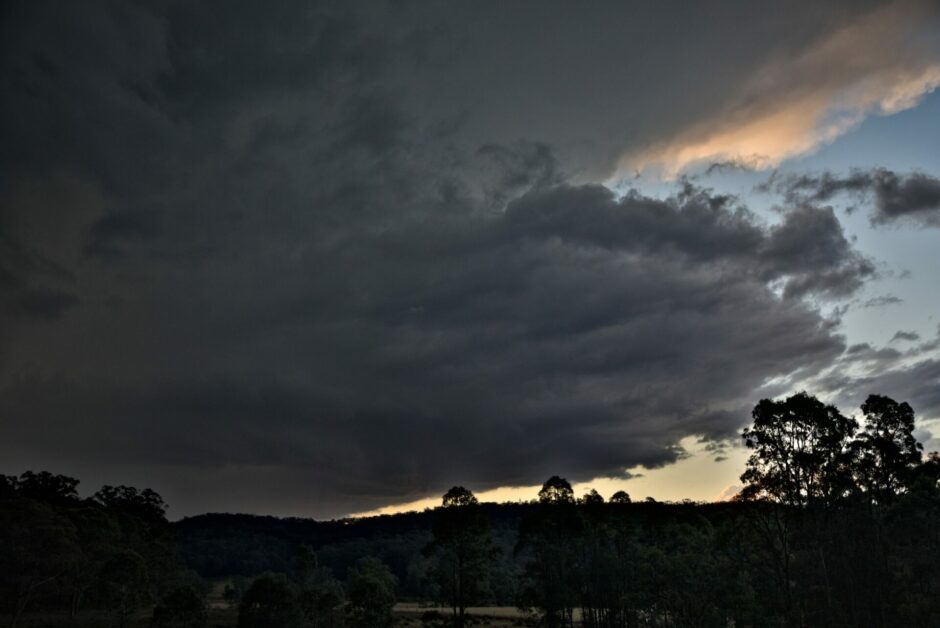
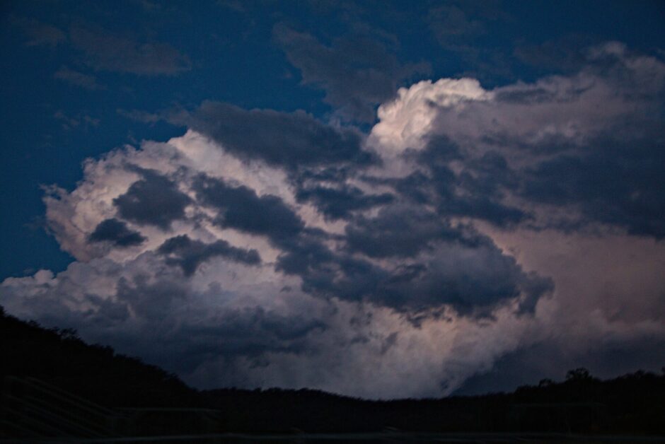
This was one of the east chases given that we simply left the Penrith region and headed pretty much straight through to the developing storm. What greeted us were the mammatus and the updraft with the base hidden initially by hills. We relocated and luckily found a hill to see most of the storm and base coming into view. Visually you could just make out that the storm was rotating slowly.
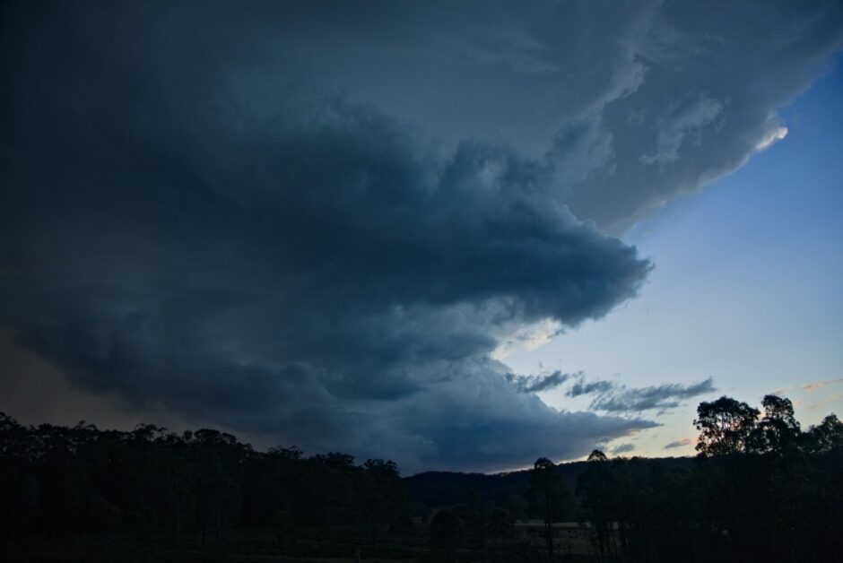
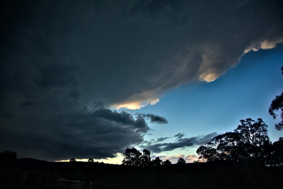
The first updraft has an inflow band at two levels. It seemed surreal to hear not only thunder but some solid cloud to ground lightning as well as anvil crawlers. This storm seemed to be cycling with a second more major updraft creeping.
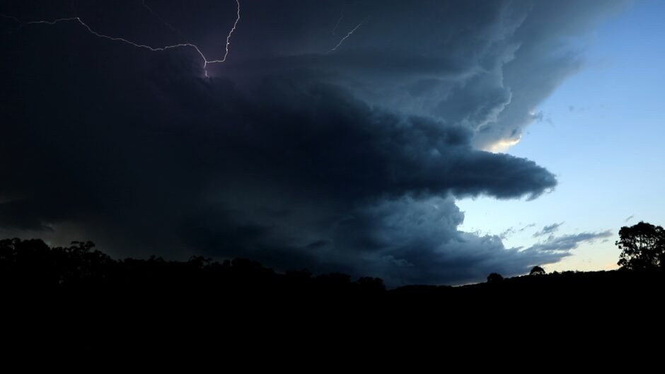
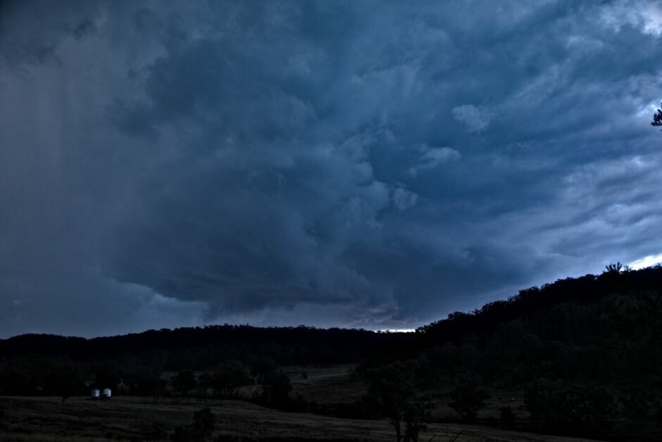
At this point the storm updraft and side anvil showed explosive development ( well for winter) and it was expected the storms would hit 300 hPa level with larger hail potential. This seemed to coincide with more intense radar signatures and also hail algorithms seemed to coincide with the largest hail in this phase and even more significant just east of us.
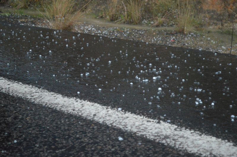
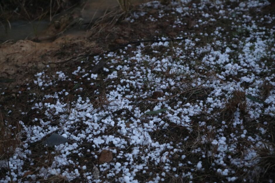
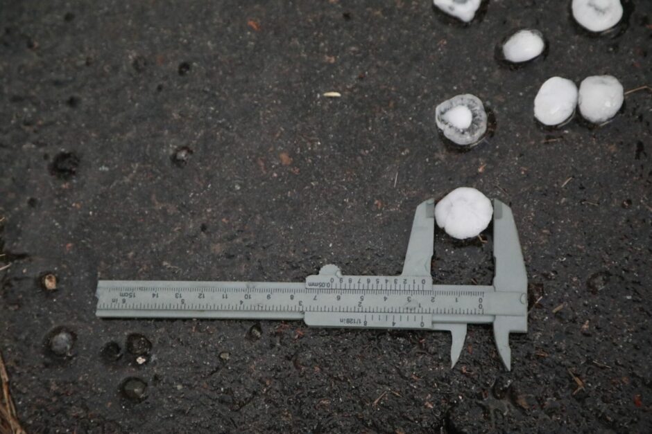
The final hurrah was the hail - hailstorms measured up to 2.5cm but some sounded larger. Further up the road it seemed there hail covering the road and possibly confirming slightly larger once as well but light was fading at this point. We encountered hail fog and stripped leaves in this region.
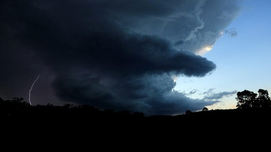
We left the area to try and intercept the next severe storm in the line but it was wishful thinking. We did however intercept and intersected the line that absorbed this storm with quite impressive lightning!
All in all a very surprisingly spectacular event for early July. Thanks to Harley for his excellent safe driving on this chase.