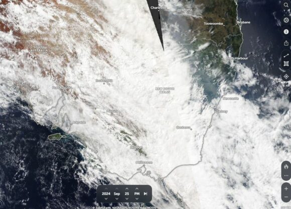
As identified within a previous statement, a weather system that brought moderate to heavy rain, storms and even flooding across outback regions of Western Australia and Northern Territory finally passed over New South Wales during Wednesday to Friday.
For large areas of the state, useful and beneficial rains did fall but there were areas to the southwest and northwest that missed out.
The cloud mass passed over Victoria providing mostly light rainfall. However, there was an exception to this with an area bordering the Murray River and the upper northeast region receiving reasonable totals of 25 to 30 mm. This included 27.6 mm at Albury Airport and 25 mm at a weather station in West Wodonga and 44.8 mm at Hunters Hill to the east.
As the system moved across New South Wales, a stronger rain band developed. The rain band passed over southern New South Wales during Wednesday, central areas and Sydney during Thursday then reaching the New South Wales north coast during Thursday afternoon. At the time of writing, a small east coast low has developed off the New South Wales north coast which has brought significant rainfall totals with rainfall exceeding 150 mm at certain locations.
Armidale and Coffs Harbour
I was in northern New South Wales with my wife during Wednesday to Friday where I could clearly make out the various stages of this weather system as follows:
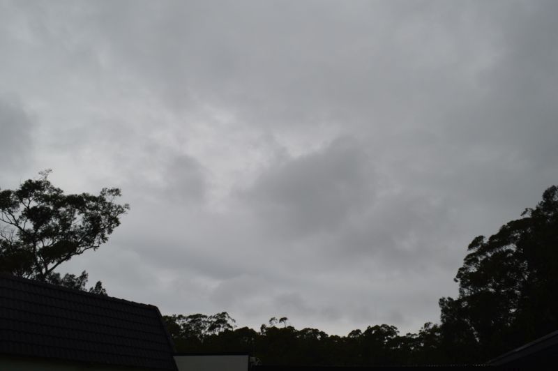
Photo 1 - Armidale at sunrise looking east Tuesday 24 September. The eastern edge of the cloud mass is illuminated by the rising sun. Throughout Tuesday and into Wednesday, the cirrus cloud overhead slowly thickens.

Photo 2 - Coffs Harbour City - Thursday morning from Muttonbird Island looking west. Thickening cloud comprised of alto stratus and Cirro stratus cloud (Mainly mid to high level cloud at the time). The primary rain band was still to the south at the time the photo was taken but the primary rain band was visible across the southern horizon. By late morning, cloud cover had thickened to such an extent resulting in very light patchy rain showers.
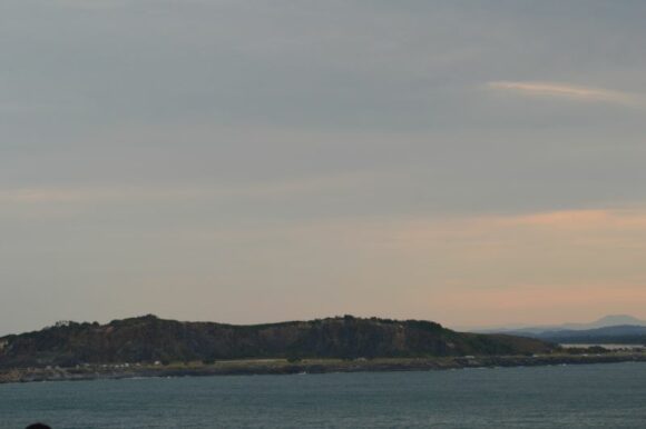
Photo 3 - Coffs Harbour City - A southerly wind change passed over after 1 pm and low level stratus cloud builds. The eventual development of nimbostratus cloud thereafter heralds the arrival of increasing but light patchy rain. By sunset, at least 5 to 6 mm of rain had fallen across Coffs Harbour City.
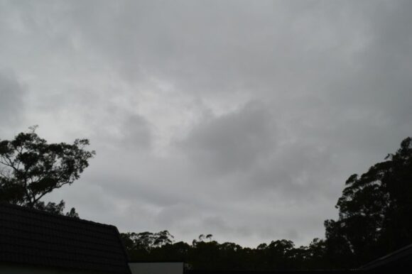
Photos 4 and 5 - Coffs Harbour - Friday morning with moderate to heavy rain. While we left and returned to Sydney, sustained rain fell across Coffs Harbour City. For the 24 hours to 9 am Friday 27 September at least 52.8 mm had fallen at Coffs Harbour Airport. For the 24 hours to 9 am Saturday morning 28 September, falls of greater than 100 mm had fallen across the city including:
- Airport - 101.6 mm.
- Buchanans Road and Perry Drive - 142 mm.
- Loaders Lane - 164 mm.
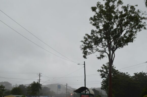
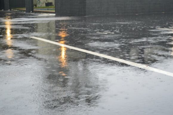
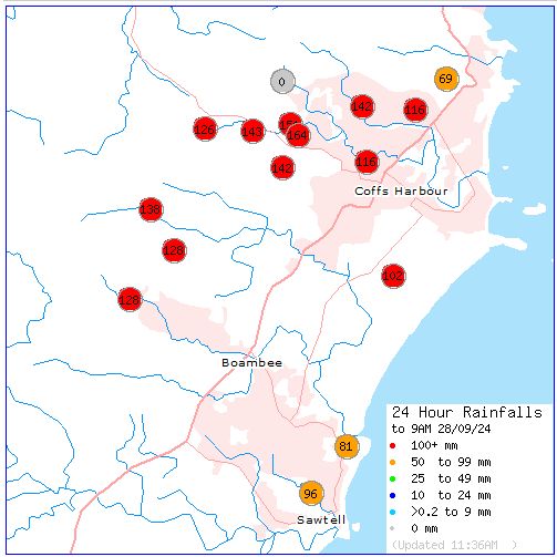
Whilst in Coffs Harbour Friday morning, I noticed that the rain intensity was greatest across the northern part of the city with slightly lighter rain towards the south. When matched against the official totals, it is noted that the heavier falls had fallen across the hilly northern regions of the city. There is evidence of orographic rainfall given that the hills to the north rise over 400 metres in elevation.
Attached is the official rainfall plot for Coffs Harbour to 9 am Saturday morning taken from “Water and the Land” showing the location of the heaviest rainfall.
It is also noted that sea waves reached close to 9 metres at Coffs Harbour coupled with peak wind gusts of 78 km/h at 9.19 am (Friday morning).
Other notable rainfall totals to 9 am Saturday morning on the New South Wales North Coast include:
- Alstonville (Near Lismore) - 146 mm.
- Doon Doon - 131 mm.
- Goonengerry - 129 mm.
Whilst driving south Friday, it was noted that much of the rain had contracted to areas north of Port Macquarie and thus relatively clear or cloudy skies prevailed further south with only very isolated showers persisting.
For the 24 hours to 9 am Friday 27 September, the following significant rainfall totals occurred near Taree:
- Comboyne Public School - 124 mm.
- Mooral Creek (The Den) - 121 mm.
I did note that there was evidence of minor flooding close to Taree from the rain event however, this was low scale and not having much impact across the wider region. This was evident in the 50 to 100 mm rainfall totals that had fallen earlier across the region.
Sydney
The event brought useful rains across Sydney with cumulative 2 days totals including:
- 20.8 mm at Penrith.
- 24.6 mm at Bankstown.
- 26.4 mm at Sydney Airport weather station.
- 27.2 mm at Badgerys Creek.
- 30 mm at Richmond.
- 37 mm at Parramatta.
- 37.6 mm at Sydney Olympic Park.
- 52 mm at Observatory Hill.
- 65.8 mm at Terrey Hills.
The 30.4 mm in my rain gauge from the event is generally consistent with totals at nearby weather stations.
It is also noted that the maximum temperature across Sydney struggled to reach 13 to 15 degrees Celsius during Thursday making Thursday the second coldest day of 2024.
Another standout feature of the day (Thursday) is that very light snow showers fell across the higher elevations of the Central Tablelands.
I have attached a satellite photo of New South Wales taken from Zoom Earth (NASA Tuesday 24 September. Thick cloud blankets much of New South Wales with only the northeast corner of the state under generally clear skies.
