Following on from the most recent post, some incredible features of this event for Sunday include:
- Daily rainfall totals exceeded 700 mm at Rollingstone Alert (Total 702 mm or 29.25 mm per hour over a 24 hour period to 9 am Sunday).
- Between 9 am and 11 am Sunday, 3 locations north of Townsville received more than 100 mm in 2 hours which is a sustained fall of greater than 50 mm per hour. This includes 124 mm at Paradise Lagoon with 124 mm or 62mm per hour for 2 hours falling.
- Flood evacuation emergencies are in force.
- To date, there is 1 fatality near Ingham.
- Whole low lying areas of the city have been evacuated. Power outages have occurred including issues with fallen trees, flooded roads, buildings and riverine flooding.
- All local rivers in flood to varying levels.
- Townsville Airport closed at 12.30 pm Sunday.
- Power loss exists around Rollingstone, Paluma and environs, Bluewater Park, parts of Hermit Park, Rosslea, Horseshoe Bay, Magnetic Island, Nelly Bay, Picnic Bay, various regions around Cardwell, Majors Creek, Ar and Kirwan affecting at least 8,709 customers.
- Up to 64 roads impacted by flooding to some degree across the affected region.
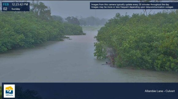
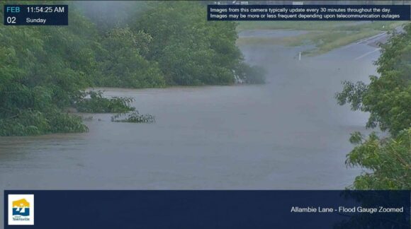
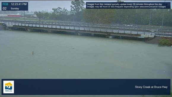
A few images of the affected area have been obtained from the local weather / live cams available across Townsville City. All the images show heavy rainfall and even the flooding crises that has developed over the past 2 days. There is an image showing a flooded Stony Creek crossed by the Bruce Hwy.
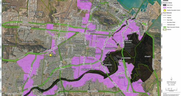
The Townsville City Council site provides an excellent flood map showing the area under evacuation orders (That part in black). This shows the low lying areas across the south and southeast part of the city most at risk of flooding.
For the 24 hours to 9 am Sunday morning, the heaviest rainfall totals are:
- Rollingstone Alert - 702 mm.
- Pace Road Rollingstone - 648 mm.
- Paluma Dam Alert - 571 mm.
- Paluma Alert - 501 mm.
- Wallaman Escarpment - 463 mm.
- Ingham - 389 mm.
Across Townsville City, rainfall across the northern areas of the city exceeded 300 mm for the second day in a row including but not limited to:
- Bluewater Alert - 449 mm.
- Upper Black River Alert - 357 mm.
- Mt Margaret Alert - 346 mm.
- Bushland Beach - 336mm.
The official recording from the airport (Townsville) was lower at 260.6 mm. Over the past 2 days since 9 am Friday morning, the airport has recorded 544.6 mm. This does not include the falls that have occurred since that time being another 67 mm between 9 am and 1.40 pm.
If this was undertaken across the whole of Townsville, it becomes obvious that the two days falls have greatly exceeded 500 to 700 mm with some totals topping 800 mm.
Between 9 am and 1.40 pm, a staggering 242 mm of rainfall has fallen at Paluma Alert which is 53.7 mm per hour for 4.5hours.
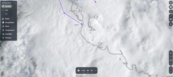
This event is ongoing and thus the totals will be driven much higher over coming hours.
Note: The feature image is not from Townsville but is one taken of a flooded creek. This image which was taken in April 2024 replicates to a high degree the flooding situation that is occurring across the Townsville region.
