Spawned by waters heated to 30C and moving at just 3 to 5 km/h prior to landfall, the storm named Hurricane Melissa has become one storm that will be remembered for years to come.
The storm had the perfect environment to form and intensify. It was small and compact with a clearly defined eye. The eye was surrounded by towering cumulonimbus clouds easily soaring to 18 to 20 km in height
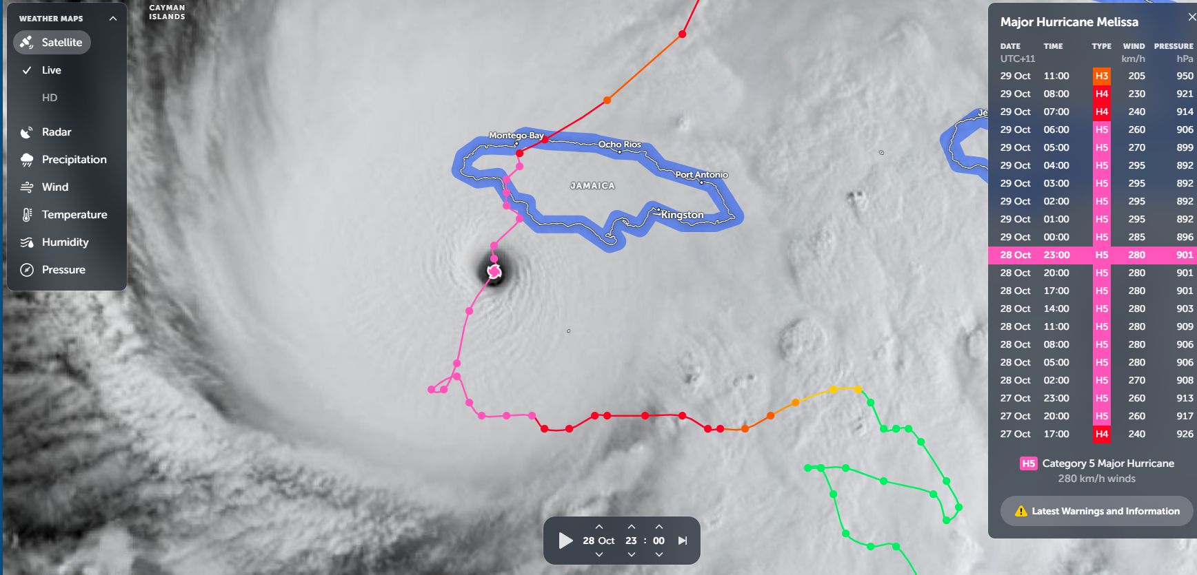
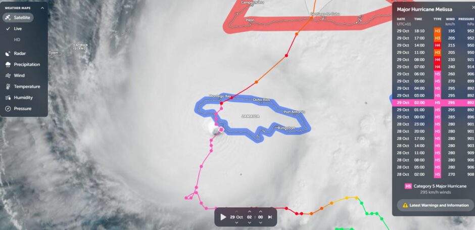
What made this storm different is that it made landfall onto the island of Jamaica and sustained its strength at Category 5 on the Saffir Simpson Scale well after landfall. The storm was packing winds at the core of close to 298 km/h and its impact across the western half of Jamaica is still being realized. Its slow movement across the island only made a bad situation worse.
At the time of writing, it is known that 77% of the island's population were without electricity services.
The storm made landfall near St Elizabeth approximately 100 km west of the capital of Kingston and as it crossed over the western half of Jamaica, it brushed the eastern side of the city of Montego Bay.
It crossed back out to sea as a weakened storm at Category 3 strength only to make landfall across the eastern half of Cuba. The storm also impacted Haiti and to date, most of the known fatalities have occurred in Haiti.
The storm is now gradually losing its power as it heads north over cooler waters.
At peak intensity, it had a low pressure of just 896 millibars making this the fifth most powerful Atlantic storm to be recorded.
The impact on Jamaica is still being realized but the damage is significant and the death toll is steadily rising.
Images of the storm from Zoom Earth shows its incredible structure just prior to landfall.
The recovery process will be considerable and will probably take years in terms of reconstruction and recovery.