Following the thunderstorm outbreak which included the squall line that impacted considerable areas of Eastern Australia and New South Wales, there have been a number of additional events that have since impacted areas of Australia.
Note: The individual storm events and associated storm chases are covered in separate posts.
The events are:
1 - East coast low - New South Wales and south east Queensland coastline
This event has brought the following but limited to the New South Wales coastline and southeast Queensland between Brisbane (Queensland) to the north and Wollongong (New South Wales) to the south.
Rainfall
Due to the formation of an offshore low pressure system, a small area of the Lower North Coast of New South Wales received significant rainfall totals for the 24 hours to 9 am Saturday morning 18 January 2025. There were even isolated rainfall totals topping 200 mm as follows:
- Careys Peak Barrington Tops - 281 mm.
- Mt Barrington - 218 mm.
- Wootton - 151 mm.
- Crawford - 146 mm.
- Mooral Creek - 145 mm.
- Upper Chichester - 131 mm.
The area affected by the 100 mm rainfall totals is relatively small being localities generally north of Dungog but south of Port Macquarie (New South Wales).
Constant showers and coastal rainfall have pushed the totals to above average for January for several coastal areas.
During Saturday and into Sunday to 9 am Sunday morning, moderate to heavy falls have also occurred in the Bellinger Valley where 100 mm totals have occurred around Bellingen and Dorrigo including:
- Dorrigo - 146 mm.
- Lowanna - 109 mm.
There are several other localities within the Bellinger Valley that received falls of 50 mm to 91mm.
Isolated 100 mm totals also fell southwest of Port Macquarie including:
- Comboyne Public School - 139 mm.
- Barrington Tops - 132 to 134 mm.
During Friday, rainfall totals were not high across Sydney with only an isolated moderate fall of 51 mm at Hornsby. For the most part, falls were light and not newsworthy.
The event reached south east Queensland and far northeast New South Wales during Saturday and into early Sunday with widespread rainfall totals reaching 50 to 99 mm with isolated totals topping 100 mm including:
- Upper Springbrook Alert -141 mm (SE Queensland).
- Couchy Creek (NE New South Wales) -108 mm
Being amongst the highest figures to 9 am Sunday morning.
While the rainfall is elevated, there has not been enough to cause significant flooding with only minor flooding being recorded across a small number of smaller rivers and streams.
Wind
During Friday, exposed coastal locations of the New South Wales coastline from Sydney to Wollongong experienced gale force winds and it is known that trees have toppled as a result. The strongest wind gusts include but not limited to:
- Wattamolla (South of Sydney) - Numerous peak gusts exceeding 100 km/h topping at 120 km/h.
- Belambi - A peak wind gust to 98 km/h at 11.02 am on Friday morning.
- Newcastle (Nobbys Head) - A peak wind gust to 95 km/h at 8.46 pm.
- Sydney Airport - Several peak wind gusts to 91 and 93 km/h during Friday afternoon.
Friday across Sydney was a cool showery windy day with constant strong and gale force winds blowing from a south to southeast direction.


2 - Tropical Cyclone NorthWest coast of Western Australia
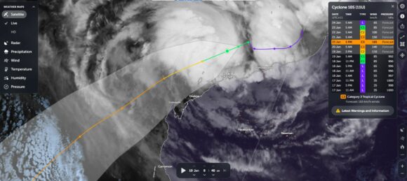
For the first time this season adjacent to the Australian mainland, a cluster of thunderstorm cells are circulating around a low pressure cell of the northwest coast of Western Australia. It is likely that the storm system will develop into a tropical cyclone.
At the time of writing, the storm is named 11U but likely to be officially named Tropical Cyclone Sean.
Using “Zoom Earth” with the overlays added, the cluster of thunderstorms is clearly visible and strong convection is evident at the centre. It appears that the storm will remain offshore and weaken out to sea.
The storm is currently fueled by ocean waters heated to 31C but off the northwest coast of Western Australia, ocean waters decrease sharply to 25 degrees Celsius or less which will hasten its decline.
At peak intensity the storm:
- Looks set to reach a Category 3 system with peak winds to 165 km/h at the core under the Australian Tropical Cyclone Intensity Scale.
- Only Category 2 under the Saffir Simpson Scale with peak wind gusts to 90 knots or 163 km/h.
The storm is expected to remain off the coastline but the outer rain bands will clip the Western Australia coastline within the vicinity of towns such as Karratha, Onslow and Exmouth.

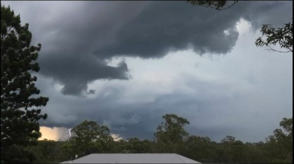
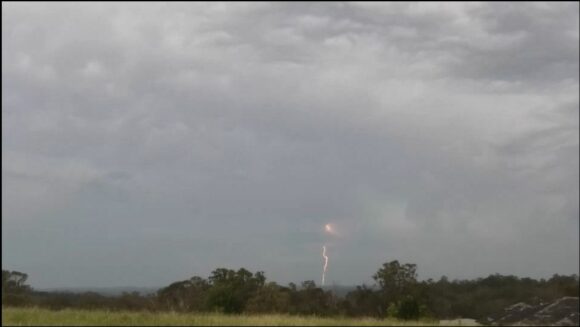
The above continues an extended run of significant and variable weather affected large regions of Australia. The images attached are from recent thunderstorm events to show case the the summer conditions being experienced.
