A tropical cyclone is rapidly developing off the North West coast of Western Australia and at the time of writing, it may have reached the threshold of a Category 1 storm at least on the Australian Tropical Cyclone Intensity Scale. However, this is still a tropical storm under the Saffir Simpson Scale.
At the time of writing, the storm is continuing to intensify around a small compact low pressure cell. It is likely that the storm will be named Ilsa in due course.
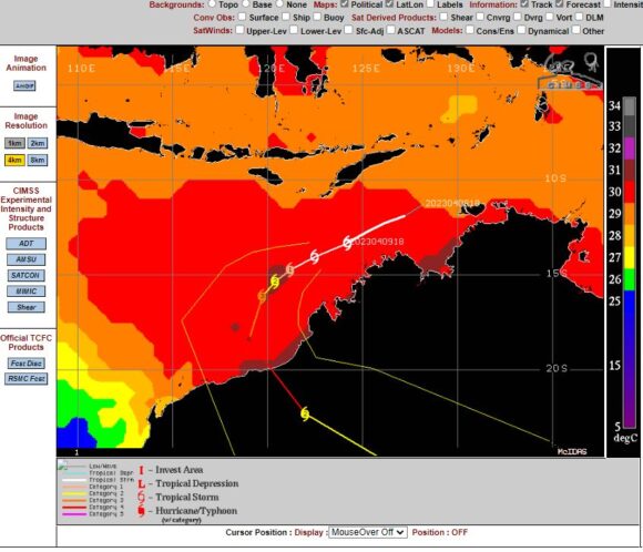
The system is passing over heated waters of 30C to 31C and within an environment which is ideal to support such storms.


What makes this storm of interest is that it is likely to be the last such storm this season within the immediate Australian waters but it is also likely to be the strongest storm to impact the Australian coastline for the 2022/2023 season.
All models suggest landfall between Broom and Karratha (North West Western Australia). While there is always uncertainly in the exact landfall, it would appear at this stage that both towns would be spared a direct hit with landfall expected over reasonably unpopulated regions.
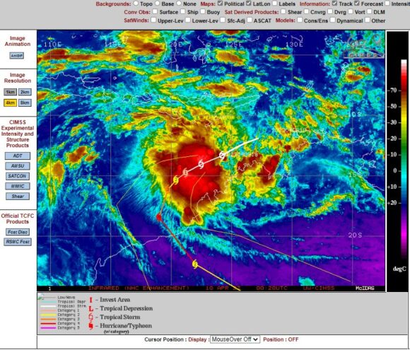
The CIMSS model suggests a Category 4 system on the Saffir Simpson Scale with peak wind gusts to 130 knots (241 km/h) just prior to landfall. The infra red image attached (CIMSS) clearly shows strong convection (Cumulonimbus cloud towers) but no eye at the present time.
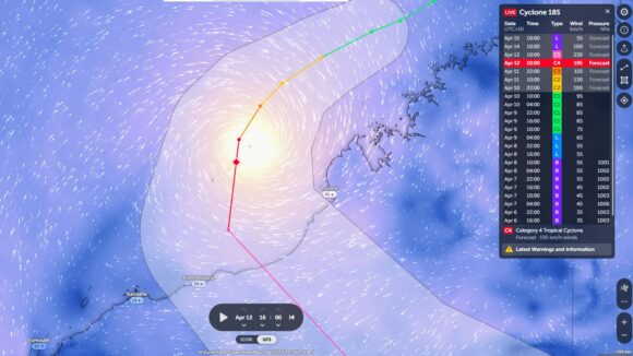
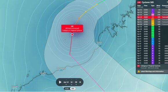
The models developed on Zoom Earth (NASA) identifies a Category 4 system at Landfall but the possibility remains of a Category 5 storm (Under the Australian Tropical Cyclone Intensity Scale 1989) with peak winds to at least 230 km at the centre.


The forecast plot (Plus the cone of uncertainty) is included within the satellite photo (Zoom Earth - NASA 2023). Further, the forecast wind speeds close to the eye and air pressure graphics is also included within the coloured graphics attached.
