A short lived but powerful hurricane has made landfall just east of the city of Tallahassee (Over Perry) in Florida - United States of America causing extensive property damage, flooding, power losses and a high death toll.
It appears to be the strongest hurricane to strike Florida’s Big Bend region ever.
The storm at hurricane strength had a formal lifespan of less than two days (Approximately 36 hours) but has left a trail of destruction in its wake.
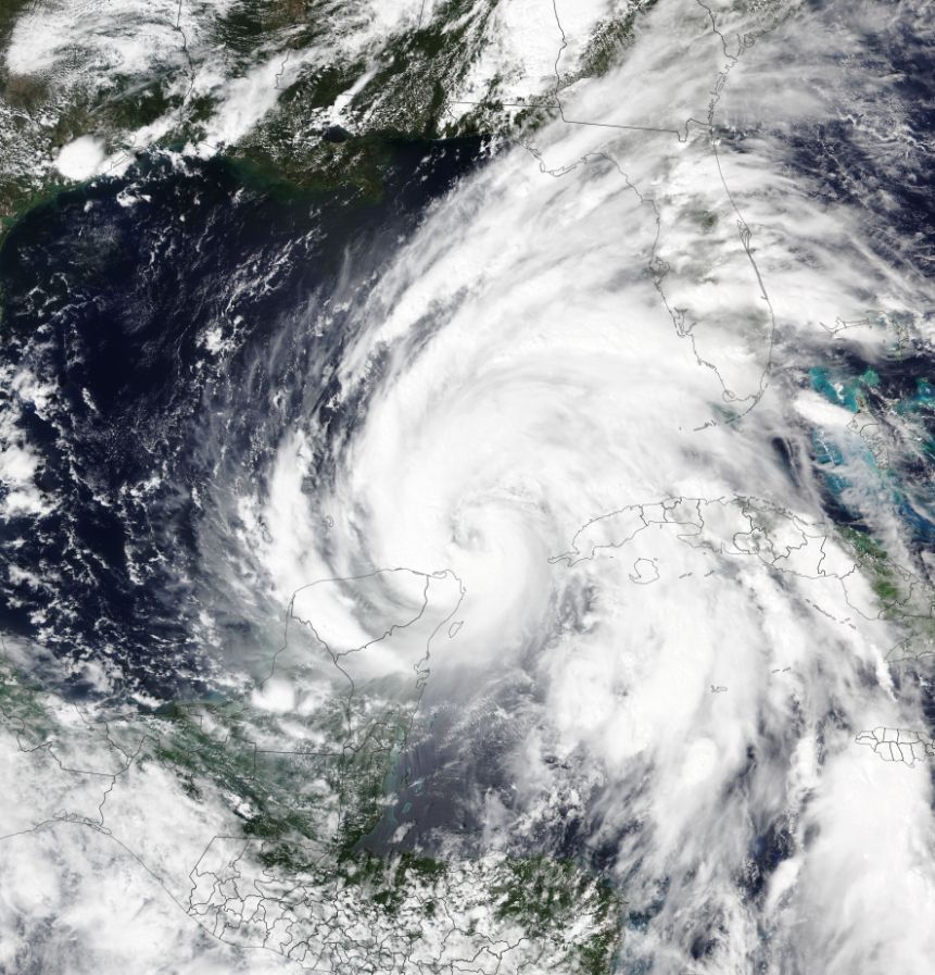
The storm formed off the Yucatan peninsula (Mexico) then traveled north at speeds of 24 km/h. Fueled by oceanic waters heated to at least 31 degrees Celsius, the storm rapidly gained strength as it neared the Florida coastline. At peak intensity, the storm attained a strength of Category 4 on the Saffir Simpson Scale with peak wind gusts of at least 255 km/h just before and at landfall.
The storm only briefly reached Category 4 before making landfall after 1 pm over Perry on Friday 27 September 2024.
Storm surges, flooding rains and destructive winds associated with the storm has left a major clean up to be undertaken across large areas. The cleanup and repairs will take considerable time. It is also understood that a high death toll has resulted with at least 50 known fatalities at the time of writing.
The feature image above is taken by NASA showing the storm forming off the coast of the Yucatan Peninsula (Mexico). Significant convection is visible with the eye starting to develop. The second image attached is from Zoom Earth (NASA) which shows a well developed storm nearing peak intensity. A small eye is visible at the centre in this image.
