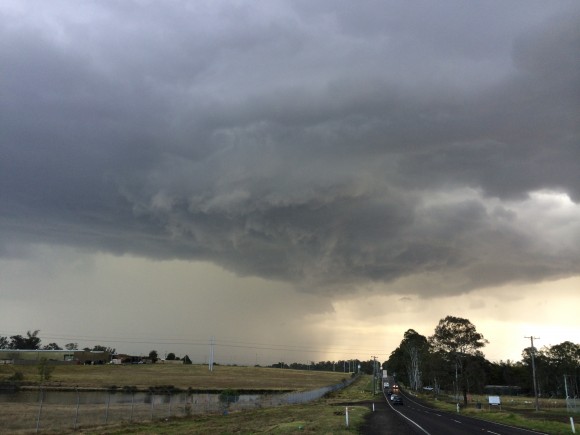
What a surprise! Although storms were expected over the ranges and even the chance of hailstones, who was to think amongst the cluster of cells would interact and produce a storm with pronounced hook that persisted for the best part of 30 minutes. You could even see a cut in the base and there was what seemed to be persistent rotation and for several minutes was filmed.
Here is a shot of the base at Box Hill at the time of the hook probably about 10 minutes into the hook (or should I say pendant).
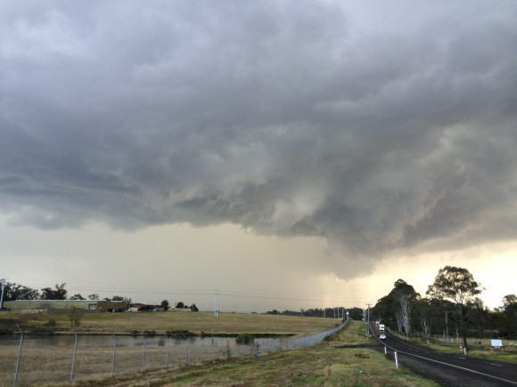
Started the day near Penrith - at school and eagerly got out. Chased the storms near Londonderry and also reported hail in separate developed near South Windsor. Then I took an interest of a base well to the east and this turned out to be this one. It looked nice and rippled but once I got a cleaner look I realised there was inflow into the storm and the storm looked organised! I took the footage and associated photographs from Box Hill and the rotation was persistent for at least 3 minutes based on video and probably 5 minutes overall.
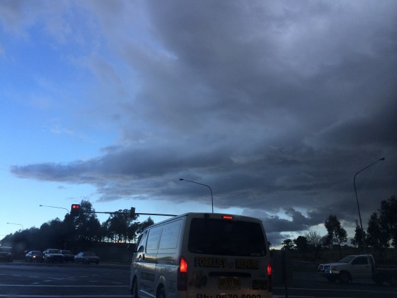
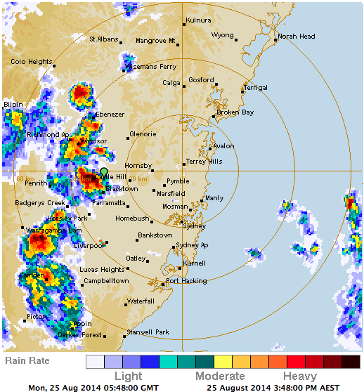
Of course the hook transitioned over the course of about half an hour apparently according to Jeff Brislane. What an impressive surprise. For once, the video itself only is sped up 4 times - compared to most at 20 times!
See : 64km Radar Loop for Sydney (Terrey Hills), 14:00 24/08/2014 to 14:00 25/08/2014 UTC

Raw footage part 1
Raw Footage part 2
Raw footage part 3
Update:
This from the Bureau of Meteorology Harald Richter
"Hi Jimmy,
Perhaps the most intriguing aspect of this case is that storm rotation occurred with very weak
deep layer shear. I am seeing a north-south running boundary that is moving west and initiates
convection around 2:30 pm over Richmond and points south. The Marsden Park cell
goes up behind that boundary as a discrete cell around 5:20 pm and decides to propagate NNW
at 3 knots. It was perhaps this propagation vector that allowed it to capitalise on some
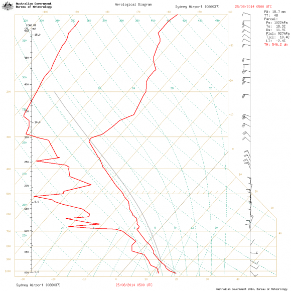
SREH in a broadly easterly flow environment (sounding and hodograph attached).
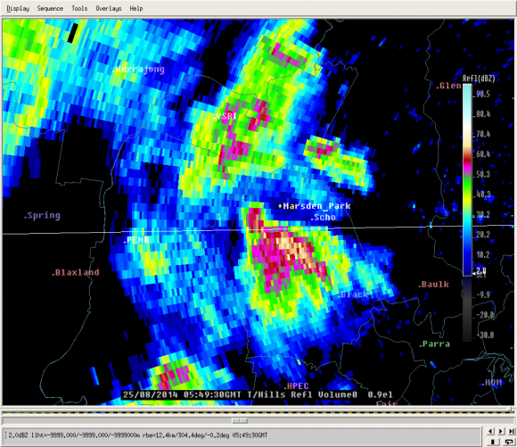
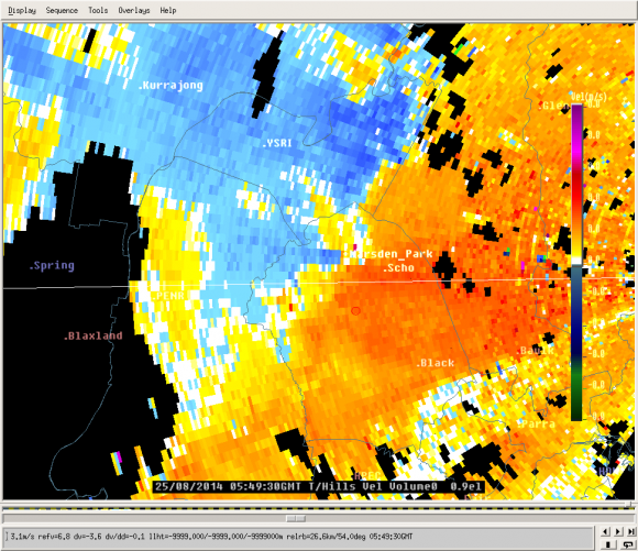
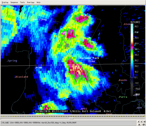
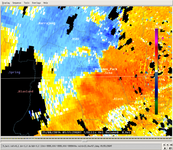
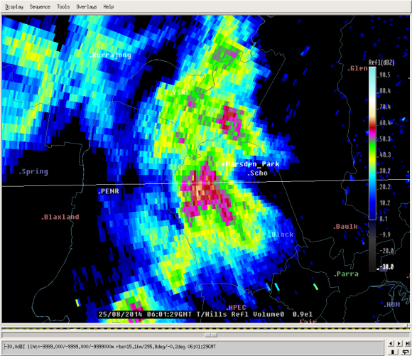
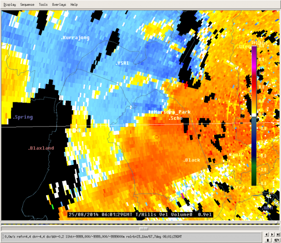
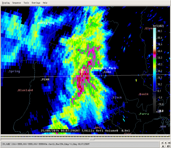
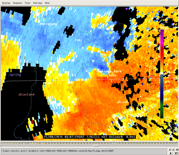
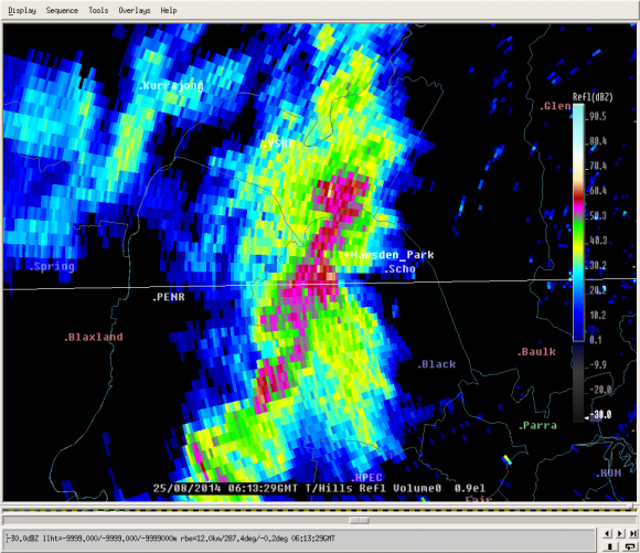
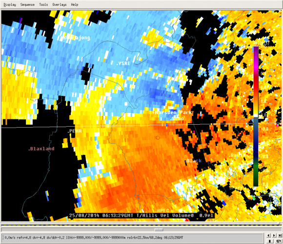
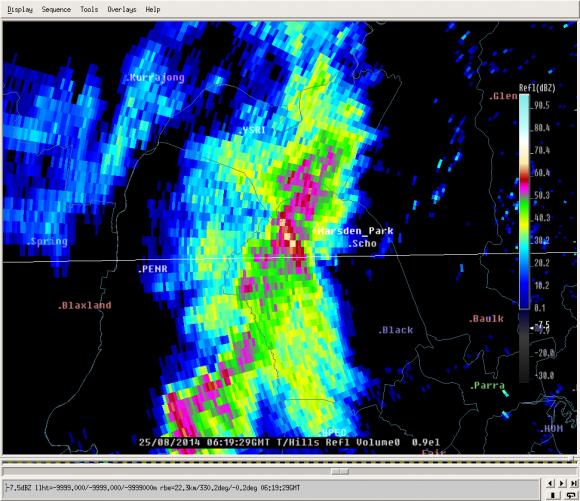
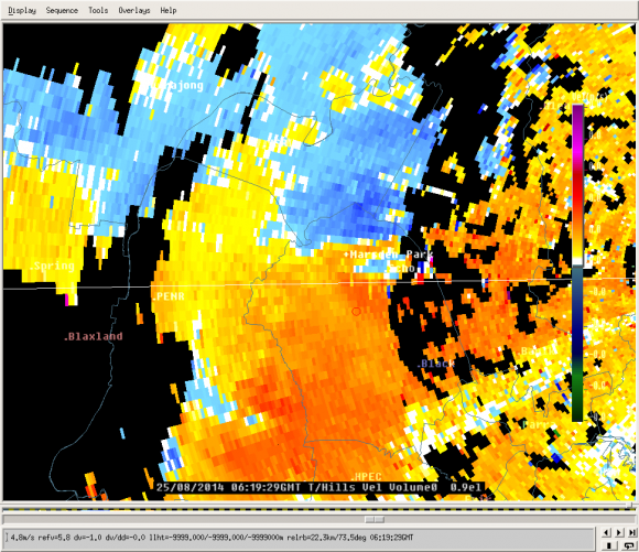
The storms clearly developed a pronounced inflow notch and well-defined but weak rotation.
I have attached a range of 0.9 degree Terrey Hills ref and vel images (0.9 deg. is about
0.5 km above radar height at the location of Marsden Park).
If you splice the individual images together into a quick animation the rotation over Marsden
park becomes very evident.
Around 4:50 pm another northward propagating storm developed even stronger rotation
near Warragamba to the SSW of Penrith.
I suspect the passage of the westward moving boundary, the NNW propagation and the steep
low-level lapse rates in the thermodynamic profile all helped on this day to allow
the development of storm-scale rotation in a weak wind profile.
Cheers,
Harald"
And this
"To me it looks to be a rotating storm that approaches the weak end of a low-topped
marginal supercell. There were a few storms along the westward marching boundary
that reached that level. I would refer to it as a short-lived low-topped marginal supercell."
Attached are some of the scans from the event as well as sounding etc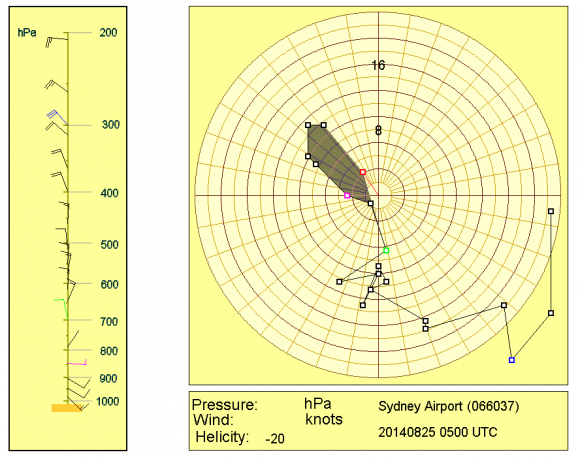
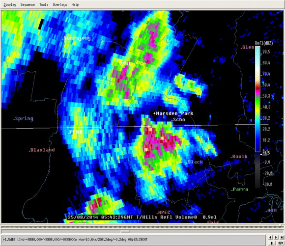
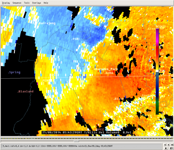

nice
Sorry Jeff Brislane, did not see your radar below in the comments! I note that the initial part of the hook although it looks spectacular seems to not look as good visually as the second cycling of the hook/inflow notch.