Sunday 6 July 2025 will go down as being a day with highly unusual weather occurring across Eastern New South Wales as conditions were more akin to spring rather than what would be expected for July.
The previous day, I reviewed some weather models and noted that the GFS was suggesting that the lifted index could drop to as low as minus 4 across portions of New South Wales including areas close to Sydney and that a pool of very cold air was to move overhead during Sunday afternoon ahead of a wind change.
It became clear that attention needed to be paid to potential weather conditions for Sunday afternoon.
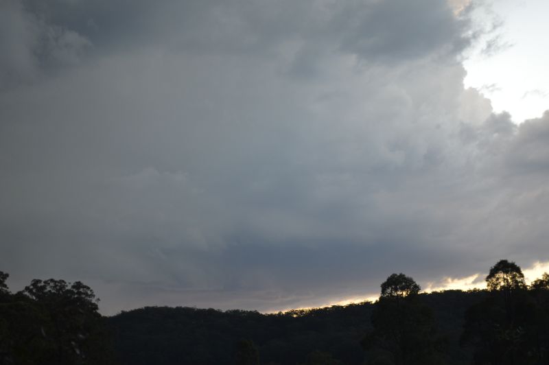
Mid morning Sunday, I noted the presence of alto cumulus castellatus clouds across portions of the sky which was certainly interesting and something to pay closer attention to.
It was also a warmer than normal typical July day as maximum temperatures across Sydney finished up peaking between 21C and 23C for the day which is well above the July average.
Early afternoon, I contacted Jimmy and after some discussion, I drove out to Penrith, collected Jimmy then decided to head north along Putty Road.
During my drive to Penrith, I noted a strong cumulonimbus cloud tower to the southwest which was over the Southern Tablelands. This was unusual as I have rarely if ever seen such a cloud tower form in such fashion during the month of July. This was part of a complex of thunderstorm cells that formed over the region during the afternoon.
I drove while Jimmy navigated and we worked out that there was a decent chance of intercepting an isolated thunderstorm cell towards Putty and or Howes Valley. We targeted that region of Putty Road.
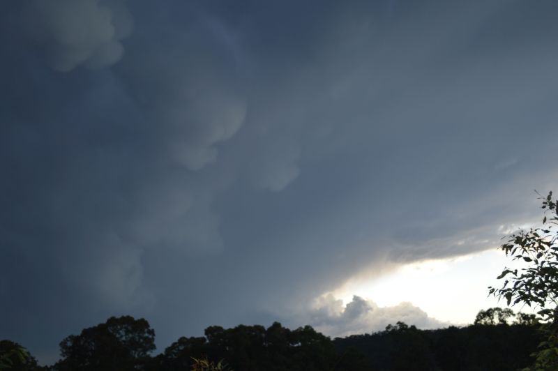
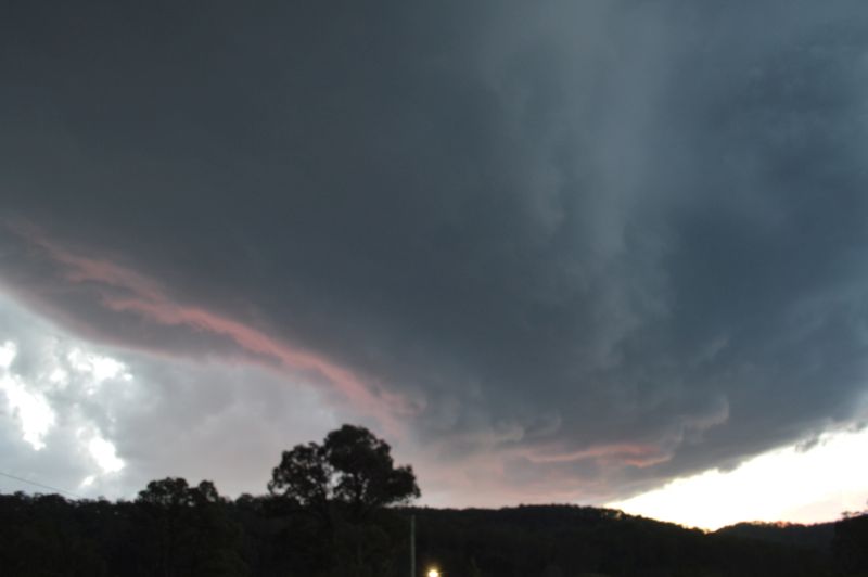
Upon our approach to Howes Valley, an isolated thunderstorm had developed to the west and we were in an ideal position for a direct intercept. At Howes Valley, we found ourselves underneath the anvil of a thunderstorm that was moving towards us as speed.
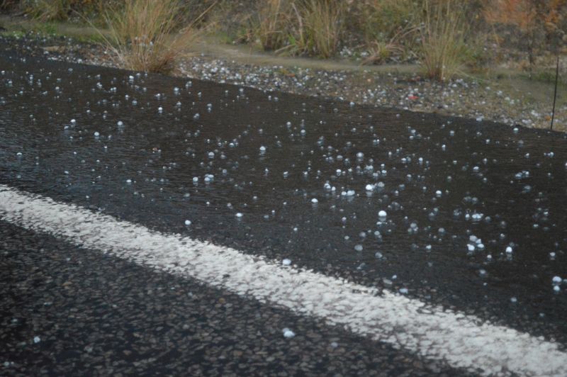
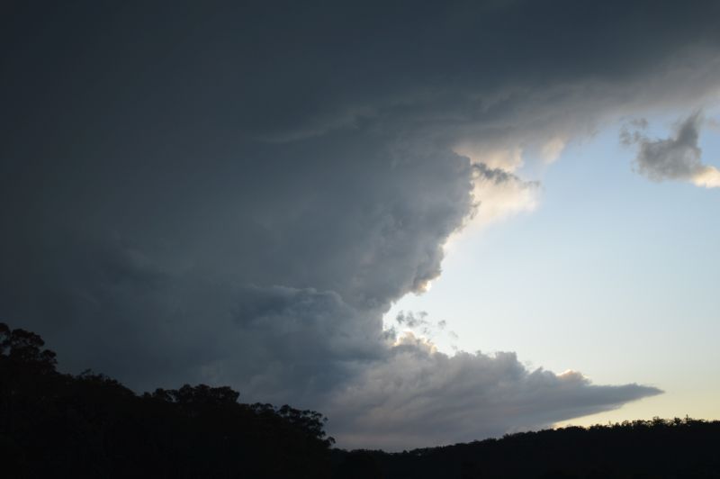
The storm featured a high number of lightning flashes within and underneath the anvil and a rain free base to the west that also tracked towards us. After taking photos and driving around Howes Valley, we successfully intercepted the base of the storm. This action placed us in an excellent position to experience the hail core as it passed over.
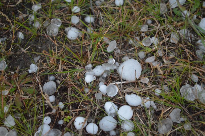
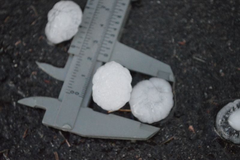
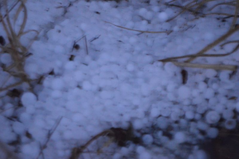
For the first time ever, I saw hail fall during July and my first ever severe thunderstorm for mid winter. Jimmy and I were measuring hail to 2.5 cm which is incredible for the month and given the noise on the roof of the car, it is possible that a few hail stones were larger. This event made the 140 km trip north along Putty Road worthwhile.
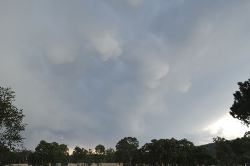
Given that we intercepted the storm right on sunset, we were able to obtain a high number of quality photos before dark (Keeping in mind that sunset was just before 5 pm). With the storm moving south east, we investigated two other sites close by for hail and noted that the hail path was relatively narrow. Further south, there were leaves scattered all over the road due to the hail stripping leaves from trees and in some areas, hail had piled into small drifts and even hail fog was observed.
We returned to Sydney via Putty Road after dark and intercepted the main squall line event north of Colo Heights. Here only moderate rain was experienced with some strong lightning flashes included.
This made for a memorable chase especially given that this was my first ever storm chase for July.
Thunderstorms in July are exceptionally rare and experiencing a storm of this strength made this event exceptional. Further to this point, the storm went on to cross the coast near Norah Head (Central Coast). It is also possible that the storm produced larger hail but within areas with no road access.
Distance travelled - 349.7 km.
While there was plenty of thunderstorm activity across Eastern New South Wales, such storms were fast moving and rainfall totals in general were often less than 10 mm. While the Howes Valley storm featured hail, there were other hail events at other locations for the day.
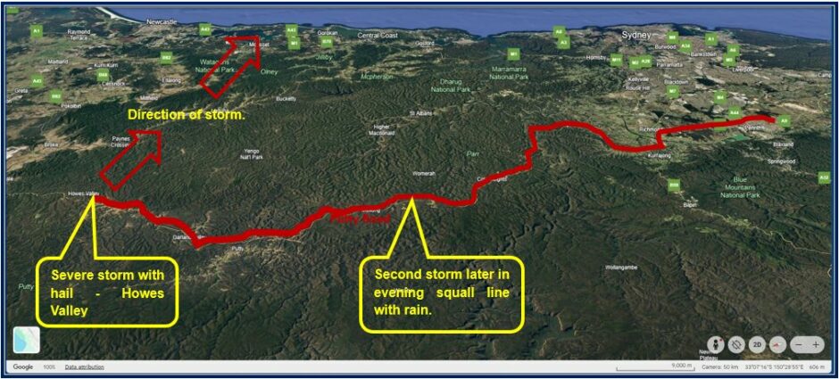
The photos of this event were all taken around Howes Valley (Putty Road). A map is also attached showing where we made a successful storm intercept.