Extreme Storms

General Weather

Re: Australian tornado climatology and information / Bulahdelah Tornado Report 1/1/1970

· by Jimmy Deguara

Michael Thomas,

Quote
You mention of the parameters being sketchy for the day. What do you feel was lacking in this storm outbreak?

I think your previous post above cover things well. I meant to suggest that I was confirming the difficulty to gather sufficient information to achieve a sufficient profile for the time the storm occurred. Was there an increase in the windshear profile. Given the dynamics, were the old profiles and 're-analysis accurate' for so long ago given the lack of data.

I guess what I look for are:

– instability and steep lapse rates. The delta H7-H5 temperature difference > 19C is a rule of thumb for violent tornadoes. Was this the case on this day?

– inflow – one would require to know the pre-storm environment but at least the low level profile was favourably directional

– mid-level moisture profile being dry to enhance clean structure and less upper level loading in terms of precipitation. This should overly deep moisture to 700hPa. Together, with upper level windshear can lead to classic supercell profiles.

– existance of boundaries can assist and this region particularly further south extending to the region west of Bulahdelah have natural boundaries. Were there other outflow boundaries on the day

– upper trough short wave passing through to break a lower level cap

Seriosuly though, the lower level wind shear is the most common missing ingredient that differs between the US and Australia regularly. I feel that deep moisture can also be an issue – the lack of dryline dynamics also tends to be present here.

Whenever we have had ingredients in place, tornadoes occur. Population density or not, someone sees a tornado under the intense storms on the day.

Regards,

Jimmy Deguara
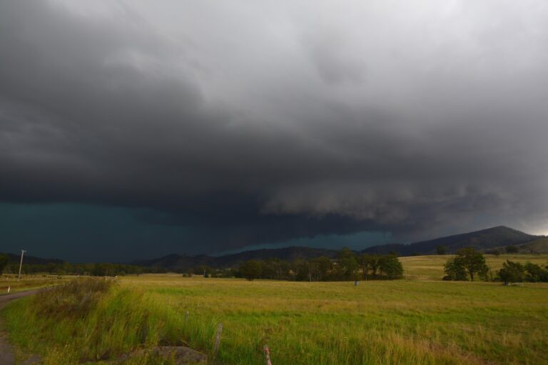
Open the storm map around Bulahdelah, NSW

More storms near Bulahdelah, NSW

More Storm Action from 27th February 2023. Followed this storm from Putty all the way through to Dungog ater work. It experienced lowering bases and … 27 Feb 2023 · Dungog, NSW This was a great chase! The first cell rotating nearby!Got the first storm S of Gloucester from birth which quivkly became a supercell but took the … 15 Jan 2023 · Gloucester, NSW 1 year ago what? Gees Colin Bryant Colin and I chased for a couple of days with this being the return trip 22nd January 2021. Nothing terribly severe… 24 Jan 2022 · Mount Seaview, NSW Awesome day. 1 year ago. Gosh Got the first storm S of Gloucester from birth which quivkly became a supercell but took the wrong turn elsewhere and m… 15 Jan 2022 · Gloucester, NSW On the 20th February 2005, Geoff Thurtell and I made our way to Mudgee for a storm chase. A storm developed and rapidly intensified into a supercell h… 21 Feb 2021 · Singleton supercell (from Mudgee), NSW Colin and I chased for a couple of days with this being the return trip 22nd January 2021. Nothing terribly severe so more of a bonus photography sess… 24 Jan 2021 · Mount Seaview, NSW Got the first storm S of Gloucester from birth which quivkly became a supercell but took the wrong turn elsewhere and missed getting onto the hook whi… 15 Jan 2021 · Gloucester, NSW NSW RFS – NSW Rural Fire Service 7 Nov 2020 · Cessnock, NSW One to end the day north of Gloucester looking generally east or northeast 3 Nov 2020 · Gloucester, NSW Cell west of Singleton #storm #hunter 3 Nov 2020 · Singleton, NSW Left work by 2pm. Targeting the Putty Road initially got the cell through the ju… 3 Nov 2020 · Hunter, NSW Hunter Shelf Cloud 30th November 2016 3 Nov 2020 · Hunter, NSW

All storm reports from Bulahdelah, NSW →

Also on 14 June

Add a comment

After the storm Hail damage repair Hail dents removed from behind, factory paint kept. Hail Dent Repair. Chase with us Chase a storm for real Guided storm chasing tours in Australia and Tornado Alley. See Thunderbolt Tours.
Coming soon Radar and storm forecasting Live radar tools and severe storm forecasts from the Extreme Storms team.