Recently, an El Nino event was declared due to what has occurred to oceanic waters off the west coast of South America. Generally, an El Nino event reduces rainfall across much of Australia, especially across the inland often leading to drought conditions.
When reviewing most recent weather models, a dire prediction was painted for much of southern Australia for the period of July to December 2026. In this regard, the chances of receiving any meaningful rainfall was not good for the last 6 months of 2026.
It appears that at the present time, the El Nino event is not having a significant impact across southern Australia. What is emerging is that there is a moisture source for rainfall despite the El Nino event. It is also noted that the warmer ocean waters surrounding much of Australia appears to be counteracting the event and thus rainfall at least across some regions is still occurring.
While noted, drought areas are starting to emerge across the inland northern New South Wales and parts of inland southern Queensland.
The most recent rainfall event of August 9 to 11 has defied all rainfall predictions for August 2026. As a result, some inland localities have almost reached their average monthly rainfall which was not expected to occur.
Furthermore, forecasts are being made for another rain event within the next seven to nine days across the same regions which is of interest.
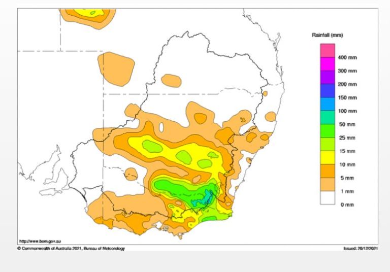
The most recent rainfall event across eastern South Australia, Victoria and southern New South Wales has defied all weather predictions as widespread 20 mm to 50 mm totals occurred. Such falls were of long duration and even lead to moderate flooding along some smaller rivers.
The key elements of this event were:
- The event impacted the agricultural regions of the Murray Darling Basin especially the southern regions.
- Flooding occurred along the smaller rivers such as the Ovens River (Wangaratta) and the Kiewa River (Bonegilla).
- Rainfall totals well in excess of 100 mm fell along a narrow corridor spanning the northern side of the Great Dividing Range of Victoria resulting in sharp rain shadows to the south.
- The runoff from the event will benefit the inland regions and rivers.
Many localities have reached or almost reached their monthly average rainfall for August. When coupled with recent events, winter rainfall for 2026 has been reasonable despite the emerging El Nino event.
Isolated flooding occurred in remote regions of South Australia (North or northeast of Adelaide) from the same weather system where falls reached 100 to 150 mm (Cumulative totals).
Cumulative totals reached 88.9 mm at Hawker and 104.6 mm at Mt Crawford.
A highlight of this event across Victoria were the 100 mm totals that fell to 9 am Monday morning including:
- Mt Buffalo Chalet – 165.6 mm.
- Handcocks – 159 mm.
- Charnwood – 143.8 mm.
- Cheshunt – 126.8 mm.
- Lightning Creek – 121 mm.
All localities are within the hilly region of Northeast Victoria just north of the Great Dividing Range.
Just outside these areas, rainfall totals of 50 to 90 mm were common to 9 am Monday morning including:
- Hunters Hill – 89 mm.
- Kiewa River – 86.4 mm.
- Thredbo – 84 mm.
- Jingellic – 57.4 mm.
On the lower slopes, 30 to 60 mm were commonplace to 9 am Monday morning including:
- Wangaratta – 67.2 mm.
- Rutherglen – 52.4 mm.
- Albury Airport – 39.8 mm.
- Yarrawonga – 38.4 mm.
Cumulative 4 day totals were much higher. Across southern Australia, cumulative totals of 25 to 49 mm were widespread across the region.
Across alpine regions, rainfall caused much snowmelt although moderate snow did occur Monday and Tuesday which replenished some of the loses that occurred as the air became colder.
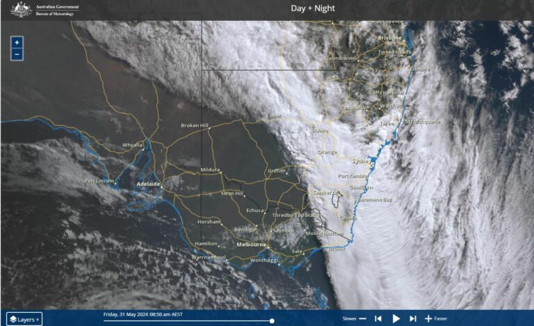
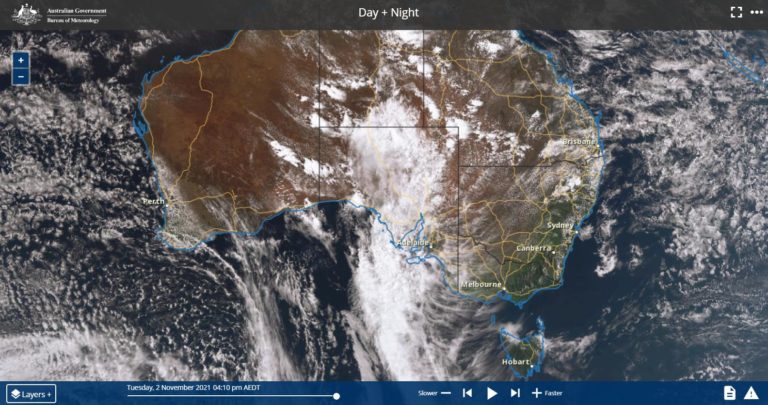
Overall, the latest event continues a sequence of northwest cloud bands crossing this part of Australia over recent months.
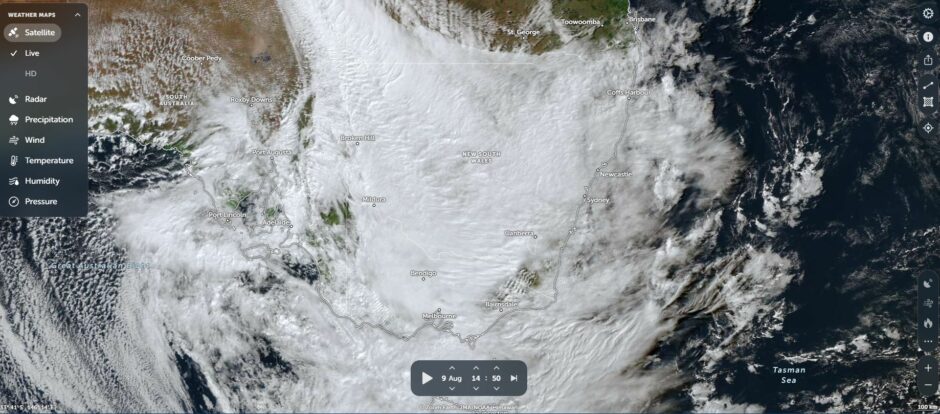
Attached to the post (NASA Zoom Earth of Sunday afternoon) shows the extensive cloud mass covering the region resulting in a widespread rain event.