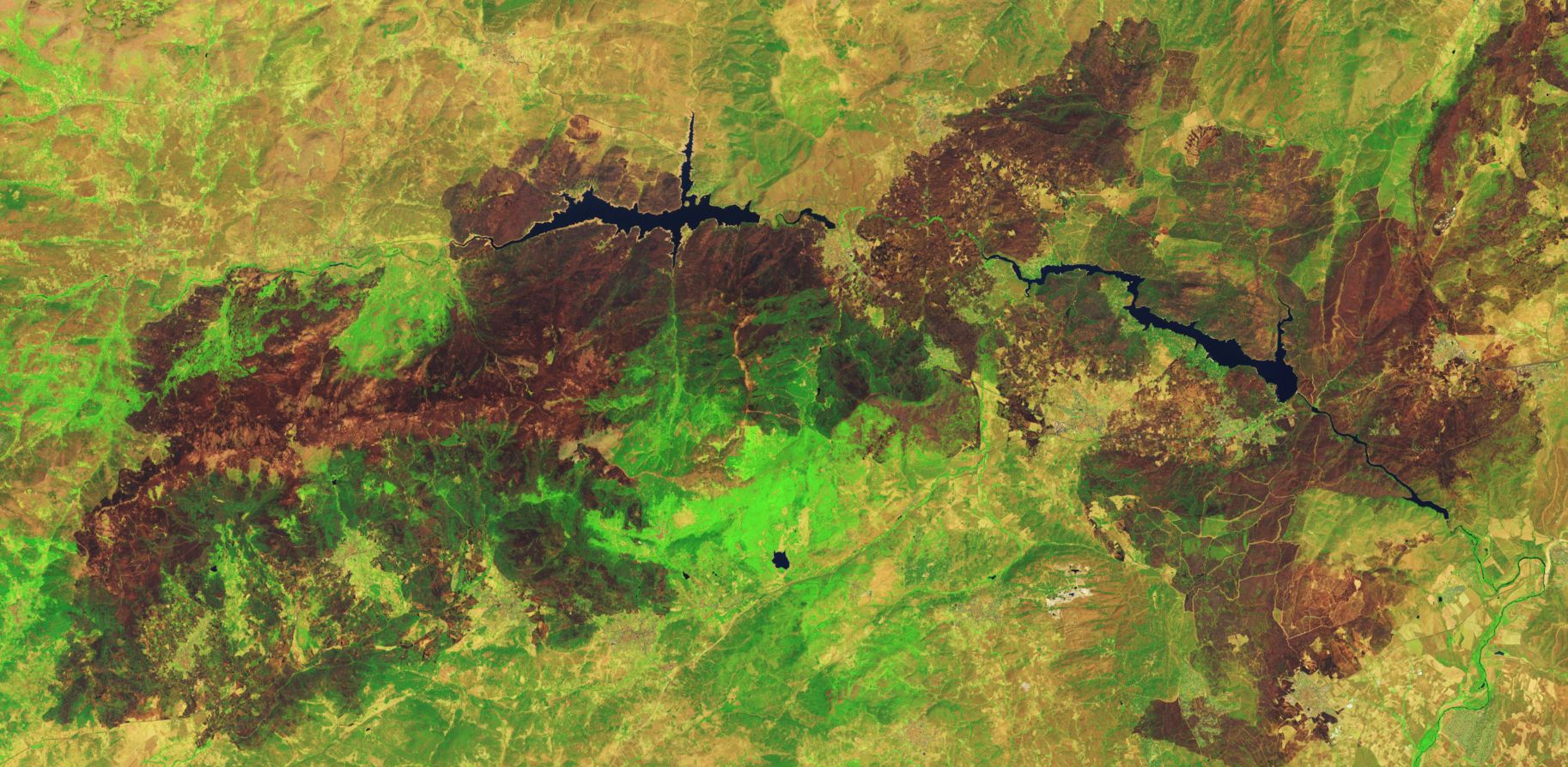
The attached image from the Landsat 9 (OLI) or the Operational Land Imager shows a large swath of central Spain charred following recent fires.
The false colour image combines infrared wavelengths 6-5-3 (NASA Earth Observatory) taken on Wednesday 29 July 2026 and shows how damaging the fires have been across parts of Spain.
Fires have also impacted parts of France during the same outbreak.
A complex of fires burning are amongst the largest in decades to occur across France and Spain. Some of the largest of the fires have occurred around Avila / Madrid regions (Spain). The Avila fire was spotted burning on Wednesday 22 July 2026. By Friday 24 July, the fire had charred at least 50,000 hectares.
During Friday (Same day), the fire merged with another fire resulting in one larger blaze that had burnt through 77,000 hectares of bushland / scrubland and farms.
Another major fire occurred in France west of Bordeaux around a village called Le Porge. This fire had charred at least 42,000 hectares.
By late July, the fires burning across France had charred an area of at least 90,000 hectares.
The most recent winter was wet with high rainfall. During spring, the vegetation dried out. Hot summer weather punctuated by heatwaves has allowed ideal conditions to occur to support large fires.
On Saturday July 25, a fire in southwestern France produced a pyro cumulonimbus cloud which is the first time such phenomena had been observed in France. These have been observed in Portugal and Spain but never in France until now.
The fires have led to considerable evacuations and there is considerable damage to property. At the time of writing, some of the fires have been extinguished or controlled but others continue to burn.
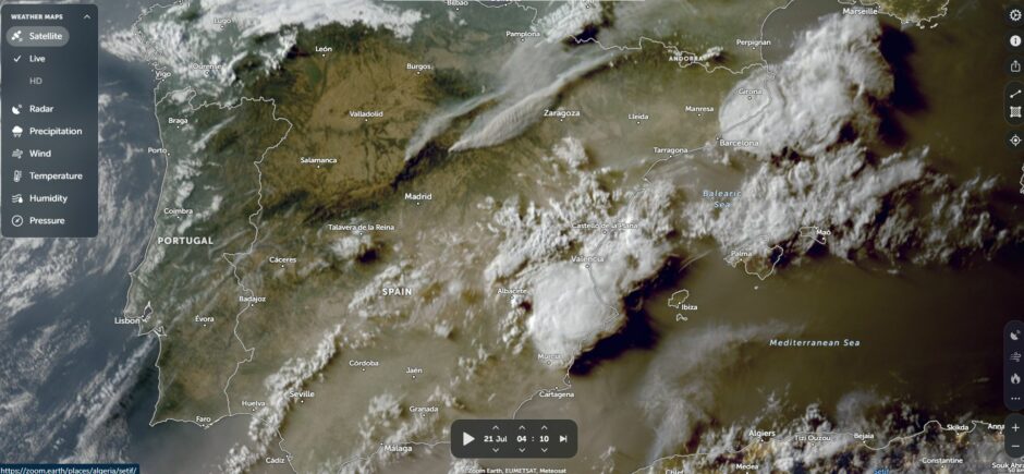
While the areas burnt do not match those that can occur across Australia, the areas burnt during the event are significant especially for regions that usually do not experience these.
The presence of a pyro cumulonimbus cloud associated with these is also significant.
I documented one of these on the evening of the 30 December 2019 at Batemans Bay (South Coast of New South Wales) just prior to the bushfire catastrophe that occurred the next morning across town. The presence of these does show the significance of this event.
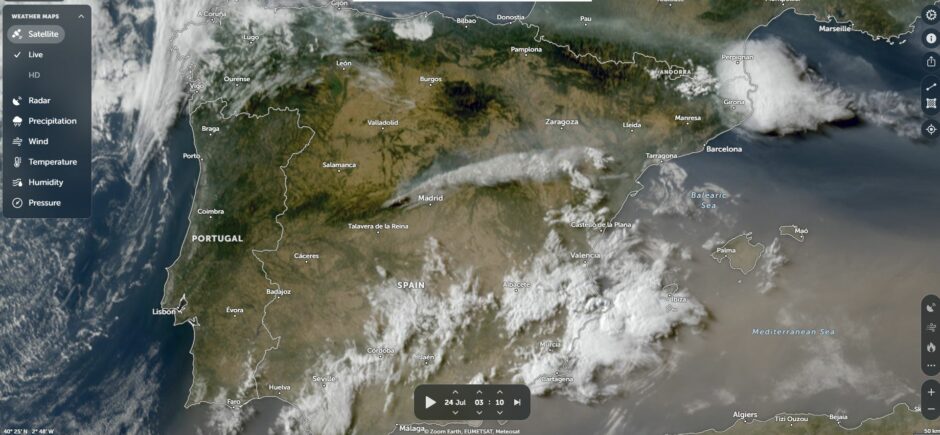
Using Zoom Earth (NASA), smoke plumes from fires burning across parts of Spain are clearly visible. What is also clearly visible is that the entire country is parched from recent heatwaves. Smoke plumes are travelling north east and crossing into France.