A sizeable clous mass is slowly making its way east and southeast and is producing widespread light to moderate rainfall across eastern South Australia, southern Northern Territory, far western New South Wales and parts of western Victoria adjacent to the South Australia state border.
The rainfall across most of affected areas is not significant with falls of between 5 mm and 25 mm being commonplace.
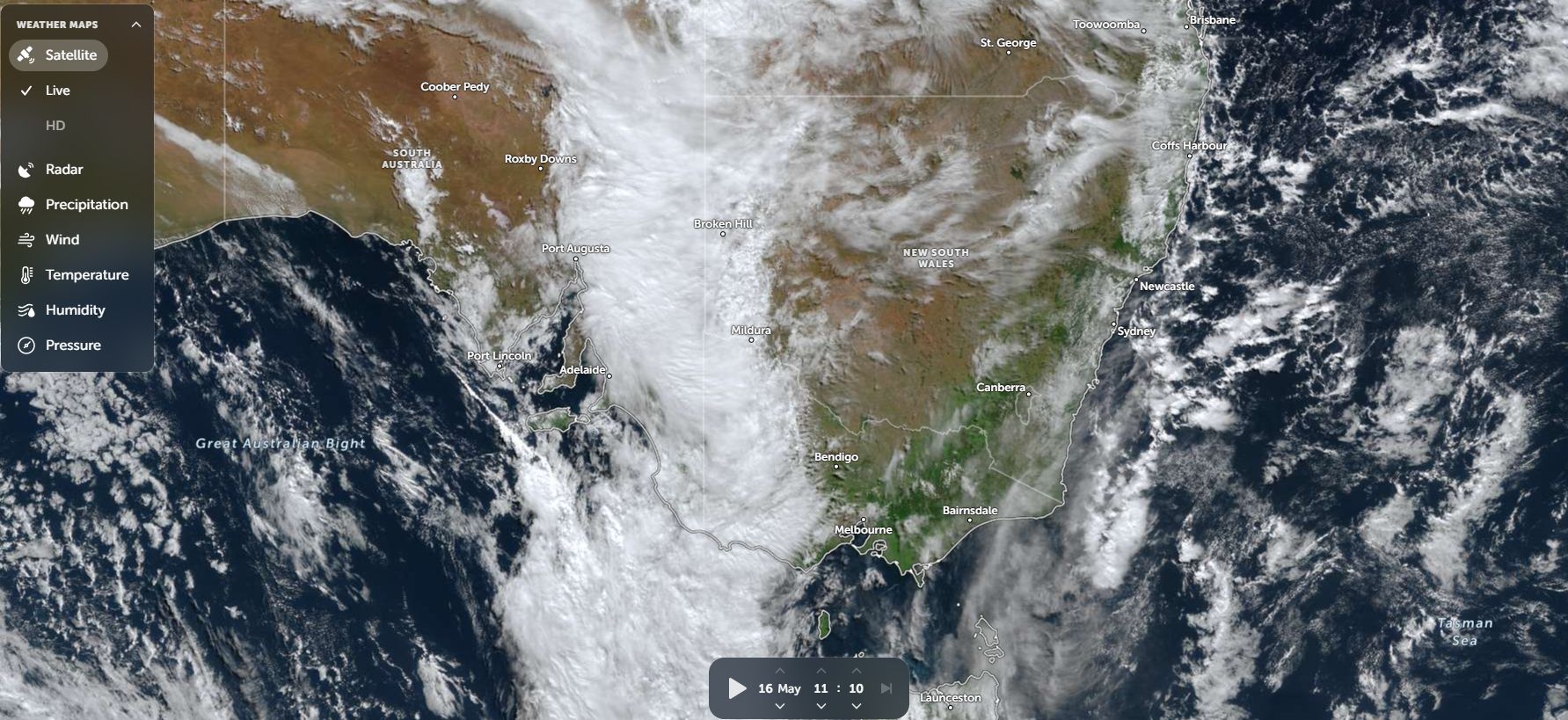
As shown on the Zoom Earth image of late Saturday morning (NASA Saturday 16 May 2026) being the feature image, the cloud mass is affecting:
- Western Australia (Eastern inland outback areas).
- Northern Territory (Southern areas).
- Queensland (Southwest region).
- New South Wales (Far western outback region).
- Victoria (Western regions close to the South Australia state border).
Given its size, the rainfall is widespread but not too heavy.
Up until 9 am Saturday morning, some of the more significant rainfall includes:
Northern Territory
- Territory Grape Farm (Northwest of Alice Springs) – 18.8 mm.
- Alice Springs – 6 mm.
South Australia
- Koonamore – 29.6 mm.
- Cleve Airport – 26.6 mm.
- Stenhouse Bay – 24 mm.
- Port August – 17 mm.
- Adelaide – 8 to 19 mm across the city region.
The moisture feeding the cloud mass is emanating from tropical areas to the northwest which is helping to maintain the cloud cover over large areas.
It is expected that the cloud mass will track to the southeast but still affect large areas of inland New South Wales and much of Victoria over the next 2 days. It is expected that widespread 10 to 20 mm of rainfall will occur from the event.
Should this occur, this could become a useful second rain event for the month of May across some of the agricultural regions of both New South Wales and Victoria.