
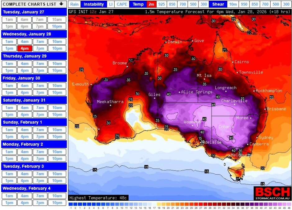
Some remarkable daytime temperatures have now occurred across three states being New South Wales, South Australia and Victoria associated with the current ongoing heatwave.
In this regard, maximum daytime temperatures have soared to 48C across parts of all three states during Tuesday.
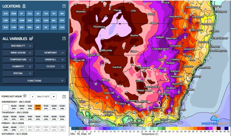
The worst affected regions were the western areas of New South Wales, eastern inland South Australia and northwest Victoria. The worst affected area is fortunately not heavily populated although Mildura City would easily be the largest urban centre affected by the most intense heat.
Again, 40C maximum temperatures occurred across a large swathe of the inland ranging from a relative manageable 41C at Albury and Wagga Wagga to around 43 and 44C at Griffth and 45C further west.
The extreme temperatures occurred further west with the worst of the heat as follows:
New South Wales
- Mulurulu – 48.8C.
- Ivanhoe – 48.2C.
- Wilcania – 48C.
- Borrona Downs – 47.8C.
- Hay – 46.2C.
Overnight minimum temperature extremes
Hay (Airport weather station)
Overnight minimum temperatures are also noteworthy during this event. The town of Hay experienced this for Wednesday morning:
- 12 midnight – 36.7C.
- 2 am – 34.3C.
- 3.30 am – 30.3C.
- 4.30 am – 26.9C.
- 6.30 am – 29.5C.
- 8.30 am – 36.6C.
- At the time of writing Wednesday afternoon, it was 47.5C at the airport.
This shows little recovery from the previous says extreme heat.
It was worse for Griffith in which the overnight minimum for Wednesday was 27.5C.
Mulurulu
For Mulurulu, the overnight minimum for Wednesday fell to a low of 28.7C. At 1.30 am Wednesday morning, the temperature was recorded as being 38.1C.
Borrona Downs
A weather station at Borrona Downs recorded this for Wednesday morning:
- 12 midnight – 39.9C.
- 3 am – 37C.
- 7 am – 34C.
- 8.30 am – 34.8C.
- At the time of writing Wednesday afternoon it was 47.5C (2.30 pm reading).
This is showing how the heat is retained overnight and is dragging into the next day with little or no relief overnight for the worst affected regions.
Note: Borrona Downs appears to be a pastoral station located east of Tibooburra.
South Australia
- Renmark – 49.6C at 2.23 pm (This appears to be the hottest temperature recorded across the country so far this summer).
- Lameroo – 48.3C.
- Marree – 48.2C.
Victoria
- Hopetoun – 48.9C (Possible new state record previously set in the February 2009 heatwave).
- Walpeup – 48.9C.
- Mildura – 48.6C.
- Horsham – 47.8C.
Across Melbourne, the maximum temperature ranged from 42C to 44C with Laverton being the hottest location.
The worst of the heat will continue across the same region and thus will not extend further east to reach the coast. The most extreme heat is centred on an inland region far from the coast. It is expected to end during Saturday when a cool change will break down the heat leading to cooler conditions.