Following two consecutive warm to hot October days, the first extensive thunderstorm outbreak for the spring and summer season occurred late Friday across parts of eastern and north eastern New South Wales.
Friday afternoon saw maximum temperatures reach 34C to 36C across Western Sydney. To date 30C maximum temperatures across Western Sydney has occurred on eight days this month and there are more such days to come over the coming week.
Friday afternoon was different because a south easterly wind change moving north along the coast provided the necessary conditions to generate afternoon showers and thunderstorms with that wind change.
For a few hours between 3 pm and 7 pm Friday afternoon, ideal conditions prevailed across parts of eastern New South Wales within proximity of the change in which thunderstorms occurred. Some of the storms became severe and there were hail events as follows:
- Sutherland Shire – A thunderstorm cell generated hail to at least 2 to 3 cm.
- Molong (NW of Orange) A hail event occurred and based upon known images, the hail appears to have reached at least 3 cm in size.
- Moorland (Mid North Coast) – Further reports of 3 cm hail.
- Within all this, I also experienced an isolated hail event within a rural area along Putty Road between the intersection of Packer Road to the north and Bull Ridge Road to the south during a storm chase along Putty Road. I measured hail within the 1 to 2 cm range.
It is probable that there were other hail events from the stronger thunderstorm cells.
This shows the transition towards summer and it is clear that the thunderstorm season has started.
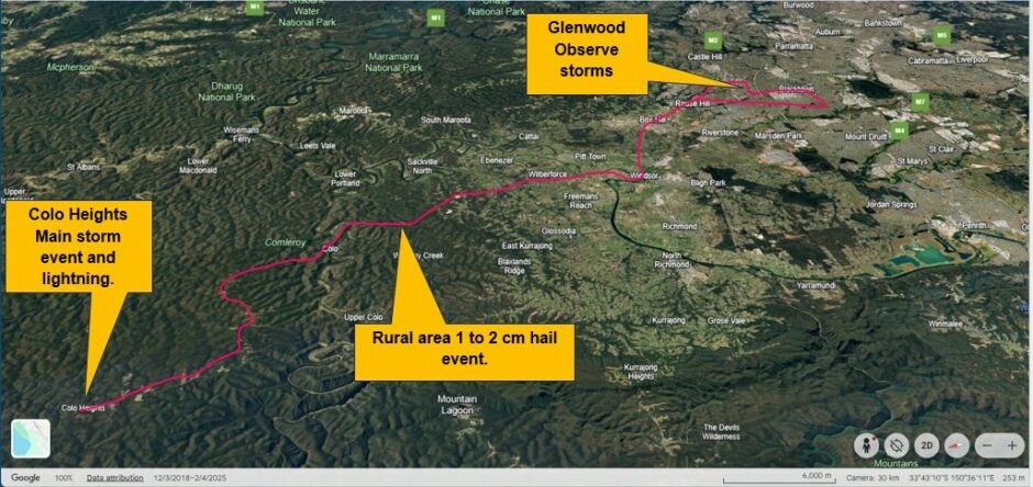
Storm Chase Putty Road to Colo Heights
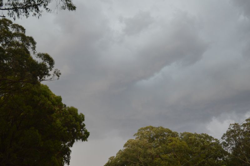
I had an afternoon ADO from work which permitted me to undertake a storm chase. After 3 pm and with the southeast change approaching Sydney, I first went up to Glenwood to view cloud behaviour and observed a thunderstorm cell to the east developing just off the coastline.
Another cell was observed to the south which would likely have been the cell that produced the hail event across the Sutherland Shire. I took some photos of the cell before heading northwest to Windsor.
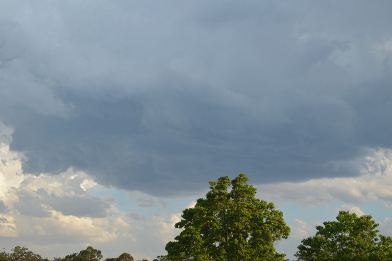
Storms were high based as expected and fast moving. I also noted the development of too many cloud towers competing for the same portion of the sky and I left Glenwood for that reason.
A cell coming in off the Blue Mountains caught my attention because it was much larger and more robust than the cells that were forming across Sydney.
I struggled through traffic along Windsor Road but I made it to Windsor then headed north along Putty Road to a rural area with suitable views observing a storm just to the northwest of me.
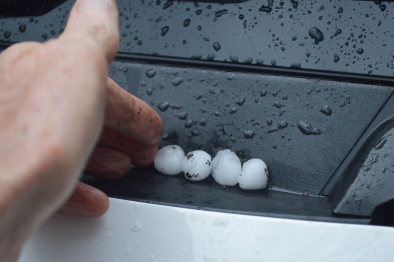
I was trying to take video film of lightning but was hit just above my eye by a hailstone which hurt due to the strong wind produced by that storm and thus I stopped filming. I then travelled north and encountered hail and stopped to verify its size. I was measuring hail 1 cm to 2 cm in size and for the type of storms, this was quite decent.
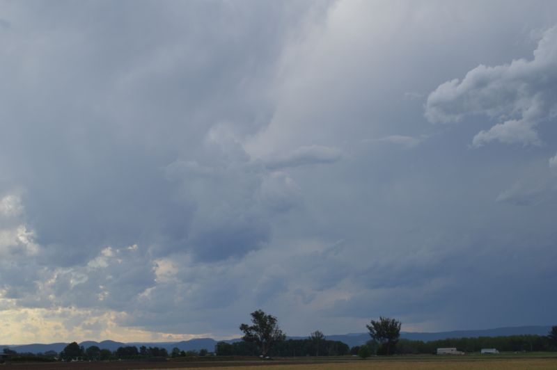
I continued north to Colo Heights and encountered two bursts of moderate to heavy rain before stopping to watch and photograph a storm cell that matured just to the east of Putty Road.
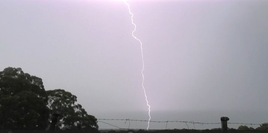
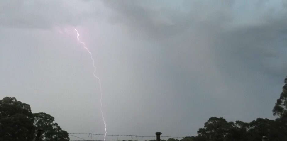
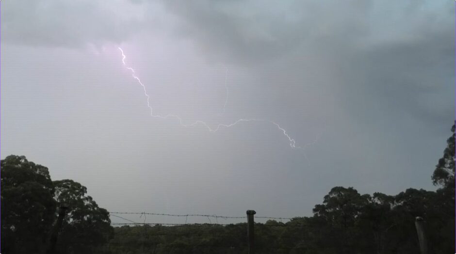
This was quite an interesting cell. It was not excessively large but had sustained and continuous thunder for at least 20 minutes with the occasional cloud to ground lightning strike adding to the event. One such strike was relatively close to me which I captured on video.
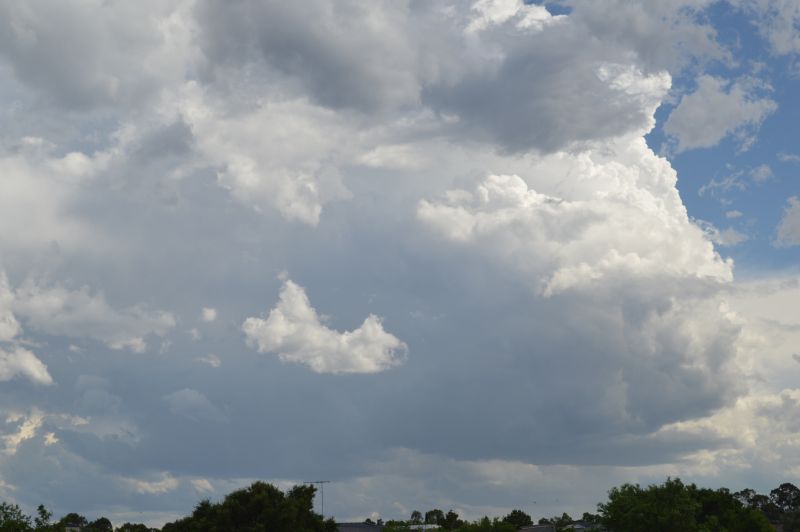
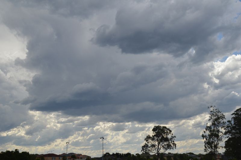
As the cell went into decline further east, I returned back to Sydney where I took further photos of smaller cumulonimbus cloud towers forming above the southerly change or being aided by the wind change (Sample of that over Kellyville forms the feature image attached to the top of the post).
Generally, this was not a bad chase with the highlight being the hail event along Putty Road and watching a thunderstorm mature at Colo Heights that sustained continuous thunder for a period.
All the images attached to the post were taken at various stops I made to catch the event.
I have also attached a map showing the location of individual events encountered during the chase.